Family days out with the National Trust this February half term
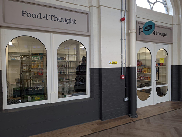
From seasonal crafts and activities to outdoor trails and winter wildlife, there’s lots to keep young explorers busy this half term at the National Trust’s places in Derbyshire and the Peak District. With miles of gardens, parkland and countryside to explore on those crisp winter days and indoor activities for when the rain sets in, there’s plenty to do, whatever the February weather brings. The National Trust’s cosy tearooms offer warming treats and kids lunch packs, and the shops have lovely selections of pocket money toys for little ones to browse. Here’s a round-up of the half term events and activities at the National Trust’s places near you. To find out more visit, http://www.nationaltrust.org.uk. Hardwick Hall, Derbyshire Half term has never been more ‘love’ly! Explore the exciting Elizabethan themes of St Valentines through outdoor play and crafts. Expect play activities in the Stableyard inspired by themes of connection, pairs, gratitude and love such as ‘Match the pairs’, Connect Four, create your own sonnet in our blackboard den, and rustle up a valentine’s feast in the mud kitchen. Find out more information: February Half Term | National Trust Calke Abbey, Foremark & Staunton Harold Discover hidden worlds this February half-term with themed trails inspired by the book ‘Wonder World: Earth’ written by Ben Lerwill and illustrated by Xuan Le. From 14-22 February, hunt for minibeasts and uncover fascinating facts about worms, and continue the adventure by visiting all three properties for unique activities at each. For avid bookworms, join a storytelling session in the Riding School at Calke to hear the story brought to life. Sessions include creative crafts and colouring, and can be booked online via Calke’s website, with SEND-friendly sessions available in a more relaxed environment, as well as shorter sessions for under-5s. ‘Wonder World: Earth’, published by Nosy Crow in collaboration with the National Trust, can be purchased onsite at Calke, so the fun can continue long beyond half-term. Longshaw Estate, nr Sheffield, Peak District. Bring your curiosity, eagle eyes and a sense of adventure to uncover secrets about the fantastic bird species of Longshaw, on The Bird Box Detectives Trail. Find 6 secret bird boxes hidden around the estate. Lift the lids to hear their calls, solve the puzzles, and tick off each bird as you go. £3 per trail sheet. On 22 February Longshaw’s rangers host a very special event; Family Bird Box Building – to celebrate National Nest Box week. Using simple hand tools, each family or group will be instructed on how to build their own bird box to take home. £15 per bird box. Special family crafts celebrating the birds of Longshaw are also being hosted on 18 and 19 February, at Longshaw’s Moorland Discovery Centre. Suitable for children aged 4-11, £8 per child. Find out more here Ilam Park, nr Ashbourne, Peak District. Get ready for a feather-filled adventure, between 14 – 22 February, on the Bird Box Detectives Trail. Secret bird boxes are hidden around Ilam Park and it’s your job to find them. Each box has a clue about the amazing bird that lives there, on this treasure hunt – but with more feathers! £3 per trail sheet, with a prize at the end! Fly down to the Dovedale National Nature Reserve for the Big Bird Count, from 14 – 21 February. You can climb Thorpe Cloud to search the skies or follow the river Dove to spot birds along the valley. With every £3 trail sheet you’ll get your own DIY binoculars and help count the different species you see, to add to the Big Dovedale Bird Count Board. Learn About the Birds Pop Up station: learn about the fascinating birdlife of the White Peak, on 21 February in Milldale. Drop into the National Trust information barn to meet our team of guides. Share your sightings on our community spotter’s board as you explore this beautiful part of the Peak District. Find out more here Kedleston Hall, Derby Enjoy a winter wander at Kedleston this half-term and discover willow wildlife sculptures along the way. The Short Walk has welcomed some new friends for all to see. Be sure to say ‘hello’! Available 14 – 22 February, 9am until 4pm. The Children’s Country House at Sudbury February Half term: Challenge your friends and family to a classic board game in the Parlour, perfect for a rainy afternoon. Solve the mystery in a game of ‘Sudbury Sleuth’, collect the clues as you explore the rooms in the Hall. From February half term onwards: Take a trip down memory lane and re-visit favourite video games from the past in the Museum of Childhood. Discover the wonders of soil science along the nature trail in Wellies Wood inspired by the Nosy Crow book ‘Wonder World: Earth’ 00
Walk Derbyshire – Beeley Moor & Chatsworth
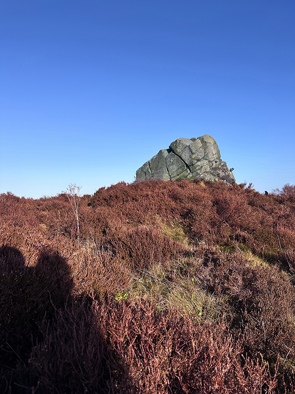
This is one of the places you may have driven past in recent years, seen the usual ice cream van and lots of cars but thought “I wonder what they are doing.” We have thought this and then carried our drive down the hill in to Beeley and onto Chatsworth for our usual walks. (Sadly the road down into Beeley is closed and has been for some time so this is no longer a cut through). Here on the corner of Beeley Lane / Chesterfield Road you will see cars, always have and always will. When you try this walk you will wonder why you hadn’t been before. It is beautiful with panoramic views of the moorland and down into Beeley past a river and small waterfalls. Our children would come here on their residential school trips and they actually let them have fun(!) and play sliding down the slope into the river. This walk takes in hills, roads and fields and makes a lovelyafternoon out. Remember to take some water and food as you will only pass the pub in Beeley if you happen to stay on the long route. (It is worth it for that!). Parking is free along the roadside but be mindful of not blocking the road for emergency services. THE WALK We start the walk from the corner of Beeley Lane where all the cars are usually parked. At the stone wall on the left you will see a little gap and we head through there and slowly amble down. We head to the bottom of the path and you will see that you can go left or right. We head left here and start to head into the woods. From here a little way down again, you will see a route taking you either left or turning right. We want to head right and start to go down the path. You will know you are on the right path if after a little while you see the river on your right hand side. Many times we’ve had fun having a paddle in this water or even the children deciding they would try to walk through that path instead of the more sensible one we were on. Why not – you are only young once. So here is really pretty. Don’t rush but enjoy the lovely water views and the pretty trees on your left. It is quite a straight forward route so no getting lost – unless you want to. The trees at the bottom are quite magical. Eventually you will hit where the river crosses the footpath – in the summer this is perfect as you can just hop across. However, if you come after much rainfall, this becomes really slippery and shimmying across a log or hopping over the stepping stones provides much fun – especially when your nephew takes an epic fall for the team. Continue down the path in front of you and when you open the gate you have two choices – one is to immediately turn up the road to the right and basically head back on yourself but going up the road so a different route. If you just want a shorter walk that is pretty then this is for you. However, we are heading straight down and we come out at Beeley. This is a gorgeous little village with the houses painted in the Chatsworth Estate blue. It is one of those villages that you just want to live in and enjoy peaceful afternoons pottering in the garden. (Maybe that’s just me!) Head through the village and you can continue to The Devonshire Arms for a swift pint. They do have a beer garden to the left hand side. Or there is the Old Smithy cafe too. After a refreshing drink and a packet of crisps – time to head back out and finish the walk. We are over half way at this point. We head out of the pub and go slight right past the houses immediately in front of you up Chapel Hill. We pass a kids play park on your left hand side and the Old Smithy on your right. When we get to the top of this road there are a couple of chocolate box cottages in front of you – take your pick for your dream house. You will see a footpath heading up a hill on your right hand side. The last time we did this walk there was a horse in the field but it was not in the slightest bit interested in us so don’t worry! Now it gets fun! Head up the hill and through a little gate. This is a steep hill so take your time. When you get to the top – take a breather and look back at the amazing view. We head up the hill and follow the footpath diagonaly all the way up to the farm. The footpath heads through the farmers track only for a short while but sometimes the cows are out. No don’t worry – these are the most well kept cows and during the winter they are in the barns, they have opera music playing and fish in their water to keep them entertained. Go through the farmers gate and after about 100 feet you will see a footpath sign on your right. Head through the small field and back out onto the track. Go straight over the track and off up a steep incline that takes you though some amazing ferns. Once at the top, you’ll come out at a track where we go right. But make sure you stop and admire the amazing views first. Now we follow the track all the way and it is a long way. Just take lots of rests it isn’t a hard walk at this point but a meander up hill. Eventually, you will come back to a part you recognise to be the beginning of the walk. And
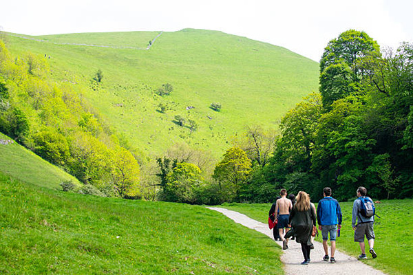
Walk Derbyshire – Ashover & Littlemoor via Ashover Rock
Such a pretty little village with stone cottages, lovely country pubs and stunning walks which feature water and hills with awesome views. Ashover is definitely a walkers paradise and offers nice places for a drink or meal after. This month’s walk features a beautiful view through the heather which should hopefully be out in full beauty about now, a small amount of walking on the road, a walk past Ashover Family Farm which was full of tulips when we did the walk but this changes throughout the year so it’ll be sunflowers in the summer and pumpkins in the autumn. When you get to the top of the hill, where the rock is, here is a lovely opportunity for a picnic and seems a reasonably popular place to watch the sunset. There is one quite steep incline up the road so take your time but it isn’t too far and definitely worth making the extra effort to reach. THE WALK :: THE WALK :: THE WALK You can park on Hockley Lane near the Old Poet’s pub. The village is awkward to park in as it is small. If you struggle to park here then you can use the Village Hall and just walk down to the start of the walk.///obviously.conclude.looms We start the walk just down the little lane to the left of the Old Poet’s pub. If it has been raining this can be a tricky little start to the walk as there are a few rocks and dips so be careful. If it is dry – still be careful but this is only for about 5 minutes. Follow the bridle path all the way down the lane, over the little bridge with the stream and up the steep incline to the top of the hill. No need to rush, take your time and enjoy the view behind you.///beards.bolts.reporting At the top of the hill head straight ahead and follow the track to the road at the bottom. From here we cross straight over to where you will see a footpath. This takes you into the woods for a little while. Hopefully rhododendrons will be out – if they are enjoy! Carry on until you exit the woods and you will be in the old quarry now. From here you need to head to the path which will take you downwards. You will notice a large disused chimney so you will know if you are going in the right direction.///blogs.wheels.handbags Again, if it has been really raining, this section of the walk will be very muddy and quite slippery underfoot so be careful. You will come out to a farm house on the right hand side. Carry on straight left down the road. You will usually see the beautiful belted Galloway here in the fields. We now walk onto Gin Lane and from here we are just a stones throw away from Milltown. If you are in desperate need of a drink at this point then from here head right to the pub which is open 12-3pm most days. We now walk past the side of the river. Have a little paddle if it’s hot. When you come to the end of the path, there is a bridge over the river and we end up on the road for a short distance. Turn left and head along the road until you see a little path slightly to the left which starts to head up in-between peoples gardens.///simmer.useful.divider When we reach the top of this path we head across Hockley Lane – be careful as it is a fast road but not particularly busy! Just past the couple of houses on your left you will see a footpath sign on the opposite side of the road up a couple of steps. Head up here and you will go past the quarry on your left hand side. From here follow the lane all the way for a few minutes. You will come out onto a road. Keep to the side as this again is a fast road but we literally need to walk 100 yards or so and you will see Eastwood Lane to your right. This is where Ashover Family Farm have the huge field to the left so hopefully you will see something beautiful growing here. We past a field with a herd of gorgeous sheep on the right which were really friendly. We start to climb up now, so again, take your time. We head all the way up to the top of the lane. This now takes you through the village of Littlemoor. What a sweet village. You can from here see views of Ogston Reservoir in the distance. Carry on along the lane and you will see the road eventually goes off to the right. Here we head straight ahead which is now Milken Lane. ///waxing.proceeds.scorpions From here you will find a footpath to the right which is going into the trees and moorland. This is now Fabrick Wood where another beautiful viewing point awaits. Head to the top for yet again another beautiful picnic spot. Enjoy! Just past the rock you will be able to see the village of Ashover down to your left. You will see a path heading down, this is the one we are taking. You will end up on a lane again and will then turn right and head down through a tunnel ///renews.credible.cleanest and into a field. Cross the field to the right hand side. You will come out at the Black Swan in Ashover. Grab yourself a swift pint and some pork scratchings! Then head down through the village to where you parked your car. There is a really cute little village shop here selling ice cream, lovely home made cakes and other items. I still believe it is cash only so please support local businesses and take some cash with you. INFORMATION Parking: Roadside along from the Poets Corner
Walk Derbyshire

Belper is a lovely little town with many shops, restaurants and a gorgeous cinema. It is situated on the Derwent River and has a vast history. Belper is the birthplace of the factory system. Derwent Valley Mills were inscribed on the UNESCO World Heritage List in 2001. With Cromford Mill hosting a visitors centre to introduce people to the story of Richard Arkwright, Jedediah Strutt, a partner of Richard Arkwright built a water-powered cotton mill in Belper in the late 18th century. The mill is still standing today, however it is no longer used in this industry. Belper is also known for its lovely River Gardens which are worth a visit as they regularly hold brass bands playing at the weekends. In the summer months you can hire a rowing boat and spot the kingfishers. There is a cafe and a play park on site. The walk takes us past Wyver Lane Nature Reserve which also has the Wyver Lane Firing Range wall which you can see within the Derwent Valley Mills World Heritage Site. The Strutt family, who built water-powered cotton mills in Belper from 1776 onwards, used their own militia to protect the mills, in case of visits from mill-wreckers and even invasion, in the time of Napoleon Bonaparte. In 1800, a firing range was provided for Belper volunteers on the Chevin Hill – a large wall which can be seen today by walking along the North Lane footpath, accessed from Sunny Hill at Milford or Farnah Green Road. We see some beautiful vista’s, farmland and in the spring months lambs and calves. There is a pub halfway around the walk too so a great place for a swift pint. THE ROUTE You can park for free on Belper Road or until 6pm at night you can park opposite Angelo’s Restaurant. We start the walk on Wyver Lane. Head down with the river on your right. We pass Wyver Lane nature reserve which has a bird hide where you can spot white heron’s if you are fortunate. Follow the lane all the way down until you see a gate – head through the gate or if you are slim enough, the tiny gap. Here we go a slight left onto the grass field and through the gateway. This part of the walk is seemingly always muddy so boots or similar a must. Head up left to the top of the field and over to the right hand side where there is a little cut through. Sometimes there are cows in the top field here but they have never caused us an issue. Head straight up to the stone wall and over the steps to the right. Pause – take in the beautiful view behind you. From here we head left down Whitewells Lane. This is a 60mph limit area and a single track so be careful if you have dogs or children, but it is not busy. This is a fab place to spot lambs in the spring. Follow this all the way till you get to the pub on the corner, The Bulls Head. The pub is closed Monday and Tuesday’s but is open on bank holiday Mondays. After a swift half, head opposite the pub down Belper Lane End. Follow the road all the way up and start to head down the hill. Look out for a footpath sign on the right where they are building new houses. I’m not sure when they will have finished the houses but for now, follow the visible path and we eventually head through a gate on the right. Head left and follow the path. The view here on the right is beautiful too. The path through the fields looks like they head to the gateway but you can’t actually get that way so just look down to the right where you will see a little path going down slightly and between two big old gate posts where you will see a proper path. Follow Shire Road all the way down until you hit the main road. This is a blind bend and as we need to cross the road please take care. We head left onto the pavement and you will follow this down to where you will see the start of the walk. DETAILS Parking: Next to Belper Mill there is a pay and display car park, also opposite Angelo’s Restaurant is a car park you can park in during the day. Pubs: There’s many to choose from, The Bulls Head is half way round the walk, but there are numerous in Belper just a short walk from the finish. Distance: 6.5km 4miles Time: Approx 1.5 Hours Terrain: Quite easy, not too muddy, with a gentle climb through fields. 00
Walk Derbyshire – An Amble through Ashover
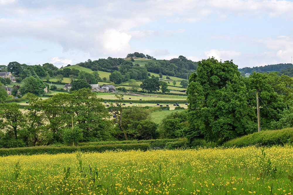
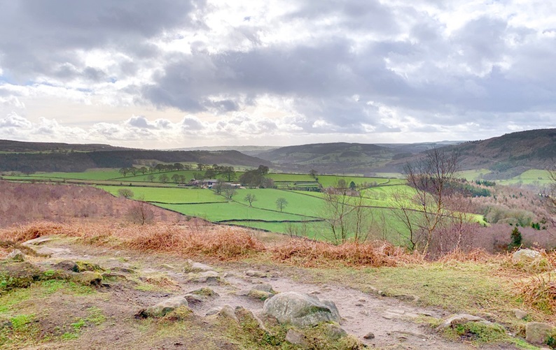
Set alongside the River Amber is the picturesque village of Ashover. Quaint cottages, stone houses and old pubs fill this favourite Derbyshire village of mine. It may take you a while to drive through the village as it is so pretty, with many cute cottages for you to stop and admire. Ashover has a truly rich history with quarries, lime kilns and lead mines. It holds All Saints Church dating from between 1350 and 1419 which was built by Thomas Babington. (One of his family members was executed for plotting against Elizabeth I). Ashover is also the home to the long standing Ashover Agricultural & Horticultural Show – this year’s show takes place on Wednesday August 14th. It is a great day out for all the family. In the village there are three pubs, a cafe, a cute coffee shop and gorgeous little village shop which sells gifts, cakes and ice cream (cash only!). There is a lovely cricket pitch with football goals, a nice children’s park and play area, and tennis courts, so plenty to occupy you. Adjacent to the cricket pitch is Ashover Parish Rooms now the Village Hall, which can be hired for weddings and events. There’s a plethora of walks in and around Ashover featuring stunning views, high vantage points, buttercup filled meadows and babbling brooks. You can see why this is a favourite for myself and many other walkers. USEFUL INFORMATION This walk is pretty easy to do. Takes just over an hour or longer if you are taking time to take in the beautiful scenery. We came through a field of cows with calves so please be careful if you have dogs. It’s a very peaceful walk which goes through fields, meadows, along the river and is easily shortened or extended. Near the end you pass 3 pubs so take your pick! Track with … https://www.outdooractive.com/en/route/hiking-route/central-england-and-the-midlands/drafted-on-2024-06-25/295370954/?share=%7Ezzgg3age%244osstcjj Parking… there is a free car park at the village hall and also plenty of spaces on the road (please park responsibly!) Pubs… three in the centre of the village. The Old Poets Corner, The Crispin Inn and The Black Swan. Distance – 4.35km Time – 1 hour-ish Terrain – Easy to moderate THE ROUTE Starting from facing the cricket pitch we walk to the bottom left hand corner to the small pavillion and follow the footpath to the left as it goes all the way through the fields, through the woods (where you will smell the wild garlic at the moment), till you hit a little junction in the path. Turn right through the gate and you will come to the Fall Hill quarry. Follow the path as this goes head straight onto Hockley Lane so please be careful! Head left on Hockley lane for a few yards where, on your right, you will see a footpath sign which looks like somebodies driveway but this is the footpath – honestly! Carry on down onto the road, don’t go down the bridleway. We are now walking alongside the River Amber and after 20 or so yards on Fallgate you will come to the SLOW sign on the road, here you will see an opening on your right which will take you along the river. Follow along the River Amber and then take the path to the right. This will go down a couple of steps and then up a couple more and through the trees. When you come out onto the lane you have an option of making this shorter by taking the bridle path to your right but this is a little treacherous underfoot, especially if it’s been bad weather. We are carrying on straight up Gin Lane in front of you. When you get to the fork in the road, take a right along the track which slowly makes its way uphill. Climb all the way to the top. You will pass Overton Hall on your right. You will come to a clearing with a path to the right. Take this. You will come to a small gate with the yellow footpath arrow. Take that and go down the stone steps – slippery when wet. Follow the stone steps to the bottom, you will go over a little bridge and following the path up Salter Lane eventually coming out onto Hockley Lane with Old Poets Corner on your left. Once you’ve had a swift pint at one of the pubs, follow straight up past the Black Swan on your left and continue around the corner till you see your car. Enjoy a pint at one of the pubs! 00
Walk Derbyshire – A Walk Through Upper Lathkill Dale

It was while I put the final bits and pieces to April – Monyash edition and, mentioning in the text that it starts and finishes in Monyash, it struck me that there is another of my favourites also starting from Monyash old market square. It is only a little under four miles, but it leads to one of the Peak District’s prettiest dales, Lathkill Dale. Over the years, this dale has become one of my favourites and can be tacked on to any number of walks radiating from Monyash, such as the one I am about to describe. It is strictly in two halves, an upper and lower along Lathkill Dale, with the upper having the furthest views. This walk like the Monyash/Flagg walk, can form a figure-of-eight, radiating from the market square and back. In total, when combined with April’s walk to Flagg, the combined distance is just under nine miles. Although further than most of my walks published in Country Images, it should be well within the capabilities of the average fit walker on a day when the sun shines and all the wild flowers are in bloom. There are three main features worth adding to the description of features seen along the way. The first is noted soon after leaving Monyash, where Peakland lead mining history can be traced from the records of Monyash Barmote Court. (The late C.H. Millington from Monyash, was the last of Peakland independent miners). The mass of narrow, stone-walled fields indicate that the land hereabouts was being tilled by Saxon settlers long before the Romans came this way, in their insatiable quest for lead. The turning point of the walk is One Ash Grange farm. It was once a monastic outpost, so far from the parent monastery that it was frequently used as a kind of penitentiary for mis-behaving monks. Water was and still is a rare commodity on the limestone uplands. It is partly cured by allowing rain water to be collected in dew ponds, and in man-made duck ponds on top of the clay bearing areas around Monyash. Finally there is the beauty of Lathkill Dale as it winds towards the dale’s upper exit. USEFULINFORMATION: A 3.75 (6km) mile gentle walk on grassy paths with occasional loose stony sections. RECOMMENDED MAP: Outdoor Leisure Sheet 24 1:25000: Scale 1:25000. White Peak Area. PUBLIC TRANSPORT:Bakewell to Monyash Services PARKING:Jack Mere Public Car Park (Free) REFRESHMENTS:Bull’s Head The Old Smithy Café THE WALK The walk starts at Jack Mere Car Park; 100yds round the corner from the Old Smithy Cafe. With the ancient Market Cross on your left, walk towards the staggered cross roads. Cross over the junction and continue ahead. Ignoring side roads, continue forwards with Fere Mere, the largest man made pond on your left. Walk on past mainly fairly modern houses to your left and right, past groups of houses covering the village’s years of development. When the road turns sharp right, go forward on to a cart track, following it towards a series of fields denoted by dry stone walls. Cross their boundaries stone stiles, or through field gates. Notice the dew pond about 60 yards on your right beyond the start of this section. When the cart track makes a sharp left turn cross a stile and go forwards to where a stile ahead in the wall marks the end of the farm track. Using stiles to mark the correct route, follow the path beside the wall, to your left and keep right beside a series of field boundaries until it reaches another dew pond. Keeping to your right of a boundary wall, go towards a series of farm buildings, usually containing spring lambs in the early part of the year. PLEASE REMEMBER TO KEEP DOGS UNDER TIGHT CONTROL, EVEN THOSE ON LEADS. Keeping to the left of the mainly stone farm buildings, go forwards past an ancient stone pig sty still in excellent state of maintenance. At the end of the last farm building, climb down a flight of stone steps let into the wall. Continue forwards, downhill on a grassy path. The stream in the narrow dale runs down Cales Dale. Do not cross the side stream, but turn left to continue walking downhill to reach a rocky outcrop guarding a rough path down to a footbridge. This is the River Lathkill. It issues from a cave about150 yards on your left. The way is marked by a narrow footpath and this is your route towards the top of Lathkill Dale. Cross a wooden footbridge over the narrow River Lathkill and turn left to continue the walk along a narrow rocky path that will lead to the valley head. Remains of lead mining activity can be found on and around the dale’s tree covered hillsides. Mainly small exploratory holes, there was once a mis-guided attempt to mine for gold lower down the dale. But the major source of any interesting remains can be found clustered around an abandoned aqueduct built to carry water about half a mile along the dale side. A curved wooden bridge reaches the ruins of the mine manager’s cottage. It was built on the east side of the dale and also built to disguise a unique water pump beneath the kitchen. Unfortunately the kitchen floor was not strong enough to bear the weight of the manager’s wife who much to her annoyance disappeared into the depths. The narrow spike of rock spire towering to your right is where the Reverend Robert Lomas, vicar of Monyash fell from his horse to his death in 1776. Amidst the remains of lead mining activity, the section of dale to be walked through has been designated as a Nature Reserve. It seems to specialise in flowers and shrubs that enjoy the conditions found in countryside based on the dry rocky, sun trapping limestone based conditions. Rare flowers only found in these conditions, such as the startling blue Jacob’s Ladder growing in the dry open
Walk Derbyshire – Shardlow’s Inland Port and Eighteenth Century Walk

When the eighteenth century Duke of Bridgewater’s fiancé gave him what we might today call the push, he decided that not only was he secretly pleased to be rid of her, but to be honest, he was also bored by London, which took up too much of her time through the London Society she frequented. Moving north, back to his estate outside Manchester, the Duke of Bridgewater didn’t take long to come up with the idea of what to do with his spare time. He also decide how to use his growing wealth from the coal being mined beneath his estate. This growing fortune we must realise had come about at the start of what became known as ‘The Industrial Revolution’. What had once been carried out mainly by hand, was now increasingly mechanised, run by entrepreneurs such as Richard Arkwright on steam-driven spinning and weaving machines, machines demanding mechanical power. That power was provided by steam engines, engines driven by coal. The Duke of Bridgewater supplied a large share of the coal, but it had to be carried to the mills on the backs of mules, an extremely slow process. So slow was the movement of coal over the comparatively short distance that mill-engines were frequently running out of fuel in their attempt to keep up with the insatiable demand for produce. The duke had the coal and the finance to develop his side of the business of producing cotton fabrics. There were thousands of tons of the stuff lying a mere hundred feet or so beneath the ground; access to it was comparatively easy, but it was one which eventually led to a new industry, together with an expansion of the duke’s coal sales. The answer to the problem of how to reach Manchester in the shortest possible time was easy. Simply dig a canal direct to the coal face and fill a barge, then float it all the way to the centre of Manchester. Hazards such as the eventual building of the Manchester Ship Canal were simply circumnavigated by innovations such as swing bridges and tunnels. Having successfully developed a canal directly from the productive end of his coal mines and the rapidly expanding cotton mills in and around Manchester, a place soon to become known as ‘Cottonopolis’, the duke used the services of a completely untrained engineer and surveyor known as James Brindley. Barely literate and with no formal education, Brindley was able to calculate, purely by eye, the best route for a canal across otherwise open country. Canals had first been built by the Romans, as a means of transporting heavy goods over long distances. Their arrow-straight roads were simply there to move foot soldiers as rapidly as possible across open countryside. Everything else was carried by barge away from sea-ports that sprang up around the country. It took until the seventeen hundreds for the likes of the Duke of Bridgewater and his engineers such as James Brindley to become enthused with developing canals. For a brief time until superseded by the railways, a sort of canal mania swept through the British countryside It had long been a pipe dream of the likes of Brindley to link North Sea ports with Liverpool, where a port devoted to the import of raw cotton and other Caribbean based raw materials like tobacco and sugar were being off-loaded. With raw materials coming in from the west and a ready market in Europe to the east, all that was needed was to move these finished goods eastwards and timber for builder’s needs from the Scandinavian forests in return. At first this was dealt with by road transport, but ideally it would be more efficient to move them by barges floating on convenient canals. We cannot be sure who spotted this answer to the conundrum, but it lay in the fact that land between the Humber Estuary and Liverpool is served by numerous rivers, but mainly the Mersey and its tributaries in the north of a large area of flat land, and also the eastward-draining Trent in the middle. With the finances of Francis Egerton, Duke of Bridgewater and the untrained skills of James Brindley, a system of inter-linking canals through surrounding counties were dug in order to create the Trent and Mersey Canal, England’s major barge-only canal. Of the three local rivers, Erewash, Derwent and Trent, only the Trent which starts life above Leek in Staffordshire has sufficient water flowing westwards between its banks, but within its eastern confines there as a steady growing flow towards the North Sea. The now named Trent and Mersey Canal makes a turn towards the River Mersey and the Port of Liverpool where nowadays goods are mainly confined to container carrying vessels offloaded directly on to lorries for delivery throughout the north of Britain. Of the two Derbyshire rivers joining the middle Trent, only the Erewash has ever profitably carried goods; this was along the short-lived Erewash Canal running between Derby and Nottingham. The Derwent was never suitable for navigation, except for using its water for the Cromford Canal. What the Derwent can do, is provide water for the Trent, which it does near Shardlow and in doing so, forms a complex of basins and boatyards complete with warehouses and workshops. The Trent & Mersey Canal was opened in 1777, initially designed to carry locally dug clay to the Potteries, but later used as a safe route for the fragile products on return journeys. Surrounding all this, is a level 3 mile path, which is the subject of this month’s walk starting from Shardlow Port. This rarity on English canals was the commercial hub of the region, where goods both finished or were an essential part of ongoing production. At one time it would have been busy with carters offloading raw materials ranging from China clay, to silk and raw cotton, carefully packed finished crockery from Stoke, knitted stockings and lace from Nottingham, or preparing cotton yarn for the weavers. USEFUL
Walk Derbyshire – Riber Via the Front Door

Standing at 850 feet above sea level on an isolated hilltop, Riber Castle, to give it its acknowledged title, has dominated Matlock’s eastern skyline ever since John Smedley built it in 1862. His idea was to make it the de-lux version of the spa hotels springing up around the town, venues of places offering accommodation for those taking part in his ‘water cure’. Visitors from all stations of society came to this attempt to copy a European spa such as Baden Baden in order not simply to drink the waters, but to be subjected to high pressure hosepipes blasted by evil-minded operatives, wielding hoses aimed at various parts of the victim’s anatomy. This rather curious method of health improvement, enjoyed a short-lived popularity until changes in attitude and two world wars brought about its demise. With its departure, Matlock took advantage of the spas. Some became nursing homes and others developed as apartments; the main one found a use as the headquarters of Derbyshire County Council. Smedley first had the idea of his ‘water cure’ when he was in recovery following a nervous breakdown. Part of his cure was time spent at one of the European spas. Feeling much better after the spell of being sluiced by the Germanic system of being mauled with powerful jets of water, he came home with the idea of turning the tiny market town of Matlock into the spa of dreams. Already a successful businessman, owning a garment knitting factory in Lea Mill that still flourishes, he decided to use his captive team of employees as guinea pigs in order to try out his new cure-all ideas. There is no record of his employees’ willingness or otherwise to take part in his experiments, but, as none of them appear to have suffered more than a loss of their dignity, they did at least form the basis of those who came for this so-called cure. Smedley was so successful that his fortunes grew and he was able to encourage his senior management to open subsidiary branches around the town, and even sponsor the building of a cable-hauled tram that climbed Bank Road from Crown Square in the centre of Matlock, conveniently near the railway station serving trains on the London to Manchester main line. All that is left of the long-abandoned cable car, is the slight widening of the street about half way up the hill, where trams could pass; the steam engine powering the cable was housed in the building now used as a car workshop at the top of Bank Road where it joins Wellington Street. He persuaded his senior employees to open satellite establishment. All of those satellites together with the main which is now DCC’s headquarters, have been put to other uses in recent times, ranging from care-homes, to luxury apartments. John Smedley decided to build his main feature Riber Castle, not just as a luxury spa hotel, but as his home. Although the pretentious towers of this mock-citadel act as vantage points for views along the valley and, one must suspect, it was where he could keep an eye on the activities of his workforce in Matlock and Lea, both of which can be clearly seen from Smedley’s eerie. It was to become the major building in a substantial group of medieval buildings which had stood there and in fact still do, since before the 17th century. Unfortunately his plan to build Riber Castle as a super hydro came to nothing, due to one simple yet overlooked fault – the builders couldn’t find sufficient water needed for the complex equipment his plan envisaged. As a result it became where Smedley spent his last days. The place seems to have been dogged by bad luck ever since; it became a minor public school for boys, then during World War 2 large quantities of sugar were stored in rooms where Victorian ladies and gentlemen once took their ease. In more recent times its ruins became a European wildlife zoo, where locally bred European lynx were exported to a Spanish national park. Their transfer was carried out by the RAF, using lynx helicopters! The latest scheme intended to preserve the future of the castle is to develop it as a luxury set of apartments, complete with a helicopter landing pad. Only time will tell if this scheme will be the success its planners envisage. This short walk in the brief but steep climb up to Riber passes through much of Matlock’s history. Starting at the medieval bridge, then moving on past the shelter that once stood at the tram terminus, the walk moves on by way of award winning Hall Leys Park that still holds the ambience needed for gentle exercise, or admiring the flower beds full of colour each summer. Where there was once a cycle race-track, youngsters can enjoy the thrills of the new track. Following jitties through Knowleston Place, the walk passes one of Matlock’s two flour mills now finding fresh uses. The mill stream that once powered their grind-wheels is followed as far as the cluster of buildings at the foot of Lumsdale. Next and after crossing the Alfreton road, a steep path climbs up to Riber’s cluster of medieval stone houses; its castle dominates the view along the Derwent valley, from a glimpse of High Tor’s limestone crags, to Masson Hill across the gorge. The walk leaves this ancient view by dropping steeply down to Starkholmes and then a riverside track will take us back into Hall Leys Park and the centre of Matlock. THE WALK From Crown Square in the centre of Matlock, follow the riverside track through Hall Leys Park as far as the side road beyond the children’s play area. Following Bentley Brook, go past the houses of Old Matlock and turn right along the main road. Cross over at the pedestrian crossing and turn right. Follow the main road, over the turning for Chesterfield and continue as far as the last houses.
Walk Derbyshire – Exploring Shipley Country Park

In 1086 when Duke William of Normandy’s monks were compiling the Domesday Book in order to record the value or otherwise, of the conquerors’ ‘new country’, in listing the wealth of lands in the north Midlands, they recorded details of a section of countryside close to what is now called Ilkeston which was a private hunting estate owned by the king. This became part of Shipley Park, land that was to enhance the wealth of subsequent owners down the succeeding centuries. This wealth came, not from hunting in the nearby forest, but from below ground covering large amounts of high quality coal, discovered and exploited from the sixteenth century and onwards.. The major benefactors of this wealth creating coal were the Miller-Mundeys, a nearby industrial-based family, who chose to live close to their collieries, giving them direct hands on control of their interests. They lived in a then comparatively small farm house and by using their growing wealth, in the eighteenth century, managed to build the first version of Shipley Hall, designed to stand proudly at the centre of their estate. In 1765 the Miller-Mundy family acquired the ownership of Shipley Colliery, developing its increased production by opening the Nutbrook Canal in order to move coal to fuel more rapidly to the burgeoning mills and factories of the Industrial Revolution. This canal, subsequently replaced by rail traffic, ran down to the Erewash Canal and then joined the Trent and Mersey Canal for onward transmission through the industrial Midlands. All that is left of the Nutbrook Canal is the name of a walking and riding trail that passes the delightfully named Swan Lake where, until the local council in its wisdom forced the closure of the entrepreneurial well-run mobile café, at one time the popular stopping place for lovers of the outdoors and all that it has to offer. With their steadily growing wealth, in 1799 the Miller-Mundy’s expanded their estate by building a palatial new house and farm buildings, alongside a water tower, the whole ensemble together with its Italianate pergola was designed by William Linley, a fashionable Doncaster based architect. Following the custom of grand house builders of the time, attractive flower gardens, set amidst semi-natural woodland running downhill from a mansion set on a slight rise. Due to subsequent mining operations, all that is left of this semi-regal splendour is the outline ground plan of the house, a few outbuildings and a lodge; together with the remains of gardens, now tended by the local council’s gardeners. Shipley Country Park, together with the grounds of Shipley Hall are open to the public and well worth spending time in their midst, especially in summer when all the carefully tended bedding plants are in full bloom. In 1887 scandal overtook the placid pace of life at the hall, when Ellen, the wife of Captain Miller-Mundy, ran off with the nineteen year-old Earl of Shrewsbury, Charles Chetwynd-Talbot. The elopement doesn’t appear to have upset Captain Miller-Mundy over much. On his death the house and colliery interests were held briefly by his descendants. The house and coalmining interests were sold to Shipley Colliery Company in 1922. The main purpose of the sale was to enable the new owners to extend their mine beneath the hall. Regrettably this led to pollution of local water courses and subsidence within the hall’s structure. In 1948 the now decrepit hall and surrounding estate were sold to the National Coal Board. With this state ownership, the surrounding farmland and nearby woods were restored, giving nature a chance to reclaim what was once its own. This policy has continued and as a result wildlife has colonised the ponds and surrounding woodlands. Derbyshire County Council took on the ownership of Shipley Estate in 1980, using the land to create the short-lived American Experience Adventure Park, surrounding Shipley Lake. Now only waterfowl enjoy the amenities where children once took advantage of the exciting rides. Part of the land has been built over for housing, but the rest and larger part of the once thriving colliery estate is open for walkers, cyclists and bird watcher’s enjoyment. The walk described below starts and finishes at the Visitor Centre, which is accessed by a side road from nearby Heanor. It then follows three medium sized ponds down to the head of Nutbrook Trail where a short section of path leads over a small wooded rise towards the ruins of Shipley Hall and its gardens. The hall drive is then followed by a field track, crossing the Heanor to Mapperley lane before turning right on to a side path across a couple of fields, back to the Visitor Centre and the chance of refreshment. USEFUL INFORMATION: A short easy walk of 2½miles (4km) on easy, well-made paths and tracks across gently undulating farmland and through deciduous woodland. The paths and tracks are mainly suitable for push chairs and similar. RECOMMENDED MAP: 1; 25,000 scale Ordnance Survey Explorer Map; Sheet 260, Nottingham & Vale of Belvoir. PARKING:Close to the Visitor Centre (pay & display), at the end of the access road into Shipley Country Park. PUBLIC TRANSPORT:Frequent buses to Heanor from Nottingham and Derby. REFRESHMENTS:Visitor Centre at the start of the walk. Also pubs and cafes in nearby Heanor. The Walk :: The Walk :: The Walk :: Following road signs into Shipley Country Park, drive along the side road from Heanor towards the start of the walk, which is next to the Visitor Centre. Turn left, away from the car park and walk down to a surfaced track following the route of an abandoned colliery railway. Turn right and walk along the track. Cross a narrow side road and then turn right on this for about three quarters of a mile until it reaches two narrow ponds. At the end of the second pond, turn right at a track junction and walk slightly downhill, and then up, through mature deciduous woodland for about a quarter of a mile until the track reaches the ruins and
Walk Derbyshire – A Walk Along the Monsal Trail

During the height of the railway mania tracks were being laid often with little or no purpose, throughout the land. While there were already lines running up the east and west coasts, linking London to Edinburgh and Glasgow, with cross country connections to Birmingham and other major industrial areas across industrial Midlands, Manchester and the burgeoning cotton towns of east Lancashire had no direct link to the south of England. As a result, a line was planned, running directly up the middle of the country, with off shoots east and west linking it to both the engineering giants of Birmingham and the ‘pot banks’ of Stoke on Trent. It would start at the ‘cathedral’ station of St Pancras in London and finish as befitted Manchester’s status at the business-like Central Station right in the heart of Cottonopolis. George Stephenson being the leading railway engineer of the time, was invited to build the line that became known, for obvious reasons, as the Midland Railway. Running the track directly up the country, he encountered no major problems in driving it more or less due north, through Leicester and Derby. It was when the line began to cut its way to the north of Derby, where Stephenson was so confident in the line’s potential that he made the then small market town the manufacturing centre of his operations. He also laid the foundations of lines running east and west, east to Nottingham and Lincoln and southwest to Birmingham and west to Liverpool by way of a hub of Crewe, eventually the manufacturing and traffic control of lines reaching north and west. It was while Stephenson was carving his Midland Line north of Derby that he hit the first of many problems. South of Derby all had been plain sailing so to say. Unlike today with HS2, there had been no serious objections, in fact landowners were falling over backwards in co-operation, hoping to fill their pockets with the wealth offered by both selling the land allowing the line to cross their land, and more importantly, lining their pockets with dividends from the business created by this, the most profitable way of carrying goods up and down the country. His troubles began once his line made its way beyond the hitherto easy-going flat countryside in the south, with no serious hills to cross or tunnel through. It was at Whatstandwell, whose tiny station became Florence Nightingale’s link with the rest of England, where the hard work began. Also, it aroused political in-fighting by two dukes. Beyond this tiny village, the route had to carve its way through the massive limestone bulk of High Tor and similar outcrops further north. It was when the line reached Rowsley that Stephenson’s troubles really began; it was here incidentally, that an important marshalling yard for goods trains running north and south eventually developed, probably one of the few advantages that came his way. Stephenson’s original plan, and one that amazingly had the blessing of the then Duke of Devonshire, was to run the line along the Derwent Valley, joining it with the planned Sheffield to Manchester Railway at Hathersage. His planed route would not spoil Capability Brown’s masterpiece of Chatsworth Park with its view from the Palace of the Peak. Here his line would travel between the green fields of Beeley and Baslow, running beneath the park, by way of a tunnel created by a method known as ‘cut and cover’. Trains would effectively disappear beyond Rowsley and reappear at Baslow where a station was planned for the Duke’s convenience. Unfortunately, this suggestion failed, mainly because the Duke of Rutland successfully lobbied in Parliament for the line to take a route that was more convenient to him, together with his own semi-private station at Bakewell, close to Haddon Hall. In retrospect this seems a rather petty idea, as Haddon Hall is more or less equidistant between Rowsley and Bakewell. Not only did the plan remove the possibility of a convenient station to Chatsworth at Baslow, but it forced the Duke of Devonshire to make alternative plans for his journeys to and from London and forcing Stephenson to build an alternative station near Hassop, far from any other passengers. From Stephenson’s point of view, re-routing the line was a potential disaster. While his original plan took the line through the fairly open and almost level countryside of the upper Derwent Valley, the new route forced the line to climb high above Bakewell, in order to gain the height needed for the climb through almost alpine terrain in the Upper Wye Valley of Monsal and Miller’s Dales. What became one of the most scenic railways in Britain was only built after the input of large amounts of cash and manpower. Another un-budgeted cost was the need for locomotives with the extra power needed to haul trains over this ‘alpine’ route. These became the beautiful maroon Pacific locomotives once used to haul trains from London St Pancras to Manchester’s Central Station. With the demise of the line following the Beeching report, the Midland was closed beyond Matlock and stripped of its track. Fortunately, this allowed the Peak District National Park to take over large sections of it together with its tunnels and scenic viaducts in order to create the Monsal Trail, an all-weather route for walkers, cyclists and horse riders. The route of the trail runs from Bakewell to a little way beyond the old Miller’s Dale Station, passing through several tunnels illuminated by solar-powered lights. It crosses the famous viaduct below Monsal Head, a popular viewpoint before taking a high-level route above the aptly named Water-cum-Jolly Dale, making this walk one of the easiest, yet most attractive walks in the Peak District. There are several pubs and two cafes along the trail, as well as in Bakewell, the Peak District’s ever popular visitor destination. One of its main attractions is the local delicacy called the Bakewell Pudding. An old cottage close to the town centre is well