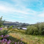
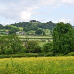
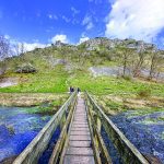
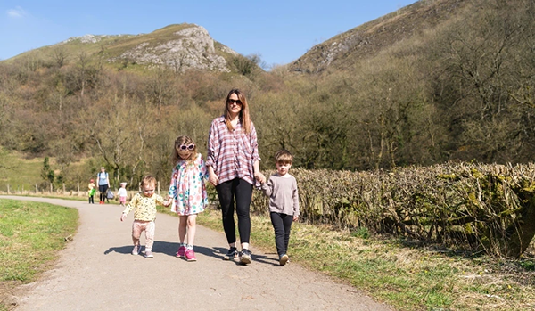
Edit Template

Walks In Derbyshire

There really is no better way to see the beautiful area that we live in than to walk in Derbyshire. Over the years we have walked what feels like pretty much the entire of Derbyshire and Nottinghamshire and feel it only right to share those walks with you. In every edition of Country Images Magazine we feature a walk for you to follow and now we’ve put them online for you to read too. If you have a mobile or tablet, why not follow the walks on it, with a map and an explanation of where to go it’s ideal for you to follow so as not to get lost. We hope  you enjoy the selection below and check back regularly for new walks.

 
  • All Posts
  • Walks
Walk Derbyshire – Shardlow’s Inland Port and Eighteenth Century Walk

February 6, 2024

When the eighteenth century Duke of Bridgewater’s fiancé gave him what we might today call the push, he decided that not only was he secretly pleased to be rid of her, but to be honest, he was also bored by London, which took up too much of her time through the London Society she frequented. Moving north, back to his estate outside Manchester, the Duke of Bridgewater didn’t take long to come up with the idea of what to do with his spare time.  He also decide how to use his growing wealth from the coal being mined beneath his estate.  This growing fortune we must realise had come about at the start of what became known as ‘The Industrial Revolution’.  What had once been carried out mainly by hand, was now increasingly mechanised, run by entrepreneurs such as Richard Arkwright on steam-driven spinning and weaving machines, machines demanding mechanical power.  That power was provided by steam engines, engines driven by coal.  The Duke of Bridgewater supplied a large share of the coal, but it had to be carried to the mills on the backs of mules, an extremely slow process.  So slow was the movement of coal over the comparatively short distance that mill-engines were frequently running out of fuel in their attempt to keep up with the insatiable demand for produce. The duke had the coal and the finance to develop his side of the business of producing cotton fabrics.  There were thousands of tons of the stuff lying a mere hundred feet or so beneath the ground; access to it was comparatively easy, but it was one which eventually led to a new industry, together with an expansion of the duke’s coal sales. The answer to the problem of how to reach Manchester in the shortest possible...

Walk Derbyshire – Fernilee & The Goyt Valley

January 2, 2024

The South Manchester town of Stockport gets most of its water from two reservoirs filling the narrow upper reaches of the Goyt Valley near Buxton.  It is hard to realise that  this was a self-supporting estate with its own coal mines and small industrial estate where gun powder was made.  Errwood Hall, the central building in this complex,  its ruins now partly hidden in a side valley draining from high moors to the west, was the home of the estate’s owners.  The family’s children were educated by a Spanish governess.  Loved by the children, when she died prematurely, her grave was placed in a beautiful woodland situation, alongside senior members of the Grimshaw family.  There is also a wayside shrine above the valley. More akin to those in the Alps it stands high on the hillside, below the summit of Long Hill road and is usually decorated by floral tributes. The Upper Goyt Valley is surrounded by high moorland surrounding mature pinewoods, to the west is a long ridge that overlooks both the valley and sweeping hills  dominated by Shutlingsloe, Cheshire’s highest hill, a steep sided cone that can claim the title of a peak, a rarity in a county more commonly known for its low-lying or flat-topped hills, than sharp-tops, better known as peaks, proof that the word ‘Peak’ in the title of the Peak District has nothing to do with sharp-pointed hills. The meaning behind this expression is said to connect the district to the tribe of ‘Peaclonders’’ who inhabited the region in Celtic times. The eastern side of the valley is mainly open treeless moorland overlooking the spa town of Buxton far below.  The heights of Combs Moss, one of the Peak District’s lesser known features, shelters Buxton from most of the cold scouring winds blowing in...

Walk Derbyshire – A Walk From Pentrich to Crich & Back

November 1, 2023

At the forefront of the Pentrich Rising were Jeremiah Brandreth, a 31-year-old unemployed stocking knitter who had a wife and two children; Isaac Ludlam, a bankrupt farmer who owned a small quarry where he had built up a small supply of pikes; and William Turner, a stonemason and ex-soldier.  From Pentrich this walk will take you over to Crich which has its own fair share of history. The almost alpine village of Crich makes a breezy welcome to travellers.  Field paths skirting the northern limits of Crich lead to two unexpected features, Crich Stand below which is  a section of an abandoned quarry with trams running on a short length of track would once have graced the streets in places as far apart as Portugal’s Lisbon, or Blackpool promenade.  In 1840 George Stephenson discovered deposits of coal at Clay Cross and formed what later became the Clay Cross Company.  He realised that burning lime would provide a use for the coal slack that would otherwise go to waste. He leased Cliff Quarry and built limekilns at Bullbridge. They were connected by wagonway known as “The Steep”, a 550 yards incline at a slope of 1 in 5. Crich Chase Meadows  was designated as an extension of the Crich Chase Site of Special Scientific Interest (SSSI). The meadows stretch out over a steep slope, joining a patch of ancient woodland called Smith’s Rough. USEFUL INFORMATION DISTANCE: Moderate trails, field-paths and country lanes. With some muddy sections. RECOMMENDED MAP: Ordnance Survey 1:25000 scale OS Explorer, Chesterfield & Alfreton. PUBLIC TRANSPORT: Stage Coach East Midlands No.148 is hourly from Ripley to Pentrich and goes on to Alfreton.  CAR PARKING: Parking on the main road in Pentrich REFRESHMENTS: Various pubs, cafes and shops along the route. THE WALK :: THE WALK :: THE WALK...

Walk Derbyshire – Along Lover’s Walk – Ilam

August 30, 2023

The popular village and National Trust property of Ilam and its hall, are based on a Saxon settlement, later expanded in Victorian times.  In its early days it was where the early Celtic Christian missionary St Bertram baptised his flock, using a well on the slopes of Bunster Hill to the north of the village for that purpose.  The Saxon villagers took advantage of the comparative safety offered by the sheltered hollow created by the joining of the rivers Dove and Manifold. In the mid1800s Jesse Watts-Russell a shipping magnate and industrialist, employed the services of the Victorian architect James Trubshaw to replace the Elizabethan mansion and farmhouse with the picturesque Gothic palace with its fairy-tale embellishments.  As part of Watts-Russell’s grandiose scheme, the old village, a mixture of cottages hundreds of years-old, he employed George Gilbert Scott to design the alpine style cottages which, complete with their attractive gardens, are a never ending delight for today’s visitors.  He is often confused with his ennobled son of the same name, who moved on from designing pretty cottages, to being responsible for grandiose schemes such as the design for the rebuilt House of Commons, Battersea Power Station and Liverpool Anglican Cathedral, along with the now fast disappearing GPO red telephone boxes. Jesse Watts-Russell erected the Eleanor-style cross at the road junction beside the pretty cottages of Ilam village.  Meant as a memorial to his first wife unfortunately if historical folk-lore tales are right, she was never popular with his estate workers.   Intended as a competitor to the standards of the Earl of Shrewsbury’s estate at Alton Towers, the Watts-Russell family despite the expense and upheaval only lived at Ilam for a couple of generations.  Since then the hall had a short life as a country hotel, then having been gifted to...

Walk Derbyshire Cromford Meadows & Black Rocks

July 25, 2023

Cromford owes its birth to Richard Arkwright, founder of the water-driven cotton spinning frame, one of the leading inventions of the Industrial Revolution.  Harassed by home-based cotton spinners and weavers in his native Lancashire, in 1771 he opened his first mill, using the convenient power of the nearby River Derwent, close to the Crom Ford, a name that was taken by the factory village he built to accommodate his operatives. Later on he was awarded a knighthood and died an extremely wealthy man – a man who once offered to pay-off Britain’s national debt from what he claimed was ’petty cash’. Developed as aself-contained village, Cromford provided all the amenities necessary for life in what was then a remote corner of Derbyshire. It had every available kind of shop, ranging from the proverbial butcher and baker, to haberdashery and even traditional blacksmiths and leather workers to cater for the day to day needs of the village and surrounding farms.  Health problems were also catered for by an early version of the chemist’s dispensary.   In order to protect it from unwelcome disturbance, the mill became more like a fortress when viewed from outside; guarded by narrow windows rather like gun-slits, and certainly no windows or unlocked doors were accessible from street level. A reasonably benevolent employer, at least by the standards of the time, Sir Richard as he became, and his later sons, gave Cromford its church and founded a school teaching the basic three r’s.  North Street, part way up the hill towards Wirksworth was built to both accommodate textile workers, but also provide space for traditional stocking-frame knitters of the fashionably Derby-ribbed stockings.  Stocking frame knitters traditionally required the best possible light for their work.  To suit all needs, the knitters worked in specially adapted upper rooms, each...

Walk Derbyshire – High Peak Trail Across Middleton Moor

June 30, 2023

When the civil engineer William Jessop and his associate Benjamin Outram finished building the Cromford Canal. While they were linking the expanding industries of the Derwent Valley to the Midlands, it was soon realised that if the canal was continued in a northerly direction, it would open the burgeoning new cotton industry to markets around and beyond the Trent Valley, and vice versa for mutual growth. The original idea of continuing the canal across the limestone moors and linking with the Peak Forest Canal at Whalley Bridge, was soon dropped for the simple reason that the linking canal north from Cromford would have to climb almost 1000 feet across the comparatively waterless limestone uplands of the White Peak. Even then the canal mentality still held sway and following an Act of Parliament dated 2nd May 1825, permission was granted to build a 33mile long railway, still following the canal pattern, costing an estimated £32,880, one of the earliest railways built soon after the opening of the Stockton and Darlington Railway. Permission to build what became known as the Cromford and High Peak Railway, was awarded to Josias Jessop, the second son of William Jessop, the canal engineer responsible for the design and building of the Cromford Canal. As Josias Jessop had been trained in canal engineering, it is hardly surprising that his railway was designed as though it was a dry canal. Rather than go round or underneath hills, the route climbed on steep gradients, with trains hauled up and down by cables powered by stationary steam engines. Still thinking in canal terminology, stations were called wharfs and the inclines took the place of canal locks. There are several sharp bends such as the one at Gotham where the track turns through ninety degrees in less than a hundred yards....

Load More

End of Content.

We hope you enjoy the walks, but check back regularly for more walks in Derbyshire and walks in The Peak District as we are constantly adding new ones.

Country Images Magazine

Featured Posts

Euromedia Associates Ltd

Country Images Magazine is Derbyshire’s leading independent lifestyle magazine, proudly rooted in the heart of the county and dedicated to celebrating its rich heritage, natural beauty, and vibrant communities. Each issue features a carefully curated selection of articles exploring Derbyshire’s history and landscapes, alongside the latest home and interior design trends, local theatre productions, cultural events, dining destinations, and lifestyle inspiration.

In addition, Country Images provides a trusted platform for showcasing independent local businesses, highlighting those that offer outstanding products, personalised service, and a genuine commitment to quality. Through thoughtful editorial and strong community connections, the magazine continues to inform, inspire, and connect readers across Derbyshire.

Euromedia Associates Ltd Logo