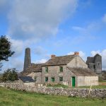
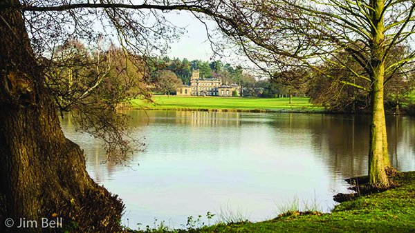
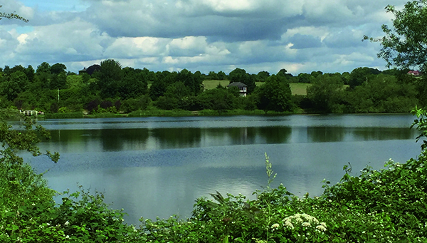
Edit Template

Walks In Derbyshire

There really is no better way to see the beautiful area that we live in than to walk in Derbyshire. Over the years we have walked what feels like pretty much the entire of Derbyshire and Nottinghamshire and feel it only right to share those walks with you. In every edition of Country Images Magazine we feature a walk for you to follow and now we’ve put them online for you to read too. If you have a mobile or tablet, why not follow the walks on it, with a map and an explanation of where to go it’s ideal for you to follow so as not to get lost. We hope  you enjoy the selection below and check back regularly for new walks.

 
  • All Posts
  • Walks
Walk Derbyshire – Osmaston Park

June 1, 2022

The A52 Derby to Ashbourne road passes through some of the gentlest rural countryside in Derbyshire.  Tiny villages little changed in centuries sit around junctions of minor roads that wander pleasantly between both ploughed fields and pasture. This walk skirts three of them, one barely bigger than a hamlet; starting at Osmaston, the largest, it wanders through Osmaston Park and on to Shirley. Field paths and farm tracks then take us by way of Shirley Mill and into the outskirts of Wyaston. Here a right turn takes the walk back into Osmaston Park, entering the village by way of its delightful green. It is complete with a duck pond and seats to rest and admire the scenery.  Osmaston where the walk begins and ends was the home village to Osmaston Park, whose estate employees’ thatched cottages are now much sought after properties.   The village church appears Victorian, rebuilt by the architect H I Stephens of Derby in 1845, but from the size of the venerable yews in its churchyard and the mediaeval font, it is obviously built on ancient foundations.   While the parkland is magnificent, the 19th century Osmaston Manor is no more, abandoned apart from estate houses and the odd tower peeping over the surrounding trees as seen on the latter stages of the walk.   Shirley, like Wyaston is only entered by a short but worthwhile extension to the walk as it passes so close: this village easily dates from the 14th century, but there are even older Norman stones slotted around the church doorway. The remains of a much damaged Saxon cross in the churchyard and a massive yew that was once badly damaged in a gale give some hint of its age.  Further on is Wyaston that nestles in a green hollow a quarter...

Walk Derbyshire – The Four Villages Walk – Brassington, Ballidon, Parwich & Bradbourne

April 26, 2022

I am indebted to Amber Valley Group of the Ramblers Association, as it is they who first planned this interesting walk.  Despite their good work, especially in producing the excellent leaflet I picked up way back in 2005, regrettably the leaflet is now out of print, but luckily I came across a rather dog-eared copy the other day, which helped me to follow my version of their described walk. I enjoyed it so much that it prompted me to carry out some research into the history of these ancient places of worship, together with the villages they have served since Saxon times.  Here is my version. Starting from the small car park above Brassington, the route soon passes St James,’ a church with at least Norman foundations, if not earlier.  It has served the village for centuries, a focal point for generations of lead miners who delved far beneath the nearby grassy moors.  The only link with this long-dead industry is in the name of one of the local pubs, The Miners’ Arms, and a smoke-stained cave high on jagged Rainster Rocks.  This is where a miner and his family lived as described by Daniel Defo in his book about a journey through England in the early 1700s.  His description of the family living like a group of troglodytes clearly brings to life the harsh conditions of a life dependant on living and working in stygian gloom for days on end. First mentioned in local records around 1281, when its Norman foundations were laid on the site of an earlier Saxon oratory, is St James’ church.   The present church, Grade II Listed, is the result of the Victorian craze for ‘improvements’, such as the embattled parapet added to the Norman tower, but at least they left the plain bowl...

Walk Derbyshire – Along the Great Nortner & Bonnie Prince Charlies Trails

April 1, 2022

This short walk skirts the rapidly expanding western boundary of Derby enjoying some of the fine surrounding countryside, and returns by way of the Bonnie Prince Charlie Walk. The Great Northern Railway was once a cross country line from Grantham to Stafford by way of Nottingham, effectively linking both east and west coast mainlines.  It passed through Derby to the north of the city centre, crossing Friar Gate (Ashbourne road), on a magnificently decorated wrought iron bridge: it still exists and its listed status ensures its preservation. Apart from the trail, the bridge (now a two-starred listed monument), is the only nearby link with what must have been an extremely useful railway.  Another subsequently useful link with the history of this line is the recently restored Bennerley Viaduct, a uniquely constructed listed and stared building – a rarity in this country, it is made from latticework wrought-iron, crossing the Erewash Valley, as well as its canals and also the Nottingham/Sheffield branch of the Midland Railway, in one huge high level swoop. With the restoration of Bennerley Viaduct, much of the central section of the Great Northern has been open to pedestrian and cycle traffic, albeit the bit beyond the viaduct unfortunately is buried beneath housing estates.  What the Bennerley Viaduct does, however, is act as a link between two canal tow paths, thereby making an excellent walk through a long gone industrial area. For a longer walk, the section beyond Mickleover takes some beating; this walk follows part of the Mickleover section before wandering off through Derby’s Green Belt to follow part of the Bonnie Prince Charlie’s Way. Suffering the fate of the Beeching Axe, the line was decreed to be uneconomical, but rather than submit meekly its demise was slow and long drawn out.  Officially the line was closed...

Walk Derbyshire – A Winter Warmer – To Riber & High Tor

February 27, 2022

This winter’s walk is one of my favourites, both in summer as well as winter.  I can see Riber Castle quite easily from our bedroom window, in fact most of the walk is visible from where we live, high above the Derwent Valley.  I followed the walk on a wintery day last February, when the silent fields were covered by softly falling snow.  As this offering is to be published in the March 2022 edition of Country Images, let’s see what nature has in store. Starting in the centre of Matlock by the Crown Square entrance to the Hall Leys Park, the walk climbs steadily up to Starkholmes, one of Matlock’s residential neighbourhoods extending beyond Old Matlock.  Metesford’s original hamlet grew around St Giles Church, still the town’s parish church after at least six or seven hundred years.  A steep footpath was used by servants every day and in all weathers to reach Riber Hall and later on, Smedley’s short-lived masterpiece, Riber Castle.   Fortunately this is the end of steep climbing for the day and the way downhill is by a narrow winding country lane, back into Starkholmes.  Here a right turn for about a hundred yards along Starkholmes Road, leads to High Tor Road on the left.  This back road takes us into High Tor Grounds, Matlock’s ‘alpine’ park.  From the top of a winding lane, an old stony track drops back downhill into the riverside path leading back into Hall Leys Park. The three major points of interest visited or seen on this walk are, in chronological order, Hall Leys Park, Riber Castle and its Jacobean village, then High Tor Grounds as the final part of the walk. THE WALK From Crown Square, Matlock’s busy cross roads, the walk immediately enters Hall Leys Park.  It was originally...

Walk Derbyshire – Where Izaak Walton Fished – Hartington

January 25, 2022

Izaak Walton, seventeenth century author of ‘The Campleat (sic) Angler – The Contemplative Man’s Recreation’ would have been familiar with at least half of this walk. The Dove was one of his favourite places to cast a fly, along with his younger friend, the impecunious Hartington landowner, Charles Cotton. They regularly fished the river’s clear waters, mostly below Hartington, especially favouring the quiet pool opposite Cotton’s home at Beresford Hall.  This quiet spot they named Pike Pool in acknowledgement of a monster pike that traditionally lay in wait beneath the shadow of the tall pillar, or spike of rock rising from the deepest and shadiest part of the pool.  In the treatise, Walton calls himself VENATOR (traveller) and Cotton is known as PISCATOR (angler).  Charles Cotton had a fishing temple built as a resting place for them, it still stands behind a high stone wall in the grounds of now demolished Beresford Hall, but being on private land the only time to catch a glimpse of it is in winter when the surrounding trees are bare. The Dove flows through two accessible dales below Hartington which are followed on this walk. Named in some far off time, these are Beresford and Wolfscote Dales, just waiting to be explored after the walker climbs down through comparatively dry Biggin Dale on the way back to Hartington. Leaving the riverside path and following a short walk across fields beyond the head of Beresford Dale that would have been familiar to the two angling friends, the village is reached after a mere fifty yards of road walking. Hartington has long been a busy village.  A market place for locals until a few decades ago, but now the only agricultural industry is the delicious Stilton cheese, made in one of only a handful of places...

Walk Derbyshire – Following The Norman Conquerors In Hartington

January 9, 2022

Once Duke William was crowned as King of England following the Battle of Hastings, it took several years before the Normans could claim true domination of the country beyond the readily subservient south of England.  Throughout the north and marshes of East Anglia, rebellious Saxons made it clear that they wanted nothing to do with these upstart French speaking incomers.  As attempts to pacify those who objected to this change of status failed miserably, King William, the Norman, had to resort to violence, instigating what became known as ‘the Harrying of the North’, when vast areas of Northern England were laid to waste, with the people either murdered or driven off the land they and their forebears had farmed for generations. What became known as the Peak District although being comparatively uninhabited, didn’t escape the takeover, and to put his stamp on the region, King William divided the land amongst those knights who had served him well in battle.  With William Peverel taking most of the land to the north and east of the Peak as his hunting preserve, the rest, mainly those lands to the east of what became Staffordshire and north Derbyshire were handed over to de Ferrier in order to expand his hunting estates further south in Leicestershire. While we may be used to imagining castles as impregnable fortresses built of stone, many began life as manmade hillocks protected not by stone but with rapidly thrown up timber palisades, a kind of quick-build system.  Generally they fitted a standard design with the strongest part being incorporated within, or on top of the high mound, or motte where the lord and his knights sheltered, and a lower much larger area or bailey protecting everything necessary for everyday living.  Here would be a noisy collection of everything from a...

Load More

End of Content.

We hope you enjoy the walks, but check back regularly for more walks in Derbyshire and walks in The Peak District as we are constantly adding new ones.

Country Images Magazine

Featured Posts

Euromedia Associates Ltd

Country Images Magazine is Derbyshire’s leading independent lifestyle magazine, proudly rooted in the heart of the county and dedicated to celebrating its rich heritage, natural beauty, and vibrant communities. Each issue features a carefully curated selection of articles exploring Derbyshire’s history and landscapes, alongside the latest home and interior design trends, local theatre productions, cultural events, dining destinations, and lifestyle inspiration.

In addition, Country Images provides a trusted platform for showcasing independent local businesses, highlighting those that offer outstanding products, personalised service, and a genuine commitment to quality. Through thoughtful editorial and strong community connections, the magazine continues to inform, inspire, and connect readers across Derbyshire.

Euromedia Associates Ltd Logo