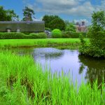
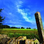
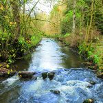
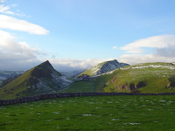
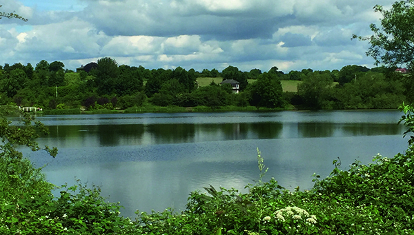
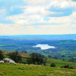
Edit Template

Walks In Derbyshire

There really is no better way to see the beautiful area that we live in than to walk in Derbyshire. Over the years we have walked what feels like pretty much the entire of Derbyshire and Nottinghamshire and feel it only right to share those walks with you. In every edition of Country Images Magazine we feature a walk for you to follow and now we’ve put them online for you to read too. If you have a mobile or tablet, why not follow the walks on it, with a map and an explanation of where to go it’s ideal for you to follow so as not to get lost. We hope  you enjoy the selection below and check back regularly for new walks.

 
  • All Posts
  • Walks
Walk Derbyshire – A Walk from Grin Low & Buxton Country Park

November 27, 2021

There are not many walks claiming to start downhill, but this one does (although the height lost must be regained at the end, but nothing is perfect, is it?) The walk starts from the car park accessing Solomon’s Temple before dropping down to the centre of Buxton and its Pavilion Gardens, returning by way of Poole’s Cavern Country Park. A once devastated landscape covered with small scale limestone burning has changed into a pleasant hillside, where mature woodland criss-crossed with meandering footpaths leads to three interesting features.  The walk explores them together with the rest of the byways. Around the early 1800s Grin Low hillside was devastated by the results of two centuries of quarrying and lime burning, leaving a lunar landscape of humps and hollows where whole families lived like troglodytes.  As part of his ambition to turn Buxton into a northern spa, in competition with Bath and Harrogate, the 6th Duke of Devonshire planted the 100 acre wood with a mix of broad leaf trees such as beech, oak and sycamore together with a few conifers.  These have now grown into maturity and along with the grassy moor around Solomon’s Temple they have created what is now designated as a Site of Special Scientific Interest (SSSI) where swathes of rare sub-alpine species bloom, along with many wild animals and birds making their home here.   Along with paths meandering through the woods and across the open hilltop, there are three specific features that will provide plenty of interest to young and old.  Starting from the car park and picnic site, these are: Poole’s Cavern Arguably this is the most natural cavern open to visitors in the Peak District.  Even though it was never mined, it has links with ancient people from long before the Romans settled in what...

Walk Derbyshire – Taddington to Flagg & Chelmorton

November 7, 2021

This month’s walk has a little bit of archaeology thrown in for good measure.  All it takes is a strong pair of legs, keen eyesight and maybe but not essentially, a lightweight set of binoculars. Starting and finishing in the delightful village of Taddington, a place where winter snows seem to come long before other Peakland settlements.  Walking almost due south at first, the way begins by crossing seven tiny fields; small strip fields seem to be a feature locally.  Crossing the Bakewell/Chelmorton road, a field path follows the length of one of the narrow strips to reach Flagg where they have races for riders ranging from teenagers to mature middle aged farmers every Easter Sunday, a day when nature invariably arranges a snow storm to keep everybody on their toes.  The long narrow fields date back to Saxon times when their shape was dictated by how much land a man and two oxen could plough in a day. From Flagg a sharp right-hand turn leads through a series of slightly larger fields, traditionally left unploughed.  The walk then follows minor roads and footpaths all the way to re-join the Bakewell/Chelmorton road; a left turn here for about 150 yards and steadily descends beyond a moorland cross-roads, as far as a minor road going right, downhill into Chelmorton, arriving conveniently opposite the Church Inn.   This village has the best preserved collection of unspoilt narrow, strip fields.  Its church is dedicated to Saint John the Baptist, the saint who the Bible tells us, spent time in the wilderness, where he lived on locusts: a locust weather vane on top of the church steeple commemorates the event.  After a little under half a mile of walking on field paths over an airy limestone upland filled with tiny flowers, the path crosses...

Walk Derbyshire – Walking Eyam, Bretton Edge and Foolow

October 5, 2021

Here is a walk through some of the historical countryside surrounding the plague village of Eyam, a village where the Covid-19 pandemic must have jogged some deep folk memories from a time when the inhabitants of Eyam made a courageous stand against an outbreak far worse than that which beset them in more recent days. The walk starts logically one might say, from the car park directly opposite a small, but fascinating museum devoted to the stand made by those villagers in 1665/6, when led by a far sited young rector, the Reverent William Mompesson and assisted by his friend and predecessor, Puritan minister Thomas Stanley.  Simply by what was surely firm and sensible leadership, they managed to persuade the people of Eyam to hold themselves in total isolation, despite more than half their number succumbing to the dreaded virus known as Bubonic Plague. All around Eyam village you can find relics of that terrible experience, from the natural pulpit in Cucklet Dell where Mompesson preached in the open air.  Other relics are Mompesson’s Well high above the village on the edge of Eyam Moor where the far sighted vicar aided by the local landowner, the Earl of Devonshire, arranged for kind hearted suppliers to leave essential supplies, paid for by cash left in the purifying waters of the well.  Another transfer point is the limestone boulder beside the path leading down to Stoney Middleton.  Money dropped into holes filled with vinegar carved in its surface was rendered safe by the purifying action of the vinegar.  Along with these exchange points are the number of simple graves dug into places well away from the village church; they were dug by survivors who had the onerous task of burying their nearest and dearest in places ranging from local fields and even...

Walk Derbyshire – Walking from Golden Valley to Codnor Castle

August 26, 2021

Here is a walk through history – from medieval times through the industrial revolution to the present day.  Starting at the quaintly named Golden Valley, it passes the monument to a Victorian ironmaster and civil engineer, before crossing farmland slowly recovering from the depredation of open-cast coal mining in order. From here farm lanes reach a castle built by one of William the Conqueror’s knights.  On the way back the walk follows the line of an abandoned section of the Cromford Canal. When the tunnel taking the Cromford Canal was dug beneath Butterley Park near Ripley, extensive amounts of ironstone and lime were discovered, making the raw materials founding the Butterley Ironworks.  Specialising in large innovative projects, the company is best known for its construction of the Falkirk Wheel in recent times, to the famous pillars that still support St Pancras Station roof.  What is not so well known is that the company made the cast-iron ‘trough’ carrying the Llangollen Canal over the river Dee.  Such was the value and range of useful ores found during the canal tunnel’s construction that gave the name to Golden Valley. Although later roof falls made it necessary to close Butterley Tunnel, a long narrow lake that once held water to top up canal locks lower downstream, has settled into the countryside.  It is popular with both walkers and anglers, some of whom were startled when their hook snagged an unexploded German bomb.  Cottages, many of them once the homes of ironstone or coal miners exploiting the mineral wealth of Golden Valley. Codnor and Ironville are relics of that industrial past, but now mainly offer accommodation to those working in nearby factories dotted around the modern industrial estates. The walk starts from any one of the car parking spaces dotted around the valley road...

Walk Derbyshire – Combs Reservoir

May 26, 2021

Combs Moss is an outlier of the higher moors of the Daark Peak.  It sits between Buxton and Chapel-en-le-Frith, mainly overlooking the latter.  Looking upwards from Chapel, a long escarpment dominates the skyline, marked by two protruding side ridges radiating from its eastern edge.   The further of the two, between Combs and Short Edges, is the site of a pre-historic fortress.  Using the steep drop on its northern side a double defensive series of ditches at its back, made it an almost impregnable outpost.   Using the steep slope of the escarpment, enemy attackers coming from the north would be seen long before they reached the difficult slope rising beneath the fort. With rough moorland slowing attackers from the south and east, whoever held the fortress would have plenty of time to prepare themselves from anyone wanting to use surprise in their favour. Combs is an anglicised version of the Welsh word ‘cwm’, meaning a mountain hollow.   This hollow became an ideal place to build a reservoir supplying water for the Peak Forest Canal, the northern arm of a canal network linking Trent and Derwent Valley waterways to the North West by way of a railway across the dry limestone countryside of the White Peak.  Peak Forest Canal runs west from Whaley Bridge joining the north western network at Marple where it links the industrial Midlands with Lancashire. I have a special interest in this walk around the upper reaches of the Combs Valley. During my first camp with a scout troop, we pitched our tents in a farmer’s field just outside Combs village. One of our walks followed a rough path up on to the escarpment, the route following one of the side streams.  The sight of what seemed endless miles of rough moorland stretching south when...

Walk Derbyshire – Thorpe Cloud

April 18, 2021

Two prominent hills guard the southern entrance to Dovedale; bulky Bunster rises to the west at the end of a broad limestone ridge, while Thorpe Cloud’s graceful summit looks to the east.  The steeper of the two, the Cloud has footpaths on three sides and as such has become a popular venue for walkers looking for a short exciting scramble.  Alternatively it makes the centre piece of a little known walk linking the Dove and Manifold Rivers close by their junction. This walk begins at the Dove Dale car park, before moving along a short road through the tight gap between the Dove’s guardian hills.  At the road end (it is really there to guide anglers to the start of their beat), the famous Stepping Stones take walkers over to the opposite bank.  An alternate crossing can be made if the river is in flood, by using the wooden footbridge closer to the car park. If we were to continue to explore upstream along the path over the high rock we come to the place where an eloping parson came to grief a couple of centuries ago.  From the stepping stones, this walk turns right to pass round Thorpe Cloud’s lower slopes, by climbing broad Lin Dale.  A grassy track reaches the Ilam road next to a public toilet.  Thorpe village dots the far side beyond the main road and the walk then follows a series of quiet back roads, past the village church, before dropping down to Coldwall Bridge over the lower reaches of the Dove.  Nine out of ten visitors ignoring Thorpe’s charm fail to realise that its foundations date from at least Norman times, but all that is left from that time is the unaltered tower of its church. A wide track drops down to the river,...

Load More

End of Content.

We hope you enjoy the walks, but check back regularly for more walks in Derbyshire and walks in The Peak District as we are constantly adding new ones.

Country Images Magazine

Featured Posts

Euromedia Associates Ltd

Country Images Magazine is Derbyshire’s leading independent lifestyle magazine, proudly rooted in the heart of the county and dedicated to celebrating its rich heritage, natural beauty, and vibrant communities. Each issue features a carefully curated selection of articles exploring Derbyshire’s history and landscapes, alongside the latest home and interior design trends, local theatre productions, cultural events, dining destinations, and lifestyle inspiration.

In addition, Country Images provides a trusted platform for showcasing independent local businesses, highlighting those that offer outstanding products, personalised service, and a genuine commitment to quality. Through thoughtful editorial and strong community connections, the magazine continues to inform, inspire, and connect readers across Derbyshire.

Euromedia Associates Ltd Logo