From Hen Racing to a Bygone Industry What do you know about Bonsall?

Bonsall is tucked away in an upland bowl, high above the Derwent Valley and seems a place where time has passed it by. Nevertheless it has been home to a proud group of villagers since long before William the Conqueror’s scribes listed it as Bonteshall in the Domesday Survey. Its early prosperity was based on lead mining and the ore’s by-products, and also calamine (zinc carbonate) which when amalgamated with copper makes brass. Textile manufacturing followed the development of Richard Arkwright’s spinning mills at nearby Cromford, but before that came about, manually operated knitting frames were busy producing stockings in little barn-like sheds still recognisable up and down the village. Farming was Bonsall’s oldest activity, an occupation that took place as it still does on the rolling acres of limestone moors just beyond the village centre. Probably it is Bonsall’s remoteness that has preserved many of its old buildings and traces of the now dead industries. Access to the village is along the steep side road leading into Yeoman Street and the village centre before the road divides at Fountain Square, and then climbs to aptly named Uppertown by way of a winding tricky byway. The road up into the main part of the village is known locally as ‘Clatterway’, no doubt from the sound of mill workers’ clogs as they made their way down to Arkwright’s Via Gellia Mill. Now split into small industrial units, it was the unlikely birthplace of ‘Viyella’ fabric, the name a variant of Via Gellia, was invented by Hollins & Co, the firm which took over the mill. Red tape so loved by bureaucrats was briefly made in Bonsall. Standing on the corner directly opposite Via Gellia Mill is a house where the name above the door ‘The Pig of Lead’, recognises that it was until fairly recently a pub where miners could slake their thirsts before climbing back up Clatterway. The ‘pig’ has nothing to do with porkers but comes from the word for a lead ingot. A short diversion beyond the mill leads to another link with by-gone industry. A high wall separates what was once a lead smelting mill, but is now a storage depot for a skip-hire company from the busy road. This was latterly the site of a colour works where limestone-based powders were mixed with coloured sands for industrial use. It ceased production in the 1960s, but its sister company in Matlock Bath continued for a few more decades. At points along the Via Gellia road, occasional free-standing walls are all that is left of lime kilns where stone from nearby quarries was burnt to create valuable lime destined to sweeten farm fields far and wide. Turning up the Clatterway, the road passes groups of attractive cottages, once the base of no fewer than five separate industries. Within the space of around a quarter of a mile there was a blacksmith, a colour works (later moving into the Via Gellia site), a carpenter and finally a water-powered corn mill. There was even a small workshop making once fashionable combs from tortoiseshell. A ropewalk in a long narrow field made essential safety lines for lead miners. Bonsall Brook flows along a deep ravine to the side of Clatterway, its waters enhancing the attractive cottage gardens. Bonsall Brook seems to flow from below the lorry park next to the village recreation ground, but it starts life beyond the top of the village at Town Head and until it was culverted openly flowed down the side of Yeoman Street where every house had its own little limestone slab, which the locals proudly referred to as marble bridges. Traffic demands led to culverting the brook in order to widen the street; the nearby recreation ground is on the site of an in-filled dam made redundant with the reduced demand for water to power mills in Cromford. A fountain that once trapped the unwary by creating an ice rink every winter marks the turning into The Dale. Standing above it is a small café that was the ‘New Inn’, later it became known as the ‘Fountain’ until it closed in the 1980s. Next door is the village hall which took over the building from the local school when it was moved to larger premises next to the parish church, across the valley. To the left of the fountain and that increasing rarity these days, a well-cared for public toilet, a garage stands on the site of a private gas works; it belonged to the now completely demolished grand house called ‘The Study’, home of the Prince family. Yeoman Street and its continuation High Street can be said to mark the true centre of Bonsall. Although there are few indications of their former use, many of the houses lining both sides of the street were once shops. Due to its slightly isolated situation, the village was more or less self-supporting, with grocers, butchers, milliners, tobacconists, sweet shops and a corn chandler all serving the village’s needs. There were two Co-op shops, a post office and at least three fish and chip shops! The post office and co-op stood opposite the King’s Head public house and the premises have been so well converted it is hard to tell that the 19th century terraced house was once a shop. The mounting block outside the King’s Head is a sure indication of its 17th century origins. Its Jacobean links are continued by the low beams and totally unspoilt interior; all the past landlords are listed on a notice hanging behind the bar. The house next door known as the Queen’s Arms is of equal age and was also a pub that became a café and guest house. Facing both buildings is Bonsall’s stepped market cross which if local information is correct is built around a wooden framework, but nowadays rarely used as either a preaching cross or where produce was sold. Taking a right turn at the cross the narrow street first known
Walk Derbyshire – Along the Great Nortner & Bonnie Prince Charlies Trails
This short walk skirts the rapidly expanding western boundary of Derby enjoying some of the fine surrounding countryside, and returns by way of the Bonnie Prince Charlie Walk. The Great Northern Railway was once a cross country line from Grantham to Stafford by way of Nottingham, effectively linking both east and west coast mainlines. It passed through Derby to the north of the city centre, crossing Friar Gate (Ashbourne road), on a magnificently decorated wrought iron bridge: it still exists and its listed status ensures its preservation. Apart from the trail, the bridge (now a two-starred listed monument), is the only nearby link with what must have been an extremely useful railway. Another subsequently useful link with the history of this line is the recently restored Bennerley Viaduct, a uniquely constructed listed and stared building – a rarity in this country, it is made from latticework wrought-iron, crossing the Erewash Valley, as well as its canals and also the Nottingham/Sheffield branch of the Midland Railway, in one huge high level swoop. With the restoration of Bennerley Viaduct, much of the central section of the Great Northern has been open to pedestrian and cycle traffic, albeit the bit beyond the viaduct unfortunately is buried beneath housing estates. What the Bennerley Viaduct does, however, is act as a link between two canal tow paths, thereby making an excellent walk through a long gone industrial area. For a longer walk, the section beyond Mickleover takes some beating; this walk follows part of the Mickleover section before wandering off through Derby’s Green Belt to follow part of the Bonnie Prince Charlie’s Way. Suffering the fate of the Beeching Axe, the line was decreed to be uneconomical, but rather than submit meekly its demise was slow and long drawn out. Officially the line was closed to freight on 7th September 1964, but until the 4th September 1967 it continued to operate carrying passengers only. Even then it had its uses when the Mickleover to Willington section was used as a test track for experimental rolling stock. The station at Mickleover is still there, but fulfilling a completely new existence as a private house and with the name of the Great Northern Railway immortalised by the one-time station pub on the main road. Starting from the small car park beside the Mackworth to Mickleover road opposite the Great Northern pub, the walk follows the converted railway for about a mile before branching out along paths to the North West, meandering over the fields leading towards Radbourne. A walk along a short rural lane wandering away from the village forges links with part of the Bonnie Prince Charlie Walk. This path is abandoned where it abuts a field track, which in turn is then followed all the way back to the railway trail. Here a left turn is made to return to the car park. THE WALK – STEP BY STEP From the car park follow the surfaced lane down to the site of the old station and join the trail. The remains of the old Mickleover station have been converted into private houses, but it nowadays turns its back on what was once the station platform. You can still see traces of siding where coal deliveries for the local district and goods were offloaded. The trail which here runs as far as Etwall is as proclaimed by the blue cast iron signpost to be part of Route 54, within the national cycle network. Walkers and cyclists can enjoy the safety of the track away from the danger of motorised traffic. Interesting art-work beside the bridge next to the last house gives a few facts and figures appertaining to the Trans-Pennine Cycleway, that runs, as the information on the nearby five-barred gate, for 350miles between Derby and Berwick on Tweed. Follow the trail for a little over a mile and look out for a footpath sign on your right. Leave the trail and drop down to and then cross a narrow stream. Climb up through rough woodland and out into open fields. Follow the right-hand edge of woodland before crossing four crop growing fields. Go through two gates on either sides of the minor road in order to enter a small wood. Leave the wood by going through a kissing gate and then bear slightly left and uphill. Aim for a wooden pole. It marks the route and on reaching it start to walk gently downhill, bearing right on a faint grassy path. This section of the route is along the right of way through Radbourne Hall Park, traditional home of the Pole family, at least since the late 18th century when the brick-built hall was erected. In 1781 the hall was the home of Erasmus Darwin, father of Charles whose theories delved into the origins and development of life on earth. Bonnie Prince Charlie is said to have spent a night at Radbourne Hall on his abortive march south. The village sprawls in a layout the medieval inhabitants would easily recognise, possibly finding it easier than modern visitors who frequently complain about getting lost when attempting to find the church. Incidentally it is probably easier to find when following this walk, as it lies in plain sight a matter of four or five yards from the footpath from Mickleover. Cross a small bridge and then aim for St Andrew’s church. Go through the little cast iron gate on your right and walk past the church, keeping the bell tower to your right. If the church is open it is well worth a visit, if only to admire the medieval tombs. Here lies Sir John Chambers, friend of Edward the Black Prince in the 14th century. Many of the Pole family intermarried with the Chandos family and later were laid to rest within the nave. Here is the effigy of Peter de la Pole who died in 1432 and is shown lying alongside his wife Elizabeth. He has long straight hair and holds a sword marked
Celebrity Interview – Steve Backshall

Explorer, naturalist, television presenter and writer Steve Backshall has dived with sharks, been hunted by a polar bear and gone on expeditions to parts of the globe that have never been explored before. So what is he afraid of? His answer may shock you: “I’m afraid of people. I think we’re far more frightening than any animal could ever be.” Taking time off from preparing for his new show Ocean which is touring to both Buxton Opera House and the Royal Concert Hall in Nottingham, Steve explains that he’s not afraid of any animal. This is despite being bitten on the leg by a caiman while searching for anaconda in an Argentinian swamp. “I’ve been working with animals long enough to know what I have to do to stay safe. As long as I keep to my own rules, then things tend to work.” Some of the animals he has encountered in his career will be on stage with him when he presents the show Ocean. The audience need not be worried – they will be life-sized replicas. “What I’m trying to do,” says Steve, “is bring marine environments and more importantly marine animals to life on the stage inside the theatre. That will be some of the very biggest creatures ever known to have lived, some of the most iconic animals that we have on our planet, many of which we know next to nothing about. “I’ll be using life-sized replicas and some of them simply won’t get into theatres. I don’t think that’ll be a problem in Buxton or Nottingham because they’re good-sized theatres. But it certainly will be in some of the venues.” Steve is compiling his first tour for five years, finding clips of some of the shows he has done over the past 25 years, editing them together and sourcing the props he needs for his show. He will be doing 34 shows in five weeks, a schedule which he describes as “insane”. “It’s going to be really hard. At the same time it’s exciting because for me, doing stuff on camera you’re quite removed from the audience and you can get caught up telling the tale you want to tell rather than the one the audience wants to hear. “Having that immediacy of reaction that you get on a tour is so important to someone like me and you get so much back, particularly from the younger members of the audience. “Being able to see people who are already filled with passion about wildlife, about conservation is massive.” Steve is grateful that he is able to perform live as well as undertaking television work. “I wouldn’t just want to do touring – it’s very exhausting and you’re too exposed: just one person up on stage and there are so many things that can go wrong. “I enjoy television. It’s something I can really get energised by. There’s always something new every single day. You just don’t know what’s going to happen next and I find that absolutely thrilling.” Stephen James Backshall was born on 21 April 1973. His parents worked for British Airways and he was brought up on a smallholding in Bagshot, Surrey where he was surrounded by rescue animals. After reading English and theatre studies at the University of Exeter, Steve studied martial arts in Japan, earning a black belt. Then his life changed completely. He had an idea for a television series, bought a video camera and went off to film what was happening in the jungle in Colombia. “It seems crazy now,” says Steve, “but that’s exactly what I did. I was very lucky in that I made the right contacts at National Geographic and the video that I made ended up forming the basis of a series. It properly chucked me in at the deep end. “My early efforts (with a video camera) were I’m sure pretty rubbish but they were real. It probably captured the imagination because it was authentic.” It led to National Geographic taking Steve on as “adventurer in residence” and he worked for the channel for five years. “Basically they gave me the company credit card and said ‘go off and film what you do’. It was a baptism of fire to say the least.” He moved to the BBC’s The Really Wild Show in 2003 and then came the series Deadly 60. He searched for predators that were “not just deadly to me but deadly in their own world”. The programmes were sold to 157 countries. Deadly 60 won a BAFTA award for best factual series in 2011 and Steve picked up the BAFTA for best children’s television presenter. In 2018 he started a project called Expedition which involved his taking on extreme physical challenges and encountering extraordinary wildlife in pursuit of new discoveries and world firsts. So what is he most proud of? “That’s a tricky one. There’s been so many things. The Expedition films went to places that people had never been to before. We made the first ever ascent of arctic mountains, the first descent of Himalayan rivers, discovered old human art in forgotten caves in Borneo. “Those sorts of things are always massively high up the list of things that make me really proud.” Steve lives close to the river Thames on the border of Berkshire and Buckinghamshire with his wife, Olympic champion rower Helen Glover and their three children. During lockdown the Backshalls were able to take advantage of their surroundings: “We took a lot of time to find ways of giving our youngsters their first experiences of the outdoors right on our doorstep.” Steve who early in his career wrote for the Rough Guides publishers maintains that his first love is writing. He has put his name to a number of wildlife books, some of them linked to the Deadly 60 and Expedition series, and he has also written four novels which feature “action, adventure, predators and peril”. He is now working on a book with Helen
History of Endurance
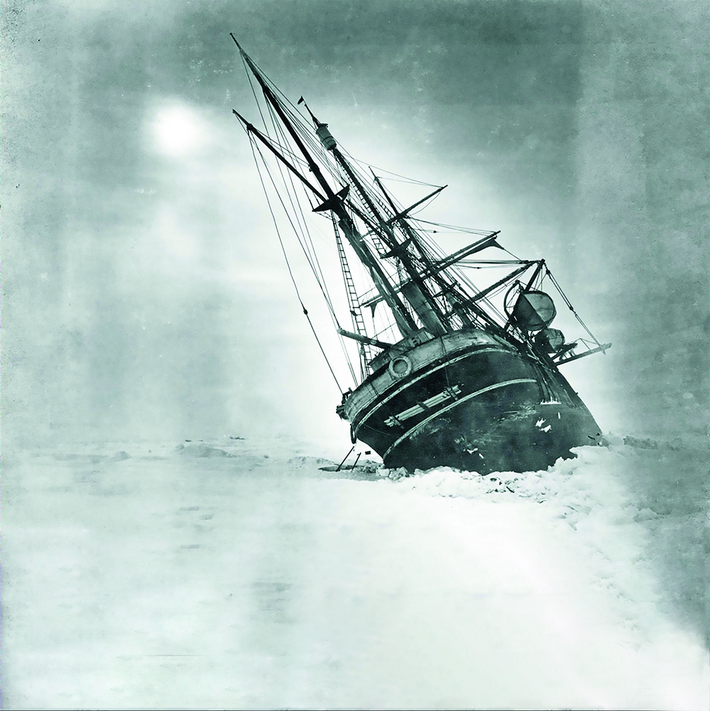
In late 1914 the world was threatened by war. Shackleton volunteered to cancel his plans for an expedition and placed his ship at the disposal of the UK Government. The First Sea Lord, Winston Churchill, instructed him, however, to proceed. Shackleton accordingly headed south, but chose to avoid the Falkland Islands, which he reckoned might be attacked by the Imperial German Navy, and to approach Antarctica from the relative safety of South Georgia. And indeed, it was as Endurance entered the Weddell Sea that the British and German fleets engaged in the Battle of the Falklands. Shackleton’s aim for his Imperial Trans-Antarctic Expedition (the “Endurance Expedition”) was to achieve the first crossing of the White Continent from the Weddell Sea via the South Pole to the Ross Sea. While Shackleton would lead a party that would set off for the Pole from the Weddell Sea, a separate party was to be landed on the shores of the Ross Sea with the objective of placing supplies from the Pole to the Ross Sea that would support Shackleton’s party on the second part of their crossing of Antarctica. Despite many difficulties, the members of the Ross Sea party succeeded in placing the supplies as planned. Tragically three members of the expedition died before the party was picked up from their base on the Ross Sea. Endurance too encountered difficulties, becoming stuck in the dense pack ice in early 1915 and the crew had no choice but to abandon ship and set up a makeshift camp on the ice, as the sea ice overwhelmed the ship. On that day, 21st November 1915, Captain Frank Worsley wrote the coordinates of the location in which the ship sank in his diary: 68°39’ 30”S, 52°26’30”W. One of the objectives of the Endurance22 expedition is to use that information to help locate the lost vessel. The band of 28 crew would have had to draw upon every ounce of strength, tenacity and courage that they possessed in order to survive the failed expedition, which is now remembered in history as one of the most epic feats of endurance in the heroic age of Antarctic exploration. They trekked to the edge of the sea ice, then sailed in the salvaged ship’s lifeboats to Elephant Island where there were seals and penguins to eat and a sheltered bay in which to camp under the upturned lifeboats. However, knowing that it was unlikely that anyone would come to Elephant Island to rescue them because it was so remote, Shackleton and Worsley led a small party in one of the open boats to South Georgia, where there was a whaling station. Worsley navigated with just a sextant over the wild seas of the Southern Ocean. Landing on the south side of the island, Sir Ernest then had to traverse the hitherto uncharted and uncrossed mountains and glaciers to reach the Norwegian whalers. Rescue missions to reach the stranded expedition members at Elephant island were thwarted by the thick sea ice. Finally, on 30 August 1916, the fourth attempt was a success, and the expedition party on Elephant Island was taken to safety in Punta Arenas by the Chilean tug ‘Yelcho’. The Imperial Trans-Antarctic Expedition (1914 – 1915) Sir Ernest Henry Shackleton (15 February 1874 – 5 January 1922) was a polar explorer involved in several British expeditions to the Antarctic in the early 1900s. Shackleton was a member of Captain Scott’s Discovery Expedition (1901–1904), during which he, Scott and Edward Wilson set a new southern record by sledging to 82°S. During Shackleton’s Nimrod Expedition (1907 – 1909) he and three companions achieved a new ‘farthest south’ record reaching 88°S; just 112 miles short of the south geographic pole. Shackleton’s Imperial Trans-Antarctic Expedition (1914 – 1917), was an attempt to make the first overland crossing of the Antarctic continent. The ship chosen for the expedition was the Endurance, built in Norway and launched on 17 December 1912. She was initially named Polaris and was specifically designed for operating in ice-covered waters. The expedition left the UK in August 1914, and departed from South Georgia for the Weddell Sea on 5 December. The expedition soon encountered significant sea ice cover and on 18 January 1915 at 76°34’S, Endurance became trapped in the ice. Several attempts were made to free Endurance from the ice, but to no avail and by the end of February, temperatures had fallen and the ship was frozen in for the winter. The expedition members remained living aboard the Endurance for several months until 27 October 1915 when Shackleton took the decision to abandon ship. Their position was 69°5’S, long. 51°30’W. The Endurance was under heavy pressure from the ice which tore away her rudder post and crushed in her stern. Shackleton wrote: “we have been compelled to abandon the ship, which is crushed beyond all hope of ever being righted, we are alive and well, and we have stores and equipment for the task that lies before us. The task is to reach land with all the members of the Expedition. It is hard to write what I feel”. The Endurance finally broke up and sank in the Weddell Sea on 21 November 1915. The 28 men of the expedition were isolated on the drifting pack ice hundreds of miles from land, with no ship, no means of communication with the outside world and with limited supplies. The story of their survival and eventual rescue is one of the greatest polar stories. Using three lifeboats from Endurance, the men travelled initially across the sea ice and then open water to reach Elephant Island. From there Shackleton and five others used one of the lifeboats, the James Caird, to sail to South Georgia to raise the alarm and seek rescue. The remaining expedition members were rescued from Elephant Island on 30 August 1916. In March 2022 the Falklands Maritime Heritage Trust confirmed that the Endurance22 Expedition had located the wreck of Endurance, Sir Ernest Shackleton’s ship which has not
The Lost Houses of Derbyshire – Eastwood Hall, Ashover

Ashover is a most interesting, beautiful and large parish in central Derbyshire, situated just south east of the main road from Matlock to Chesterfield (A632). The parish is home to several minor country houses – Eddlestow, Goss, Marsh Green and Stubben Edge Halls, not to mention Eastwood Grange – but also includes a lost house, Eastwood Hall, albeit that its ruins are still a prominent feature of the landscape. South of the village, there is a lane linking Hard Meadow Lane with Stubben Edge Lane called – you guessed it – Eastwood Lane. Although Google StreetView has never bothered to venture along it, it is a pleasant drive, and its main feature is a substantial agglomeration of farm buildings, rising up amongst which appears a tree seemingly of extraordinary and vast bulk. This is the remaining vestige of Eastwood Hall. When Mick Stanley and I first visited, in winter 1980/1981 whilst researching the first edition of The Derbyshire Country House, it was moderately visible, standing gaunt to a considerable height; when Carole and I revisited to make a more up-to-date photograph for my forthcoming book on lost Derbyshire houses (from Amberley, expected early next year, thanks to Covid delays) we found it utterly invisible, despite it being April 2021: it was completely swathed in greenery – a huge shapeless lump. As the ruin is a grade II listed building, this is not good news, for such a plenitude of growth will inevitably weaken an already damaged structure in ruins for 376 years: one can imagine it collapsing entirely in one of the sort of storm we enjoyed in February this year. This, of course, might not be particularly good news for the owner, as a later west wing, built out of the rescued fabric, is still inhabited and a collapse could quite easily flatten it! Fortunately, these storms tend to come from the west, so they may feel confident that any collapse will fall eastwards. So profuse is the growth, indeed, that it may be holding the poor old thing together. At the time of Domesday Book (1086) two manorial estates at Ashover, previously in the possession of a pair of Saxon thegns called Leofric and Leofnoth, had been bestowed upon one Serlo, who held it as the subtenant of the Norman grandee Ralph son of Hubert of Crich. Serlo’s great-grandson, Serlo of Pleasley, left two daughters and heiresses and, through marriages over the two following generations one daughter’s share had descended to Ralph de Willoughby and the other’s to Isidore de Reresby of Rearsby, Leicestershire and Thrybergh in Yorkshire. Presumably, Serlo had lived on the estate, if only because by 1302, the Willoughbys had built a fresh house, and called it New Hall, presumably to differentiate it from its predecessor. Part of their estate eventually was acquired by the Reresbys, too. This was the house that later became Eastwood Hall. Sir George Sitwell claimed, to Derbyshire archaeologist S. O. Addy, that the ruins in his day included ; ‘The arch over the east doorway…a very fine and interesting specimen of Norman architecture at the early part of the 12th century, and the interior of the hall or vestibule also shows traces of the same style…the early English windows and masonry in the western tower probably date from about 1220’ Addy, however, could not verify any of this on the ground and, whatever had been built in the 13th and 14th centuries seems, in reality, to have been obliterated by a mid-to-late 15th century rebuild. This rebuild took the form of a five storey tower house which, after Prior Overton’s Tower at Repton (1437) and the High Tower of Wingfield Manor (1444) must have been the earliest residential tower house in the Midlands, a region which, in the Tudor age, became famousfor them. The house is constructed of Ashover Grit or Chatsworth Grit (types of millstone grit sandstone) roughly squared and brought to course, with dressings – quoins, fenestration and so on – of the same. The initial build, which may have been intended as a hunting lodge for occasional use, was a free-standing tower of five storeys; the ‘battlements’ noted in the 18th century were probably decorative Tudor merlons put on later in the 16th century to add a bit of dash to the house’s appearance, for no licence from the Crown to crenellate the house has ever come to light. The east front had the highest part at its south end and a later, lower, three storey range was added, probably in the 16th century to form a five bay east front with miniscule two light mullioned windows below a thin string course lighting the upper floor, with some mullion and transom windows for the ground floor. This range probably included something of a great hall. The central bay was deeply recessed but later acquired a porch to infill the space. Sir Thomas Reresby married Mary Monson, who brought him a Lincolnshire estate and £2,000 which he spent turning this slightly adapted hunting lodge into a proper residence for a landed country gentleman. He added a new range to the south west and carried this round to form a west front, adding a short service wing to the north and a single storey parlour range to the east side of the high tower. The interior, it would appear, was enriched with ornamental plasterwork, but Sir Thomas eventually over-stretched himself financially, vesting the estate in trustees. In the end, he was obliged, in 1612, to mortgage it to Samuel Tryon, a London merchant who foreclosed in 1623. Tryon then split up the estate by sale, and sold the house to Revd. Immanuel Bourne (whose family came from Whirlow, near Sheffield) the vicar of Ashover, who adapted it as a very grand and eccentric vicarage. When the Civil War broke out, Bourne attempted to temporize and in so doing got the worst of both worlds. At first the Royalists held much of the County, and in 1643 he
Product Test – Green People

Feel The Sunshine With Green People Add a little sun kissed glow to your face and body with these luxury products by Green People Our Promise To You Natural & organic • Kind to sensitive skin Sustainably sourced ingredients • Cruelty-free & vegan Free from ethyl alcohol & gluten For more information and to buy online visit www.greenpeople.co.uk SELF TAN LOTION 150ML £23 Non-streaky self tan lotion for all skin types A revolutionary natural self tan – the first certified organic in the UK. Achieve a healthy, natural-looking tan without harmful sun exposure. DHA, derived from sugar, gives the appearance of a natural tan. Quick-drying and non-greasy, leaving skin soft and supple. Lightly scented with natural essential oils. Helps to conceal blue veins in legs. 89% certified organic ingredients GRADUAL TAN MOISTURISER 50ML £20 A daily moisturiser for a gentle build-up of colour Achieve a natural sun-kissed look all year. Use daily to gradually build up a natural tan on your face and neck. Ideal if you cannot tolerate sunlight or want to avoid the sun. Rich in prebiotics, antioxidants and Omega fatty acids to protect, balance and nourish. Natural scents of Mandarin, Orange and Ho Wood – no ‘fake tan’ smell. Suitable for all skin types – even sensitive and acne-prone skin. 89% certified organic ingredients. Concentrated formula: a little goes a long way. To achieve a beautiful natural colour, we use Dihydroxyacetone derived from sugars which work with amino acids in the outer layer of your skin to form an even brown colour. Age Defy+ Liquid GoldTanning Drops 30ml £35 Organic tanning drops for a perfect sun-kissed glow for face and body kin-tanning serum drops to customise tan intensity and achieve a natural golden glow. Simply use more drops for a deeper tan. A non-streaky tan develops 12-24 hours after application and lasts up to 5 days. Nourishing, organic tanning drops for the face and body. Unscented and suitable for all skin types. Contains the skin-compatible tanning agents Dihydroxyacetone (DHA) and Erythrulose. Seaweed and Green Tea promote younger skin and protect against free radical damage. Mix 1-5 drops with any facial moisturiser or 6-10 drops with any body lotion. 85% certified organic ingredients TRIED & TESTED :: TRIED & TESTED :: TRIED & TESTED Self Tan Lotion Really easy to apply, is super moisturizing and goes on streak free. Gives a really natural looking tan and with no nasty smells!!! CB Gradual Tan Moisturiser I was excited to try this as it contains green tea and prebiotics, unusual in a gradual tan moisturiser. Used daily it built a gentle, streak free subtle, summer colour at the same time as acting as a moisturiser. I was very impressed with this and happy to have an organic gentle tanning cream. JP Liquid Gold Drops I love the packaging on this product. It applies well and when you add a little water you can make this into a milky texture which glides on really easily. Leaves skin feeling very clean and smooth. VP 00
Walk Derbyshire – A Winter Warmer – To Riber & High Tor

This winter’s walk is one of my favourites, both in summer as well as winter. I can see Riber Castle quite easily from our bedroom window, in fact most of the walk is visible from where we live, high above the Derwent Valley. I followed the walk on a wintery day last February, when the silent fields were covered by softly falling snow. As this offering is to be published in the March 2022 edition of Country Images, let’s see what nature has in store. Starting in the centre of Matlock by the Crown Square entrance to the Hall Leys Park, the walk climbs steadily up to Starkholmes, one of Matlock’s residential neighbourhoods extending beyond Old Matlock. Metesford’s original hamlet grew around St Giles Church, still the town’s parish church after at least six or seven hundred years. A steep footpath was used by servants every day and in all weathers to reach Riber Hall and later on, Smedley’s short-lived masterpiece, Riber Castle. Fortunately this is the end of steep climbing for the day and the way downhill is by a narrow winding country lane, back into Starkholmes. Here a right turn for about a hundred yards along Starkholmes Road, leads to High Tor Road on the left. This back road takes us into High Tor Grounds, Matlock’s ‘alpine’ park. From the top of a winding lane, an old stony track drops back downhill into the riverside path leading back into Hall Leys Park. The three major points of interest visited or seen on this walk are, in chronological order, Hall Leys Park, Riber Castle and its Jacobean village, then High Tor Grounds as the final part of the walk. THE WALK From Crown Square, Matlock’s busy cross roads, the walk immediately enters Hall Leys Park. It was originally developed from two riverside fields, called the Haw Lees, on land bought from Henry Knowles in 1898 by Matlock Urban District Council for visitors and locals to use as a ‘promenade and pleasure resort’. The park was officially opened on 23rd June 1911, commemorating the coronation of King George V, and is now managed by Derbyshire Dales District Council, through whom the park has won several awards for its appearance and facilities. These range from attractive flower beds, to band concerts as well as a popular skate board park, tennis courts, electrically powered boats and a miniature diesel train, alongside a well-used children’s play area. The Café in the Park makes a perfect place to stop and refuel at the end of the walk. Matlock’s south-eastern skyline is dominated by what has become the town’s unofficial logo, Riber Castle. This Grade II listed building dates from the 1860s when John Smedley, a local textile magnate who brought fame to the town by promulgating the use of water to cure all manner of aches and pains. From his main hydropathic establishment on what became known as Smedley Street, now used successfully as the headquarters of Derbyshire County Council, Britain’s great and the good, flocked to Matlock for the dubious privilege of being sprayed by powerful jets of cold water, but the town never became another Bath or Harrogate; the lack of natural hot water even stopped it from competing with nearby Buxton. During World War 2, the building already working against impossible odds to attract visitors, became a secret training college for British and allied forces involved in various forms of subterfuge against the enemy. Already struggling to attract wealthy visitors, the birth of the National Health Service with its free medicine to all, drove devotees away from the dubious advantages of the ‘water cure’. John Smedley decided to build Riber Castle as his personal residence, making a statement, it was the self-appointed accolade commemorating a lifetime’s work, putting Matlock on the map as a spa. Unfortunately the place couldn’t double as somewhere to experience his ‘water cure’ as an added incentive, because the one thing the site was lacking, was water in large enough quantity. When he died without anyone wanting to live at what became known in some quarters as ‘Smedley’s Folly’, the place gradually fell into disuse, first becoming a boys’ minor public school, then as a store for emergency food supplies during World War 2. Finally its ruins were temporarily used as a European Wildlife Zoo. The latest attempts at rejuvenating the place came to a temporary standstill a couple of years ago, but plans are still in hand to convert Riber into a high class block of apartments complete with helicopter service to North Midlands and other regional airports. The third and final feature of interest is High Tor, a real mountain and within easy access to Matlock town centre. The walk follows trails once trodden by ponies carrying Victorian ladies in crinolines up to its summit café, a place that mysteriously burned down soon after Derbyshire Dales District Council bought High Tor and its woodlands. DIRECTIONS Enter Hall Leys Park from Crown Square and follow the riverside path starting from the War Memorial stone and an old tram shelter that once stood at the centre of Crown Square. This was where passengers could catch a cable-drawn vehicle up Bank Road, thereby saving a relentlessly steep climb. (In wintry days before the onset of motorised traffic, small boys used the tram to take their toboggans to the top of Bank Road, from where they had a glorious downhill run). Go past the foot-bridge on your right and walk on past the boating pool and children’s play area. Follow the Knowleston Place back-road for a few yards, and then turn right into a small park. Cross a small footbridge and bear right following Bentley Brook beneath the wooded limestone crag topped by Pic Tor to the brook’s confluence with the River Derwent. Following the riverside path downstream until it joins a macadamed path immediately in front of the railway bridge, and rising to your left. Use this to reach the Starkholmes road. Cross the
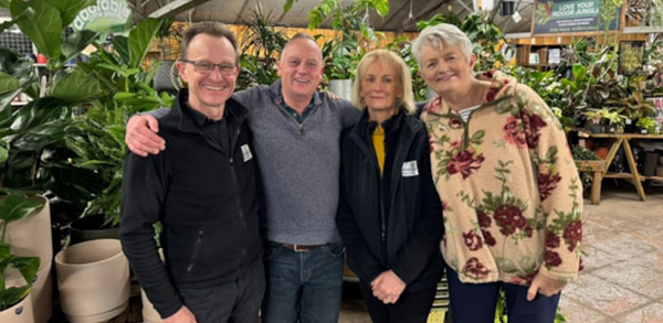
Celebrity Interview – Sara Blizzard

Getting up at 3am to go to work is enough to bring a deep depression on many people. But not Sara Blizzard – she has a sunny outlook whenever she comes into our living rooms presenting the weather on BBC Television. This month marks the 23rd anniversary of Sarah’s East Midlands Today debut. She breezed onto our screens with her elfin looks and appears hardly any different now. She still enjoys telling everyone whether they need to get out their sun cream or their sou’wester. What you may not know is that she was a shy child who didn’t want to be in the spotlight. But she overcame her shyness to have a successful radio and television career, being at the helm of the cable TV equivalent of Crimewatch before turning her sunny disposition to presenting the weather. Do people in the street have a go at her if she gets the weather wrong? “We always say it’s not an exact science but there are days when the forecast has gone one way and by the afternoon I might be out with the dogs and I’m like ‘this isn’t doing what we said it was going to do!’ “You’re very much aware of that because you don’t want to be giving people not quite the right forecast. I think they pull your leg more than have a go.” She recalls one incident on a day that should have been dry when there was an unexpected shower. “A farmer was putting very expensive fertiliser on his fields and that one shower just happened to be over where he was. I’ve never forgotten that because I didn’t appreciate it at the time but the cost that goes into what they do and all their hard work – it wasn’t really our fault, it was just nature doing its thing. “People are more likely to pull your leg rather than say you’ve ruined my life or ruined my day out.” Sara Louise Blizzard was born on 17th August 1970 in Coventry. Her father Kelvin was a sheetmetal worker and a welder, making engines for Rolls-Royce. Her mother Gladys, nicknamed Robbie, worked in advertising in London. After meeting Kelvin she moved to the Midlands and joined the NHS. They did not urge Sara to follow a particular career. Her mother’s main concern was the large classes at the nearest comprehensive school, so only child Sara went to the independent Pattison College – a stage school. “Mum thought it might bring me out of my shell. It was full-time education with dancing in between. We were on the go all the time. It was definitely a different way of having an education but I think it gave me a background for presenting. “I never wanted to go on stage because I don’t think I’d have remembered the lines, believe it or not. I can remember the weather but I can’t remember a script onstage.” While at school she appeared in a few professional shows including Tim Rice and Andrew Lloyd Webber’s Joseph And The Amazing Technicolor Dreamcoat and Chitty Chitty Bang Bang which toured to Coventry. Sara did not go to university. Her broadcasting career began on hospital radio at Walsgrave General. She had a friend who was diagnosed with cancer when he was only 18. “The one thing he really loved was people coming onto the ward and taking his requests. And I thought ‘what a nice thing to do.’ I applied to be a volunteer.” She was accepted and was given her own show, Sentimental Sunday, playing easy-listening music and people’s requests. Another volunteer knew the boss of Coventry’s commercial station Mercia FM and told him about Sara. “There weren’t many women in radio at the time and he offered me a job on the air. It was in the middle of the night – it was five hours long from midnight onwards. “It was a killer shift but it’s amazing how many people are up for whatever reason in the night. You were their companion whether they were ill or working, so it was an interesting five hours.” When Mercia FM was bought out, the new owners moved Sara along the M69 and came up with the idea of having three people doing the Leicester Sound breakfast show, called Two Guys And A Girl. That was because her fellow presenters were both called Guy. After three years the station was sold again. But every cloud has a silver lining and Sara got wind that L!VE TV, the new cable channel headed by media heavyweights Kelvin MacKenzie and Nick Ferrari, was looking for staff. Sara threw caution to the wind and became part of the news team, being assigned to the north west. “I was given Liverpool and two days’ notice to pack my bags. It was quite a shock to the system but I did it. I ended up living in hotels for a couple of weeks until I could find somewhere to live. I have to say Liverpool was the best two years of my life.” She recalls her first job for L!VE TV in 1997, a bomb scare at Aintree when an IRA bomb threat forced the evacuation of the racecourse and the Grand National was postponed for two days. “I hadn’t got a clue what I was doing. The boss at the time said ‘can you go down there, even if you’re only at the front gates, and get the reaction from the people as they’re coming out.’ “This chap walked past me, quite smartly dressed and I asked him for his thoughts. It turned out to be (racehorse trainer) Jenny Pitman’s son Mark. He was actually working for Sky as a presenter and gave me a really good interview live on air. “That was one of those very lucky moments in broadcasting. I’ll never forget that day because it really was a baptism of fire.” One of the programmes Sara worked on was Merseybeat, with Merseyside Police
Places Pevsner Forgot – Hilcote

It seemed incredible to us that a settlement containing perhaps the finest miners’ cottages in the Midlands should have been missed by Sir Nikolaus Pevsner in his travels. Possibly, in 1953, when compiling the first edition of his guide to Derbyshire in his historic series The Buildings of England and having visited Blackwell, of which Hilcote is historically a part, he steered clear of what then was the off-putting sight of the B. Winning pit of the Blackwell colliery as he passed along the B6406 (Berristow Lane) en route to Pinxton. After all, there was then no M1 (from which he would have had a view of most of Hilcote, at least in winter) nor an improved A38, nor a MacArthur Park shopping experience encroaching on the flanks of Pinxton Castle. Who could blame him? Mind you, Hilcote infrequently gets mentioned in the usual sources for the history of local settlements. All the usually informative Bulmer could say in 1895 was ‘Hilcote is a long scattered village a quarter of a mile south of Blackwell.’ No mention here of coal mining, although it was then in full swing! Indeed, the first mention we could discover about the place was one of 1323 when Joan de Somerville, a considerable co-heiress of the Chaworths of Alfreton, married a Welsh grandee called Rhys ap Gruffydd, better known at the English court (in which he served under three monarchs) as Syr Rhys, having been knighted by Edward III in the field for his efforts against the Scots in 1346. Hilcote was a minor portion of the very considerable estates she brought to this illustrious Welsh family, descended from Ednyved Fychan, seneschal to the Kings of Gwynedd and Princes of All Wales. Henry VII was a direct descendant, although the manor of Blackwell (including Hilcote) was sold by Rhys’s posterity to the Babingtons, by whom it was divided into two manors bearing impenetrable names Sulney and Trussebut, the latter including Hilcote. The tiny hamlet was acquired in 1586 on the downfall of Anthony Babington, by the Holles family of Nottinghamshire and descended from them to the Cavendish Dukes of Newcastle, whose heirs sold them in 1742 to their cousins the Dukes of Devonshire. At that time, it consisted of a scatter of houses due south of Old Blackwell Church on Hilcote Lane but, even then, there were coal workings in the north part of the hamlet. They seem to have waned in the later 18th century, though, the directory for 1846 claims that Hilcote was ‘noted for its collieries, at present not worked.’ In 1857 Nathan Mellor a coal master is listed as resident there, so something must have been stirring below ground, and in 1864 there was a family of colliers resident. But in 1870 the big firms moved in, the Blackwell Colliery opening the B Winning pit at the south end of Hilcote in 1873-1874. Adjacent to the site, which lay on the east side of Berristow Lane and south of Pasture Lane, straddling the Normanton Brook, was a mass of railway lines coming in from the west, smithy, coke oven, brickworks with four kilns, an old shaft (presumably that worked previously) and a row of cottages on Berristow Lane, along with a pub, the Hilcote Arms. In 1964 the site closed as loss-making,d and over the following decades the land was reclaimed, in this case fairly successfully. We chose to enter Hilcote from the A38 junction, and by so doing soon found the brick terraced cottages of the first phase of mining flanking the road, the Hilcote Arms occupying a corner position at the junction with Hilcote Lane. It is a sturdy and attractive piece of brick building, entirely en suite with the surrounding cottages, which also appear superior, in constructional terms at least, to many we have seen in the area, with cambered stone lintels and gauged brick arches to the entrances; we thought Pevsner might have appreciated it. Further up the lane the houses are later, mainly terraced but less well designed on the west side, whilst on the east side there is nothing but post-1964 bungaloid growth, presumably on what had been slag heaps or other manifestations of a large colliery, although in 1898 there were still two open fields on this side of the Lane. As the colliers’ cottages fizzle out at the north end of the village, the round bulges out to the east (now called New Road) only to rejoin the same alignment half a mile further on, leaving a straight vestige of the previous alignment visible in a line of hedgerows. Quite what the road had to be diverted to avoid, we were not sure. We chose to return south along Berristow Lane and turn left into Pasture Lane, entirely rural on the north but to the south, bungalows, until the road is almost about to turn into a track to a farm, when we encountered a terrace of twelve Edwardian miners’ cottages, facing south and only accessible from their gabled rear extensions. The looked pretty substantial, though. Retreating a few hundred yards and we turned left into New Street, to encounter the true glory of the settlement, for the Blackwell Colliery Company, clearly an enlightened employer, had built this road to run all the way down to the Normanton Brook, positioning a miners’ welfare hall at the lower end opposite a primitive Methodist Chapel and school. It thereupon lined the street with no less than twenty pairs of well built, excellently designed brick houses – one could hardly call them cottages – three storeys, with blue brick banding, side entrances through small arched and gabled porches from a small easy-to-manage garden, stone lintels to what had been sash windows (but are now largely disfigured with a motley variety of uPVC substitutes) and substantial gabled attic dormers. They appear to date from the late 1880s to the early 1890s; they certainly appear on the 1898 OS map. Who, we wondered, was the Company’s architect,
Lost Houses of Derbyshire – Old Foremark Hall
The estate at Foremark, where once the invading Vikings over-wintered in 783-784, was granted to Nigel de Stafford,a (genuine) comrade-in-arms of the Conqueror and ancestor in the male line of the Stafford, Longford and Gresley families. His family’s later sub-tenant was a junior member of the powerful de Ferrers family, whence it passed through an heiress to Bertram de Verdon, a substantial south Derbyshire land holder, in the later twelfth century. In 1387 the de Verdons sold it to Sir Robert Franceys, one of whose descendants two centuries later married the heiress of his close relations, the Franceys family of neighbouring Ticknall. The family seat then was at Knowle Hill, on a plateau at the top of the west edge of the ravine, in which lay the later house there, which I wrote about in these pages just over three years ago. It is presumed to have been a timber framed courtyard house; the surviving remnant of the present house lies on the footprint of the east range of its predecessor. Jane, daughter and heiress of William Franceys of Foremark married in 1602 Thomas Burdett of Bramcote – not the Bramcote down the end of the A52 from Derbv in Nottinghamshire, but that near Polesworth in Warwickshire, albeit not so very far from the SW edge of Derbyshire. The Burdetts, who originated at Lowesby in Leicestershire, had been at Bramcote since 1327, but the couple decided to live at Foremark in an old stone house that the Franceys family had built in Queen Elizabeth’s time. Thomas was High Sheriff of Derbyshire in 1610, and in 1619 was created a baronet, taking his title from his ancestral estate at Bramcote – mainly because his father-in-law was still alive at that time, and to be ‘of Foremark’ would have been more than a trifle presumptuous! It was their son Sir Franceys, who seems to have set about rebuilding or enlarging the house at the Restoration. He also replaced the parish church of St. Saviour at the same time, positioning it a few yards due east of the house, to serve almost as a domestic chapel as well as for spiritual nourishment of the villagers of Foremark and Milton. We are fortunate in that a painting, attributed to Jacob Esselins and believed to be of this house, was sold at Christie’s in May 1998. It was painted around 1665, so the building was then largely new, although very traditional in style, probably dictated by the portions of the existing house that Sir Franceys wished to include. The house we see was of locally quarried Keuper Sandstone, U-plan with four straight coped gables, the central pair recessed over the great hall – almost certainly a hangover from the Franceys’ house – divided by a chimneystack. The western cross wing terminated in a matching gable with six and three light mullioned windows, whilst its counterpart of the east of the façade was clearly of the later build, with mullion and transom cross windows throughout. The west front also appears to have had two further gables like the other, coped and with ball finials. The stables (replaced in the 1720s by the present range) were also on this west side and the whole ensemble was set within a wall pierced by a pair of imposing gate piers (clearly of Sir Franceys’ day) from which one descended into the forecourt. In 1713 William Woolley described it as ‘large and convenient with a large well wooded park and coney warren adjoining.’ In 1662 it was assessed on a substantial 24 hearths for tax purposes. Regrettably, there is no hint as to the interior, bar an enumeration of the rooms in an inventory. The church (listed grade I) may have been begun during the Civil War, for a sundial dated 1650 graces the exterior but, unlike Sir Robert Shirley at Staunton Harold, Sir Franceys clearly did not risk continuing until the return of better times; the building was sufficiently complete to be dedicated in 1662. There are two other sundials, too, and the four bells are by George Oldfield and bear various dates between 1660 and 1668. The east end has the arms of the family above the Gothic window, surrounded by positively Elizabeth carved strapwork, despite the late date. Inside, there are box pews, a delightful arcaded oak screen, probably locally carved in a style well out of date by 1660, a medieval font, a timber altar with a later Hoptonwood stone top and in 1710 ironsmith Robert Bakewell added a pretty communion rail, and a splendid pair of iron gates under an elaborate overthrow at the east end through which the Burdetts had to pass on their way to worship. The gallery was only installed in 1819. Whilst Sir Franceys Burdett’s house stood, the three, house, park and church, could be read together as a coherent ensemble, and in a particularly fine setting. Sir Robert Burdett, 3rd Bt. was a long serving MP and was thrice married, although of his five sons only one survived but even he managed to pre-decease his father by two months. Hence, by the time of his death in 1716 aged 76, his younger brother Walter was expected to succeed to the title, but Sir Robert seems to have been a game old soul, for Elizabeth, his widow, was pregnant when he died in the January, and was duly delivered of a boy in May, named after his father and who succeeded at birth. This Sir Robert came of age in 1737, and it is thought that the fête champêtre depicted that year by Thomas Smith of Derby in front of the ancient heritage by the river at Ingleby on the estate was held to mark his coming-of-age. The caves there were enlarge at about this time to enable such convivial events to be made more convenient, just as Knowle Hill was demolished and rebuilt as a folly by Sir Robert in the 1760s for similar reasons. The year after this