Modern Collectibles – Cinema Posters
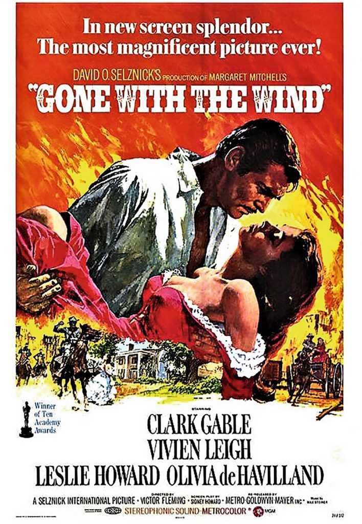
Recently the original of the poster for the classic Carry-on film Carry on Cleo was offered for sale at an anticipated four-figure sum. This caught my eye more for its anticipated price as for anything. Of course, the film, was memorable for Kenneth Williams as Caesar’s wonderful line, ‘Infamy, infamy – they’ve all got it in for me!’ and for us historians, the appearance of Hengist and Horsa (Kenneth Connor & Jim Dale, two ‘Britons’) was hilarious, these semi-legendary Saxon freebooters appearing 500 years ahead of their time! The idea was inspired by the 20th Century Fox Elizabeth Taylor and Richard Burton Cleopatra epic of 1963 and the intention was to use the costumes and sets of the Hollywood epic film made at Pinewood Studios in England before that production moved to Rome and built new sets there. Carry On Cleo was therefore a glorious send-up of the epic. Of course, Hollywood is famous for its leaden sense of humour (to put a positive spin on it), especially where commercial interests were at stake. The original poster (the one for sale in June) by artist Tom Chantrell directly parodied the Hollywood version but was withdrawn from circulation after 20th Century Fox successfully brought a copyright infringement case against the distributor. This version was thus swiftly pulped leaving only a few originals out there, although you can get a reprint for a tenner. The second (replacement) version was not nearly so good, either. An original of the Hollywood Cleopatra will set you back between £80 and £100 retail, the parody can go as high as £595 retail, whereas the revised Carry On Cleo poster comes in at £15, all of which sums up the range of prices cinema posters tend to command, although the fame or notoriety of the film counts, too as does the age. The standard later 20th century size is 27 x 40 inches. Intentional or not, many of the items being sold today as original posters, particularly through online auctions, do not meet the criteria used by most collectors to be deemed a collectable item. Often the word ‘original’ is misunderstood to mean ‘collectable’; however, there is a big difference. Posters strictly speaking are promotional aids produced by film studios for distribution directly to cinemas or distribution centres are considered to be legitimate ‘movie art’. They are generally printed domestically to where the film is released. They are designed, produced and distributed solely as advertising materials. Once they have been used for the purpose of advertising they are then returned or destroyed. This makes them harder to find, once a film has departed from the cinema, thus creating a very limited supply. Less collectable are posters deliberately printed for sale to collectors (nice paradox!), reprinted posters – £10-15 usually – and anniversary issues or limited editions released officially; I shall ignore TV and video posters, which are rather different again. Another complicating factor is that particularly ‘iconic’ (grossly overworked cliché) films had multiple releases, like Gone with the Wind released in 1939 which, since its original release, has been re-released in 1940, 1941, 1947, 1953, 1954, 1961, 1967, 1968, 1970, 1974, 1980 and 1998, each time with newer versions of the poster sometimes featured new or up-dated images. Thus a 1939 one recently went for £4,150 whereas a 1954 one made £120 and a 1998 one £15. Posters vary in size (numerous small ones could be posted up on one billboard) and were usually delivered folded. Rolled up ones tend to be reproductions although even repros. themselves can be quite venerable! Collectors grade them from mint through near mint, very good, good, fair and poor. As with coins, only experience can enable you to grade them accurately. To provide an example: an original poster for the enjoyable spaghetti western The Good, The Bad & The Ugly (1966) 40 x 30 folded, mint, was sold recently for £390 retail; the re-release (1971) poster near mint £245 and the same, only fair £65. When you bear in mind the sheer number of films ever released to an unsuspecting public, you realise that there must be a lot of original poster out there, despite the return clause imposed by the studios on cinemas. Thus your favourite films are probably going to be the more popular ones, and thus with the added burden of demand, more expensive, yet going after niche ones and obscurities is a good idea. But then, you might want to buy an old film poster just to put on the wall to brighten up your room, flat, apartment or house. In this case, a reprint should be fine and £20 or less should be about right. Serious collectors do not frame their specimens up, but keep them in map cabinets, or if folded in filing cabinets. The other day a pile of folded original came through Bamfords estimated at £40-60, but not including any very memorable titles, yet at a Jaguar antique fair at the former Railway School of Transport we saw another folded pile all at £30 each. Therein, of course the essential difference between auction and dealer prices. Nevertheless, original artwork usually goes via auctions as well as original of ‘iconic’ titles. The place not to buy, unless you’re looking at very modest prices for posters of dubious authenticity, is on-line. With cinema posters, seeing for yourself and handling them is essential if you are after the real McCoy. 00
Walk Derbyshire – Around Matlock Moor

A short 4 mile (6.4km) easy walk along clear paths and a quiet upland road. One steady climb of 220ft (67m). Muddy sections near both farms and woodland passed along the way. Recommended Map: Outdoor Leisure Map Sheet 24 The Peak District – White Peak Area. Transport: The X17 Chesterfield service leaves Matlock bus station (M&S) at ten minutes past every hour. Refreshments: Nothing en-route, but several pubs and cafes in and around Matlock town centre. Car Parking: Roadside opposite Highfields School on Lumsdale Road, or layby opposite Matlock Golf Club. New houses are being built on either side of the Matlock/Chesterfield road, the A632 on the town side of Matlock Golf Club. With starter homes on one side of the road, and an estate of larger properties opposite, they are fulfilling at least part of Matlock’s obligations to build much needed homes within its boundaries. Despite this development, Matlock’s eastern built-up limits soon come to an end, with the golf club on one side of the Chesterfield road, and farmland filling the other. Backing all this is the long line of mature forestry trees stretching for a good four miles across the skyline on either side of Matlock Moor. This walk touches just one corner of the moor, following a route around the golf course on one side and crossing farmland on the opposite side of the A632. The walk pivots around a huge boulder, the Cuckoo Stone, a mysterious looking rock standing in the middle of one of the fair-ways. Maybe it was brought here by ancient people as a form of pagan ritual, or possibly by way of the last ice sheet to cover Derbyshire. All this is unknown, but it certainly adds an aura of mystery to the walk. While there is a right of way passing close to the stone, this footpath’s potentially dangerous way is avoided for safety reasons. The alternative in any case is arguably more attractive and only extends the walk by about a quarter of a mile. The walk starts and finishes on the road beside Highfields School. Crossing the main Matlock/Chesterfield road, it then follows a side road lined with properties before linking with an unsurfaced track. This is followed, past Sandy Lane Farm and an abandoned quarry hiding in mature trees,. Soon the walk makes a change in direction by leaving the track at a narrow wooden gate. Here a footpath leads down to the upper reaches of Bentley Brook, a watercourse that once powered Matlock’s first industrial estate. Crossing the stream, the path climbs up to a second path and a right turn follows it all the way to the main road. This is crossed in order to reach the access to Wayside Farm and then field paths are used to reach a second farm whose name indicates its links with packhorse trains in time gone by. A quiet back lane runs between grazing on one side and mixed rhododendron and scrub woodland. At a sharp left-hand turn, the way is forward, past the remains of three of the many gritstone quarries once active around this Matlock hillside. A sharp descent leads down to the top of Lumsdale and the silted remains of the upper reservoir where the penned-up waters of Bentley Brook waited to power small mills in the lower valley. 1. From the car park opposite Highfields School, walk up to the main road and turn left. (Or walk to this point if parking in the layby opposite Matlock Golf Club). 2. Cross over and follow the pavement for about 200 yards in order to reach Sandy Lane which will be on your right, pointing away from the main road. 3. Turn right along Sandy Lane and follow it until its surfaced part turns left. 4. Continue forwards, climbing steadily uphill on a rough surfaced lane, going to the right with it on reaching Sandy Lane Farm. 5. Follow this now the highest part of the walk, for about half a mile between grazed fields on your right and rough woodland and long abandoned quarries to your left. 6. When Cuckoostone House comes into view, go half right, leaving the access lane and go through a narrow wooden gate. 7. A walled path descends towards the golf course where the Cuckoostone stands proud. A right of way crosses the links at this point, but for safety’s sake it is not recommended without a hard hat! 8. Follow the gently descending path, through a muddy section as far as Bentley Brook. 9. Cross the stream by a footbridge and then at a stile to bear left to start the short climb up the opposite hillside. 10. Go through a stile at the corner of a stone wall in order to climb steeply up to unmade Cuckoostone Lane, and turn right. 11. Follow the rough lane for a little under a mile, high above the golf course on your right and the mature trees of Bottom Wood forestry plantation to your left. 12. Go through the gate next to a house and continue forwards, now along a surfaced way. As you walk along Cuckoostone Lane, pause now and then to admire the view down the Derwent Valley. John Smedley’s Riber Castle dominates the near skyline with Crich Stand over to its left. 13. On reaching the main road, turn left and follow the pavement for about 150 yards as far as a bus stop sign. 14. Cross over and go down the access lane to Wayside Farm. 15. Skirting the farmyard, go through two adjacent field gates in order to follow the line of a dry-stone wall on your left. 16. Go through a stile at the end of the field and cross the next field. 17. Aim towards a stone house, passing it on your left and then go through a squeezer stile. Follow a wall cut by two more stiles, with a ditch separating your path from a caravan site. 18. Beyond the second
Repton Captial of the Kingdom of Mercia

The history of the North Midlands is writ large on this ancient town set high above the quiet meadows bordering the River Trent. Its history is traced from Saxon and Norman times, through Tudor to the present day. Even the Danes who came this far up the Trent in their longships, made it their winter base during their attempted expansion south from Northumbria into King Alfred’s Wessex. Repton’s parish church of St Wystan is built on Saxon foundations, part of the priory that brought Christianity to this part of the Midlands. Remains of the ruined 12th century ecclesiastical house are incorporated within the famous school, the most important remnants being Prior Overton’s Tower, now part of the Headmaster’s House. The school can trace its foundations back to the time when the earliest Saxons settled here; today it is the North Midland’s major centre of learning. The parish church, that most recognisable part of that monastery still stands, with a needle-like spire beckoning the faithful over miles of water-meadows. It shelters a rare old crypt as well as overlooking the fine school buildings old and new, with grey walls and red walls, gables and red roofs, green carpeted church yard sheltered by ancient trees, the whole overlooked by delightful cottages – along the road to Bretby there is even a rare example of a black and white house with a room that overhangs its porch. When those early Saxons erected their simple timber and mud-walled church some time around the middle of the 7th century, it began a thousand years of building, giving us one of the most noble of village shrines. They gave us a crypt which grew in fame until it became the northern equivalent of Westminster Abbey. Beginning with King Æthelbald (AD716-757) it became the final resting place of Mercian kings and queens including King Wiglaf and martyred Prince Wystan his grandson, who was murdered in AD849. For many years the crypt beneath the church sheltered the remains of the martyred prince who had been treacherously murdered by his cousin, but in 874 his remains were transferred to Evesham on the approach of invading Danes. By this time Wystan had been made a saint and his shrine a place of pilgrimage. Such was the popularity of a pilgrimage to St Wystan’s Repton tomb that the crypt was regularly dangerously overcrowded by devout pilgrims. As a result an extra set of stairs was made, creating an early example of a one-way system, which stands to this day. Around this time the Danes were for ever making a nuisance of themselves and after one particular foray in 850, they destroyed the monastery which had stood there for more than 200 years. When later Saxons built a church on the site of the old abbey, they laid its foundations on the remains of the old chancel walls, walls that are still standing to this day. Part of this rebuilding left us a crypt that has been called the most perfect example of Saxon architecture, certainly in this part of England. Only 17 feet square, it has a vaulted roof with small rounded arches resting on four spirally wreathed pillars, and eight extra half pillars on the walls. Modern windows have been cut into the walls to let light in and show us the crypt to its best advantage. There are still traces of an old altar, and an opening in the western wall which is believed to have been a peep-hole in by-gone days when lepers or the infirm could view the shrine without struggling up and down the steps. The crypt was desecrated during Henry VIII’s Act of Dissolution and forgotten until the end of the 18th century, when a workman accidentally fell into it while digging a grave. Near an entrance to the crypt from the outside, a holy-water stoup, made for the use of the priory can still be seen. Today’s visitors have none of the struggle early pilgrims experienced. Modern lighting allows access even though it must be remembered that the stone stairs both in and out are hundreds of years old. Today’s visitors to St Wystan’s, Repton’s parish church, can see the work of the 12th century and later builders who reshaped the Saxon church but the chancel walls are mostly as they were when the original 10th century craftsmen downed tools on their last day’s work. There are still the remains of two Saxon pillars with square capitals which were once part of the 13th century nave arcades, but now stand in the two-storied porch. Above its ancient door, St Wystan looks out from a small niche, watching visitors, old and young who come to see his wonderful Saxon church. Outside and on the side of the support tower of the slender spire is a clock, which prides itself as being half the size of Big Ben’s clock on the Houses of Parliament in Westminster. It comes as something of a shock when wandering around the churchyard, to see the number of Commonwealth War Graves tucked away in a secluded corner. With only the odd exception they hold the remains of trainee glider pilots killed during training flights from their school based on the site of what is now Toyota’s Burnaston factory off the A38 near Derby. Repton School celebrated its 400th Anniversary in 1957. Built on the site of the old priory church, its spacious main hall was designed in 1886 by Sir Arthur Blomfield, a major Victorian architect, in memory of Doctor Stuart Pears. It was under his rule that what was then a grammar school, became in the space of twenty years one of the great public schools in the country. The friendly local pub the Bull’s Head offered to look after our dog while using the inn’s toilets in a village without such public conveniences for visitors, rounded off a day visiting this one-time capital of Mercia, one of England’s original four kingdoms. A stroll around this attractive not-so-sleepy
Taste Derbyshire – Food Festivals
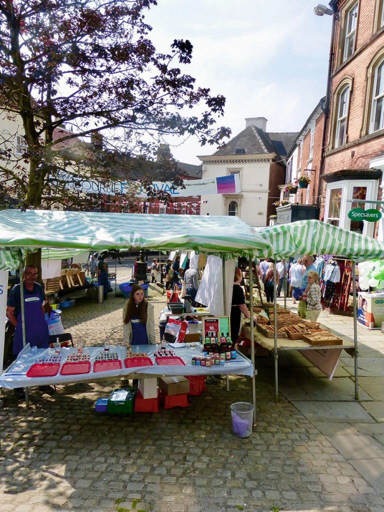
Move over Glastonbury, Y Not and Download, the hottest festivals in the UK this year are more likely to feature ciabatta than The Cure. While some hardy folk still enjoy wading through slippery mud and vegan jugglers at music festivals – everyone, and their Labrador, loves a food festival. They are everywhere and so the headline acts have to be increasingly more-ish to stand-out (chicken wings and whisky weekender anyone?). On the day I decided to swan off to Ashbourne Food Fest’ – lured by a tasty line-up of the Cheddleton cheeses, giant sausage rolls and sweet chilli jam – I had to turn down my VIP pass to a man v doughnuts challenge at the Big Food Festival on Shipley Park. “Food festivals are such a great way to spend a weekend,” enthuses Lisa Wallace, owner of Ashbourne Bakehouse and organiser of the food fest’ held in Victoria Square as part of the Ashbourne Festival. “One of the reasons I wanted Ashbourne to have one is that I’m a food festival groupie myself – much to my husband’s dismay.” Lisa originally tried an on-line market selling food to a select group of local producers but, while the idea attracted hundreds of followers on social media, it only converted into a handful of customers. “I think people want to meet the people and hear the story behind the food,” Lisa said to explain why the real-life food festival was such an instant success when it launched last year. “Like me, I think food festival-goers are excited by new things but they also want to try before they buy. The festival is a lot of fun and I’m pleased to say all of the producers asked to come back next year. It’s good for the town because people come up and say ‘Oh wow – Ashbourne is so lovely’.” While many of the UK’s food festivals are big productions featuring live cooking demonstrations, celebrity chefs and even pop-up cookery bookshops, Lisa was keen to keep Ashbourne’s ‘little and local’. “It was never about creating a profit stream, it’s a way of promoting great producers who don’t always have a shop window,” she says. “The stall-holders are chosen carefully so they complement each other. If someone buys my sour-dough bread I’ll recommend some Staffordshire cheese and a jar of Sarah Ball’s chutney from the neighbouring stalls. In fact, it’s a perfect blend of stalls if someone can get a complete meal – with drinks – from the festival complete with after-dinner chocolates and great coffee.” For details of the forthcoming Christmas foodie events, contact Lisa Wallace, Ashbourne Bakehouse, 29 Market Place, Ashbourne 01335 347206. ‘Taste Derbyshire’ writer Amanda Volley was despatched with wicker basket in hand to the Ashbourne Food Fest’ to grill some of the stall-holders and ask the burning question ‘Have you got any free samples?’ Kniveton Cider Company It was seeing so many apples left to rot on the ground in and around Kniveton which sparked an idea in the mind of locals Kev Woolley, wife Hannah Barton and a group of their friends. “It was such a waste of drinkable apples,” Kev smiles in a way which lets you know he wasn’t thinking of pressing them into non-alcoholic juice. We all chipped in to buy the equipment to make 800 litres of cider. Trouble was, we gathered so many apples we couldn’t drink the lot and approached local pubs to see if they wanted the surplus.” That was the start of the commercial operation which saw the soon-to-be cider company double the production of their award-winning ciders (Never Mind the Hillocks, Four in a Corner, Wynnsum and OB1) every year. It was so successful Kev had to look for larger premises and – as the original friends dropped out – give up his job to work on cider production full-time. “I worked in pubs before I got a proper job. Ironically, I then had to give it up to work with booze again,” he laughs. Festivals and markets are how we like to retail it,” says Hannah who is the only woman on the board of SICA (Small Independent Cidermaker’s Association). “We now stock seven pubs but we still rely on friends and family for apples from their trees. In fact, we collect from trees just 500 metres from this very market stall…you can’t get more local than that.” Find out more about Kniveton Cider Company by visiting www.knivetoncider.co.uk Cup and Saucer A passion for good tea and food festivals saw Gail Hannan having a light-bulb moment when she was made redundant after spending 15 years working in the social care sector. “I went to lots of food festivals and markets and, as a tea enthusiast, I didn’t see anyone doing any exciting loose-leaf tea blends,” says Gail, of North Wingfield. “I’d always wanted to be my own boss but it was my daughter Jess (28), who provided the push. She’s one of those annoying optimists who told me redundancy wasn’t an ending but an opportunity to pursue my dream – and she was right.” Although Gail is at pains to stress she doesn’t grow the tea – it’s a bit too chilly in North East Derbyshire – she perfects the blends by hand, often using fruit and flowers she has grown and dried. “I’m forever coming up with ideas for blends,” Gail smiles when I survey shelves bursting with tea blends which helped her win Chesterfield Food Producer of the Year at last year’s food and drinks awards. The best part of what I do is taking those blends to food festivals and meeting people. Funnily enough, I thought I’d be mostly selling to older people but they’re the ones who say ‘I prefer Typhoo’ when I ask them to sample something like my ‘Roaring Rhubarb’ blend. Younger people are far more adventurous with tea.” As for tourists who visit Derbyshire food festivals, Gail says she can predict the teas which will end up in their
Lead Smelters of the Peak District

The Derbyshire Peak was once the major supplier of lead in the world. There is the possibility of lead being dug from close to the surface in pre-Roman times, but it was one of the reasons why Rome decided to annexe Britain to its empire. There is a folk memory of a kind of concentration camp at Bradwell in the Hope Valley from which slaves were made to mine deep within the hillside. Once dug from the bowels of the earth, lead needed to be changed from crude ore into a product that could be moulded or beaten into its useful final form. Ore came from the mines, whose remains still dot the fields and hillsides of the limestone-based White Peak. Known as ‘bouse’ it was full of impurities and it was the job of women whose husbands toiled far underground to beat the ore bearing lumps of rock and wash the resulting powder in convenient streams, or specially made leats, channels flowing from small dams. More sophisticated methods used stone or wooden troughs called ‘buddles’, where water and ore flowed over baffles to catch the heavier particles of ore. Lead mines were mostly run by one or two men at a time whose daily output was often no more than a few hundredweights of ore bearing rock; a Peakland saying is that if a miner could fill his ‘weskit’ (waistcoat), pockets with ore, then he could finish for the day. Crushed and washed by miners’ wives, the ore was stored for safe keeping in a coe, one of the small barn-like buildings that still dot the fields above places like Bonsall or Wirksworth. A fine example of one of these stores stands beside the B5056 Bakewell to Ashbourne road, about a quarter of a mile south of the Miners’ Standard pub outside Winster. Railings have replaced the stout wooden doors, but it is easy to visualise miners pouring their ore through a slot in the back wall, into an early form of night safe. Periodically lead agents would collect the results of miners’ toil. They were an important link in the chain but often had an unpopular reputation for their so-called unscrupulous dealings and price fixing, but without them the ore would never find its way to its final markets. Trains of pack-ponies employed by the agents carried the crushed and washed ore to smelters sighted on the surrounding hills. Routes taken by the ponies can often be traced by the number of Jaggers’ Lanes that appear throughout our region, such as in Darley Dale, or Ashover. The word Jagger is thought to come from the Old German word Jaeger, a breed of small tough ponies used by huntsmen. With only one recognisable example, Peakland lead smelters have all but disappeared, the only clue to their whereabouts being marked on the map by the number of times the words Bole Hill appear on Ordnance Survey maps. Bole is an old word for a primitive open smelting hearth where lead ore and kindling were mixed together on top of a stone hearth. As the fire burned and fanned by the wind, it generated sufficient heat to melt the lead, separating it from impurities allowing the molten lead to flow into a suitable collecting dish. Later bellows were used to create extra draught so greater heat, but even so open hearth methods were slow and inefficient. With the passing of time more efficient methods of ore smelting were developed which became known as cupolas, or reverberatory furnaces. Basically in this type of furnace the fuel, coal which was plentiful to the east of the Peak District, was burned in a grate separated from the ore by a firebridge. Flames passed over the firebridge and ‘reverberated’ from the roof of the hearth, heating the lead ore, causing the lead to separate from the waste material, before passing through flues to a tall chimney built to provide the necessary draught. The resulting slag or waste was either raked or drawn off, while the molten lead ran into a receptacle. In later furnaces the flues were extended to cool and condense escaping lead vapour which was given off along with waste gasses. As the condensed lead ended up clinging to the sides of the flue it was someone’s, usually small boys’ job to scrape it from the brick or stonework. Unfortunately not only did they then come into contact with potentially poisonous lead, but with numerous other lethal substances which had a saleable interest to the smelter’s owner. Flues in Derbyshire smelters would meander over anything up to half a mile or so beneath surrounding fields before they reached the chimney, unlike those in the Yorkshire Dales that can still be traced, running for several miles up then out on to the fell tops. The reason for the difference in flue design is because unlike the Derbyshire smelters that ran on coal, those in Yorkshire had to rely on burning peat which being less heat efficient, would require a considerably greater flow of air in order to produce anything like enough heat. One of the many environmentally unfriendly side effects of lead smelting is the way lead fumes spilling out on to the surrounding fields poisoned the grass. Any cattle eating this poisoned grass would become very sick and probably die and in Derbyshire this became known as ‘bellands’, a kind of stiffening of the joints. Farmers kept their stock away from tainted ground by surrounding it with stone walls and planting shelter belts of trees. At aptly named Spitewinter on the highest point of the A632 Matlock to Chesterfield road, Belland Lane links the A632 to the B5057 from Two Dales, a sure hint that the soil around about was once severely poisoned. With the passage of time and regular rainfall, local grazing no longer gives cattle this dread disease. 00
Modern Collectibles – Motor Car Club Badges

Both my parents were keen motorists, and I was often as a child taken to events where like-minded people congregated. Whilst out driving with my mother, I was taught to recognise all the makes and models of cars on the road – this was early 1950s, I might add, when the roads were still littered with vehicles from well before the war. Consequently, I used to amuse myself by admiring cars, armed with some knowledge, when at some event I had quickly become bored with the main fare. This rapidly acquainted me with the tantalising array of bright metal and enamel badges sported on many cars. Most impressive were the sort of sports car, the front of which was embellished with a chrome-plated horizontal bar in front of the grille, mounted with an array of such badges. The most obvious ones were the yellow-backed AA ones and the blue-backed RAC examples. They remind one that the fitting of badges to motor vehicles goes back to the early 1900s. In 1897 Frederick Richard Simms, who is often referred to as the father of the British motor industry, founded the Automobile Club of Great Britain and Ireland. The Automobile Club soon started to attract some of the most influential people of the era. In 1907 Edward VII became its patron. Thereafter the club became known as The Royal Automobile Club, more commonly referred to by the initials RAC. The first brass badges were made by Elkingtons and in good order will cost you £100 or more. In June 1905 another major British motoring club was formed, this was The Automobile Association. Like the RAC, it is also more commonly referred to by its initials. In March 1906 the AA produced the very first motoring club badge. Earliest examples carried an impressed signature of the club’s first secretary, Stenson Cooke. A little later, the badges also featured the word secretary. The example shown, on offer at £40, looks a bit too good to be true to my eye; the engraving looks machine cut as well; hand engraving always has trailed-off ends. The RAC soon acquired an impressive club in Pall Mall which still exists although, like the RAC, the badge represents what is essentially an insurance organisation which today has no connection whatever with the London clubs. Both AA and RAC badges are datable from the numbers stamped upon them. For instance, early AA ones run from 1 to 999,999 (1906-1930). More modern versions of both can go for between £5 and £20 depending on condition. At Bamfords we occasionally get pre-Great War AA and RAC badges (upwards of £40), but rarely others. My father latterly sported one familiar to me, the Veteran drivers’ club: a ‘V’ with a central button denoting the number of years over which the member had been driving; a post-war example should cost in the £20-£30 bracket. Father also passed the Advanced Motorists’ Club exam, and bore their red, white and silver badge (earlier examples about £20), not to mention the Baltic Exchange Motoring Club! The latter would be very rare today, and command upwards of £80, but a Liverpool example was recently on offer for £70; the smaller the club, though, the rarer the badge and the higher the price; yet some go for less than £20. Civil Service Motoring Club badges, quite well cast, are surprisingly common, for instance. There are also owner’s clubs for most significant marques, especially sports car marques. A common post-war MG one is likely to be £10-£20 only, although others carry a premium. Father belonged to the Packard Register, but I cannot recall there being a badge. The most expensive one I have come across recently is a Lancia Owner’s Club badge in only passable condition for £150. Vehicle badges of course are not restricted to motoring clubs. They can, and often do, represent a wide range of hobbies and interests; regimental ones used to be very popular when the army was much larger. Being stuck on the front of a car, most tend to look aged, with chrome or brass oxidised or discoloured, and enamel chipped, and these are the ones to avoid unless you spot a real rarity. As ever, always go for those in the best condition and there are a lot out there – numerous car owners got their badges and never got round to having them put on (or didn’t particularly want to). Again, smaller, long-since amalgamated regiments are the most sought after, along with guards regimental badges and those of the Parachute Regiment, although the latter are surprisingly common yet can go for more than £50. Yet if you had an RAC or AA badge showing, their respective road scouts would always salute you, and the badge came with a key (sometimes for sale with the relevant badge) to give access to the roadside boxes, of which a superbly restored (and listed) example – box No. 530 – survives in a lay-by near Brancaster Staithe in North Norfolk. Those were the days! Indeed, the car badge is the longest living vehicle accessory, and many badges are still produced today. But beware: some collectible ones are re-produced today and end up being sold as the real McCoy. Check wear and finish. 00
Walk Derbyshire – Youlgreave & Its Two Dales

5 miles (8km): easy riverside walking along two attractive dales, linked by an interesting village street. RECOMMENDED MAP: Ordnance Survey 1:25,000 scale Outdoor Leisure Series; Sheet 24, The Peak District, White Peak Area. PUBLIC TRANSPORT: Hulley’s 171 hourly service from Bakewell (no Sunday service). CAR PARKING: laybys at roadside beyond River Lathkill bridge outside Alport. REFRESHMENTS: three walker friendly pubs in Youlgreave village. Here is a lovely walk following dales on either side of Youlgreave, one of the largest yet unspoilt village in the Peak. To its north is Lathkill Dale which is the first dale to be followed; a short stroll along the village street leads to a woodland path into Bradford Dale which is followed back to the starting point of the walk, and also the point where streams flowing down the twin dales, meet. Although the Ordnance Survey and the County Council use the first letter ‘e’ in the ‘greave’ part of Youlgreave, the locals usually spell the name Youlgrave, but in any case prefer to call it ‘Pommy’ just to confuse visitors! The village proudly maintains its independent water supply brought by pipeline from a source beneath gritstone moorland to the south. Before this came about Youlgreave had a severe water problem, especially in dry summers when many of the village wells dried up. The circular stone tank opposite the one-time co-op shop, now a youth hostel, was used to store piped water which first came to the village in 1829. Now every house has piped water like the rest of us. Although the custom is possibly much older, the five village wells have been dressed in floral motives since 1829 during the week following the Saturday nearest to St John the Baptist’s Day. Youlgreave has several buildings worth more than a passing glance, from farmhouses within the immediate confines of the village to its two-storied hall, the garden of which is occasionally open to the public, especially during well dressing week. The church is a delight and contains the tombs of several medieval knights alongside its Norman font. Unusual in its design, the font bowl is supported by a central column together with four small shafts. An upside down dragon on the main bowl holds a smaller bowl in its mouth, thought to have been made to hold consecrated oil. The font has a curious history, having once stood in Elton church. The east window was designed by William Morris and Burne-Jones, the Pre-Raphaelite artists. Church records from 1609 tom1715 record fees paid to the official dog-whipper. Deep pools in the River Lathkill are stocked with trout below Conksbury Bridge and monster-sized fish can sometimes be spotted lazing beneath the narrow pack-horse bridge below Raper Lodge, making a popular spot for children. Fishing and the immediately riverside meadow is strictly private, but you will get an excellent view as you follow the path beyond Alport, the starting point of the walk. The two dales meet and their waters mingle at Alport. The quiet hamlet is a little way from the road, a pleasant group of stone cottages with attractive gardens; a hump-backed bridge carries the side road and downstream, the remains of a grinding mill is where lead ore was prepared for smelting. Observant passers-by will see a curious notice on the gable-wall of a farm on the Youlgreave road, warning vagrants to keep away. The Walk : 1. From the road go through the gate on your left beyond the farm house. Follow the field path with the River Lathkill on your right, up-stream until it reaches a path and track junction. It is worth making a short diversion at this point by going to your right, down a short path as far as an ancient pack-horse bridge over the River Lathkill. Children especially will enjoy looking out for trout lazing beneath the bridge. Return to the path/track junction. 2. Walk uphill past Raper Lodge, (the cottage on your left). Follow the surfaced track, uphill until it reaches a minor road. Turn left and walk into Youlgreave village. 3. At the staggered cross roads in front of the church, turn right and walk through the village for about half a mile. Ignore the footpath sign on the left between two rows of cottages. Continue along the road as far as the end of the village. Look out for the water tank that once supplied the village with pure water. Nowadays Youlgreave enjoys piped water like the rest of us, but their’s still comes from a spring on Stanton Moor. 4. A little way beyond the last house in the village, go through a kissing gate set back on your left. 5. Follow the woodland path, steeply in parts, downhill into the dale. N.b. the path can be slippery in wet weather. 6. Turn left on to a wider path descending from your right. 7. Cross the stone bridge and go left along the riverside track. Small ponds along the dale were created to conserve water for the wheel driving the ore-mill in Alport. One of them, closer to Youlgreave, has been converted into the village swimming pool. (But don’t expect the water to be warm!). 8. Reaching a stone clapper bridge, cross and go through a stile on your right. Continue to follow the River Bradford, downstream until it reaches the outskirts of the lower part of Youlgreave. 9. Cross the side road and go through the gate opposite. 10. Continue to follow the river, still downstream, past an attractive packhorse bridge (but do not cross). 11. Walk on past the dramatic rock face of Rheinstor Crag until the track reaches the road. Turn left for your parked car. 00
Lost Houses of Derbyshire – Chesshyre’s House, Derby

The Chesshyre family has been amongst the elite tradesmen of Derby since the beginning of the seventeenth century, when brothers Robert and John Cheshire, sons of a Breadsall farmer, set up in business in the town. John (1613-1689) was Mayor in 1680 and left descendants in the town, as did Robert (1602-1673) who was a lawyer. He married Isabella Blood and had four sons and a daughter, of whom Samuel was Mayor of Derby as well, taking the post only a decade after his uncle. The third son was Gilbert Chesshyre mercer and gentleman, who in 1696 married an heiress of considerable fortune, Catherine, daughter of Revd. Thomas Meynell of Langley, of which place he was both rector and lord. With the death of his grandson in 1758, his estate was split nine ways, two parts coming to the descendants of the marriage. The family were well established in the parish of St. Werburgh, but Gilbert and Catherine, determined to have a new house, chose a plot – possibly close to the family’s previous residence – on the corner of Friar Gate and Ford Street. The house was probably begun at the time of their marriage, although to subsequent generations of Derby residents it was known as The Queen Anne House. Its first known appearance on record, however is in a document of 1702. This new house, no. 25, Friar Gate, was exceedingly handsome and well proportioned, and represented the finest quality money could buy in late seventeenth century Derby. Had it survived it would probably have been listed Grade II*. It was of brick, three storeys, and five bays wide under a hipped roof. It was a building of some architectural pretension with stone dressings: quoins, bolection moulded architrave surrounds to the windows, punctuated with keyblocks. The central entrance was embellished by grooved rusticated sweeps, Doric columns and a modillion frieze. The roof was also supported on modillions and was crowned by impressive cruciform-plan stacks. Indeed, the style resembled a mature development of Franceys’ House in Market Place and may well have been by the same (unknown) hand. Nor do we know anything of the interior, bar the fact that there was a timber staircase with turned balusters on a string, fielded panelling (which extended to the main rooms) and chimneypieces carved from local polished limestones. Franceys’s house boasted a frescoed ceiling by Francis Bassano, so it would not be beyond the bounds of possibility that this house boasted something along the same lines. There was also a garden extending down to the Markeaton Brook by Willow row (then still so embowered) and a fine wrought iron railing protected the street front from the vicissitudes of Derby Football. The couple’s only son was another Gilbert who, with his two sisters, inherited a portion of Langley in 1758. Born in 1694, he managed to acquire a small landed estate west of Radbourne and thus described himself as ‘of Dalbury Lees, Esq.’. He was a colonel in the militia raised by the 3rd Duke of Devonshire to oppose the southward progress of Bonnie Prince Charlie in the autumn of 1745. His reward was the high shrievalty in 1759, shortly after he inherited his share of the Langley estate. However, in 1761 he disinherited his surviving son (who died unmarried in 1764) and died eighteen months later. He had married in 1720 Dorothy Beighton of Crich, and in 1744 clearly decided to improve the roof, installing fresh rainwater goods including a lead hopper clearly monogrammed: At the same time, a Robert Bakewell side gate was installed to allow access past the west side of the house into the garden. It is close in design to that at Tissington Hall, datable to the same period. In 1938, this ended up in the museum, but presents a problem, for the coat-of-arms on it read oddly. The cast crest of an unicorn’s head erased collared and chained is fine, and may relate to the unofficial arms used by the Chesshyres, but the original shield has been at some stage removed and replaced by a thin iron confection looking like an incandescent light bulb, bearing the device vert on a chevron between three stags statant or as many trefoils slipped gules. Since I have known it, this has been tinctured to conform with the arms of Robinson of Yorkshire, but these may not have been the original colours. Presumably the shield was changed after the Chesshyres and Cheneys left. At Gilbert’s death his three parts of the Langley estate was re-divided between his daughters Dorothy and Catherine. The latter died unmarried in 1764, leaving her entire estate, including the Dalbury Lees land and a single part of Langley, to a close friend – how close in not clear, but she was only 22 when she inherited from her father – Dr. Philip Gell, who was her tenant at Kirk Langley. His son, by Honor Borough of Castlefields, was another Philip who, in 1789, on the death of a relative, inherited thereby another half of a third of Langley. Meanwhile Catherine’s elder sister Dorothy inherited the Derby house and in 1753 married a neighbour, Henry Peach of Full Street, who died in 1758. By Peach she had six children, one born posthumously and including a pair of twins. Three years later, by now the inheritor of her portion of Langley she married Robert Cheney, by whom she had a son, Robert, born 1766. She lived in the family’s house in Derby with Peach, but two years into her second marriage she inherited her portion of Langley, which happened to include the hall, into which they moved, and where Cheney lived until his own death in 1809. At this stage the impressive Derby house descended to Cheney’s eldest son, Maj. Gen. Robert Cheney (1766-1820), whilst Langley Hall was inherited by Dorothy’s eldest son by Henry Peach, also Henry (1754-1833), a clergyman who had married the niece and co-heiress of Derby’s eminent Lunar Society co-founder, John Whitehurst, FRS.
Images of Donegal & Ulster

Only a country like Ireland could have its most northerly point in the south, but as Brian Spencer discovered on a recent visit, that is part of the enjoyment of a visit to this delightful neighbour of ours across the Irish Sea. An early start from Slack’s Coaches at Matlock brought us to Holyhead’s seaport terminal in good time for the early afternoon Stena ferry to Dublin. As stormy crossings seem par for the course, the journey was not without its excitement, but we arrived off the mouth of the River Liffey on time. Unfortunately the Liffey channel is rather narrow and due to the rough sea we had to wait our turn circling for about an hour with other ships until there was room to dock. Leaving the ferry soon brought us on to an example of the way Ireland is being helped by European Union money. At one time the journey across Dublin could take hours, but now the way seems to mostly go beneath the city. Joining the outer ring of motorways we were soon at Enfield to the north-west for an overnight stay at the Johnstown Estate Hotel. If as I suspect, the hotel is an example of the way the Celtic Tiger economy is back on its feet, then all is well for our near neighbour. We were treated almost like royalty, an introduction to the superlative standard of hospitality on offer throughout the island of Ireland. Easy going along the almost empty motorway network took us westwards and north over the border to Enniskillen and back into the United Kingdom. This was our first experience of the so-called invisible border that is giving Prime Minister Theresa May a few headaches. Since the Good Friday Agreement there are no longer border posts such as the one where during the ‘Troubles’ a colleague and I were held at gunpoint while our details were checked – apparently the hire car we were driving was the same model and colour as one used in a bit of bother earlier in the day! Now the only way of telling which country you are in is by the road signs changing from kilometres to miles and vice-versa. Enniskillen is a small market town on the banks of a short stretch of river between Upper and Lower Lough Erne. An old fashioned sort of place that seems to happily cater for the needs of country-folk, it came as a shock to see the war memorial where thirty years ago fifteen people were killed by a bomb on Remembrance Sunday. There is nothing to commemorate the tragic event, but that is probably the way the Irish are trying to overcome their unhappy past. The actors Timothy West and Prunella Scales cruised around the nearby lough in one of their TV programmes about canal journeys. Huge almost sea-going cruisers were tied up at the bottom of Enniskillen’s main shopping street. Downstream, but still very much part of the town is the castle. Built in the days when lowland Scots were ‘planted’ in order to keep the native population under control, its garrison supported King James II and withstood siege by the troops of Dutch William of Orange, King ‘Billy’. A museum of the town and local regiment, the Iniskillen Fusiliers’ history occupies the main part of the castle – Iniskillen, spelt with a capital ‘I’ is apparently the old form of Enniskillen. Moving north and westwards again, but back into southern Ireland we were greeted by the sort of weather the Irish refer to as ‘a gentle sort of day’, in other words rain on and off, the way Ireland keeps its grass green. Making our way to the ‘Wild Atlantic Way’, we followed the coast, past tiny white-cottaged villages and deserted beaches backed by crashing surf. It was here that we took a wrong turning at Maas. It led us along ten miles of twisting single-track road with only one passing place for the whole journey. Fortunately this was the only place we met another vehicle. After lunch at Dunglow, a typical Irish village where every other shop doubled up as a pub (the others were betting shops), we moved on through Glenveagh National Park. This is an area of wild moorland topped by Erigal Mountain. At its highest point, a perfect cone of quartz-like stones overlooked Lough Nacung. Donegal town was our headquarters for the next couple of days. This market town is the central point for County Donegal. It sits at the head of a wide bay-like estuary fed by the River Eske, with scenery very similar to Devon’s south coast. Overlooking the sea, what was once a Franciscan monastery is now the town’s tranquil graveyard, and, like Enniskillen, the place has a castle dominating the town centre. Mostly Jacobean on earlier foundations, it was once the home of the O’Donnell’s, good and bad; one of the latter, Red O’Donnell unsuccessfully attacked it on behalf of James II in the seventeenth century. Constantly wary of attack, anyone using the garderobe (lavatory), was kept safe from receiving an arrow in a very delicate place by the exterior drain having a sharp bend to prevent arrows reaching anyone sitting on the ‘throne’. Donegal was another place where we met friendly people who made us feel at home. The briefest smiles on our part would be turned into a welcome excuse to stop and chat. We looked into a restaurant at lunchtime and although it seemed full, the proprietor immediately cleared a table for us and though he was busy, he managed to chat to us as though we were long-standing customers. By going south we turned back into Northern Ireland in order to spend a few hours in Derry–Londonderry. With its background as a hotbed of murder and mayhem, we quickly realised that this is now history and the town and its people are simply getting on with their lives. The town centre is surrounded by ancient walls and was busy
Product Test – Weleda

Replenish with Weleda Sea Buckthorn Replenishing Body Lotion 200ml £18.95 Intensive body care for dry skin. Fresh, fruity fragrant and replenishing body lotion to help your skin back to its natural beauty balance. Sun-ripened riches in a bottle – organic sea buckthorn fruits and seeds yield the oil which makes this lotion rich and replenishing. The vigorous oils are full of nutrients and natural fatty acids, easily absorbed to help build skin’s natural defences against moisture loss. We add gentle mallow extract, shea butter and fresh, fruity fragrance from natural essential oils. With over a third natural oils, it’s a thirst-quencher for dry skin. 37% Increased skin moisture (Tested after 28 days) 96% Visible care for dry skin (Self-assessment after 28 days) Pomegranate Regenerating Body Lotion 200ml £24.95 Daily use body lotion to prevent the premature ageing of the skin. Light, all-over care and skin nourishment with a sensuous fragrance. Body love at your fingertips. All you want is for your skin to stay soft – so you’ll be glad you have Pomegranate Regenerating Body Lotion close to you. With a rich mix of natural ingredients, like skin- loving organic pomegranate seed oil, gossamer apricot kernel oil, and nourishing shea butter, Weleda whips up a light, sensuously fragrant lotion designed to love skin that’s not ready to age. Daily use stimulates new cells, protects from environmental harm, and leaves you velvet-smooth all over, naturally Wild Rose Pampering Body Lotion 200ml £24.95 Light floral lotion to soften normal to dry skin. Only roses could bring this velvety bloom to your skin. Only Weleda makes it flawlessly natural. The bloom of a rose defines velvety softness – something we all want for our skin. Weleda’s light Wild Rose Pampering Body Lotion asks the tough and vigorous wild rose for her secret seed oils, which regenerate and stimulate skin, while damask rose petals bring a delicate, indulgent fragrance. Natural ingredients do nothing but good to your body, making this silky lotion a sensory treat that works wonders. Breathe in the harmonising, rich scent and feel long- lasting, beautifully soft results. Tried & Tested :: Tried & Tested :: Tried & Tested :: Sea Buckthorn Lotion This is a lovely light summer lotion which sinks into the skin really quickly and leaves the skin feeling hydrated all day. Very pleased with this product. VP Wild Rose Pampering Body Lotion Excellent coverage softens skin leaving a velvet like feel, and being wild rose smells so nice! Also Benefits from a mess free bottle so perfect for no waste and travelling. LJ Pomegranate Regenerating Body Lotion This is a beautifully light body lotion that absorbs quickly into your skin, leaves your skin feeling soft. Its free of all synthetic colourants and fragrances and is full of natural plants oils which means it smells beautiful and summery. Perfect for a summer moisturiser. CB 00