Walk Derbyshire – A Wander With An Ogston View

This has got to be one of our favourite walks which we discovered just coming out of lockdown. It takes in the beautiful views over Ogston Reservoir. You also get a bit of height on this walk so the view down the hills at one or two points is pretty stunning. Ogston Reservoir is owned by Severn Trent Water and is a Site of Special Scientific Interest. There is a public hide overlooking the reservoir in the West Bank Car Park. Ogston Reservoir is known for its sailing club and many twitchers come here to view the vast array of migrating birds. You can’t actually walk all the way around the reservoir directly, but there are some beautiful places to walk and where you can take in the views, it really is idyllic and so is a firm favourite. Ogston Sailing Club is worth checking out as they have paddle-boarding sessions and social sailing sessions, so take a look at their website for more details. The walk starts from the West Bank Car Park at the reservoir. It is a moderate walk but after we have had a downpour, you will find you definitely need wellies to go through the farmers field as it can be very muddy – also they sometimes have the cows in one specific field so please be aware and extremely cautious when walking with dogs. THE ROUTE There is free parking in the West Bank car park, then walk back towards the entrance and follow the road straight up ahead. Don’t go around to the right but straight up and you will see a house. Follow the track to the right and walk to the top of the track where you will already start to take in the views. Follow this up until you get to the farm in front of you and go straight through the gate, keeping to the right. The footpath is clearly signed so be respectful of the livestock and property. This can be the very muddy field in wet conditions. Go straight ahead and over the stile at the other side. Follow to the left of the field and it will eventually bend right. Follow this till you see a stile heading left through another field. Walk diagonally through the field and you will eventually come to a metal gate where you can go over the stile. You will walk through a garden with a house on the right. Keep walking and you will end up on the road, White Carr Lane. Be careful as it is a little narrow here. Turn right at the end of the drive. Follow the road to the right and up the hill. At the top of the hill you will see a footpath sign to your left which looks like you are going up someone’s drive. This is the correct way! All the way to the top and through the gate. Carry on a little and take time to take in the panoramic views!! Be careful underfoot as you pass through this next field as it does slant a bit to the right and we don’t want any roly-poly’s down the hill. Keep going till you end up on the road. Turn right here and continue to the T-Junction. Here we go left and walk down the road, keeping your eye open for a track on the right which is past the place which currently has a yurt on the land. Go down the lane all the way and keep following the lane– it is really straight forward. You head into the woods here so be careful underfoot. Upon the clearing keep heading along the footpath and you will eventually come out onto the Dark Lane. You should recognise where you are now. Go across the road and follow the road to the car park on your left hand side. THE DETAILS Parking: There is free parking in the West Bank car park. Pubs: The White Horse at Wolley Moor is a fantastic pub that servers great food and real, local ales. Distance: Short =3.5 miles, 6k Time: Short = 1hr 30min Terrain: Moderate, a couple of steep hills to climb, but well worth it for the amazing views. 00
Walk Derbyshire – An Amble through Ashover
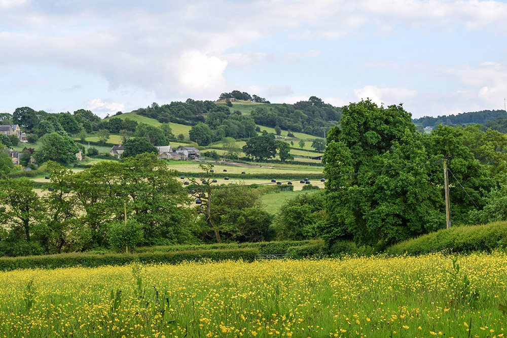
Set alongside the River Amber is the picturesque village of Ashover. Quaint cottages, stone houses and old pubs fill this favourite Derbyshire village of mine. It may take you a while to drive through the village as it is so pretty, with many cute cottages for you to stop and admire. Ashover has a truly rich history with quarries, lime kilns and lead mines. It holds All Saints Church dating from between 1350 and 1419 which was built by Thomas Babington. (One of his family members was executed for plotting against Elizabeth I). Ashover is also the home to the long standing Ashover Agricultural & Horticultural Show – this year’s show takes place on Wednesday August 14th. It is a great day out for all the family. In the village there are three pubs, a cafe, a cute coffee shop and gorgeous little village shop which sells gifts, cakes and ice cream (cash only!). There is a lovely cricket pitch with football goals, a nice children’s park and play area, and tennis courts, so plenty to occupy you. Adjacent to the cricket pitch is Ashover Parish Rooms now the Village Hall, which can be hired for weddings and events. There’s a plethora of walks in and around Ashover featuring stunning views, high vantage points, buttercup filled meadows and babbling brooks. You can see why this is a favourite for myself and many other walkers. USEFUL INFORMATION This walk is pretty easy to do. Takes just over an hour or longer if you are taking time to take in the beautiful scenery. We came through a field of cows with calves so please be careful if you have dogs. It’s a very peaceful walk which goes through fields, meadows, along the river and is easily shortened or extended. Near the end you pass 3 pubs so take your pick! Track with … https://www.outdooractive.com/en/route/hiking-route/central-england-and-the-midlands/drafted-on-2024-06-25/295370954/?share=%7Ezzgg3age%244osstcjj Parking… there is a free car park at the village hall and also plenty of spaces on the road (please park responsibly!) Pubs… three in the centre of the village. The Old Poets Corner, The Crispin Inn and The Black Swan. Distance – 4.35km Time – 1 hour-ish Terrain – Easy to moderate THE ROUTE Starting from facing the cricket pitch we walk to the bottom left hand corner to the small pavillion and follow the footpath to the left as it goes all the way through the fields, through the woods (where you will smell the wild garlic at the moment), till you hit a little junction in the path. Turn right through the gate and you will come to the Fall Hill quarry. Follow the path as this goes head straight onto Hockley Lane so please be careful! Head left on Hockley lane for a few yards where, on your right, you will see a footpath sign which looks like somebodies driveway but this is the footpath – honestly! Carry on down onto the road, don’t go down the bridleway. We are now walking alongside the River Amber and after 20 or so yards on Fallgate you will come to the SLOW sign on the road, here you will see an opening on your right which will take you along the river. Follow along the River Amber and then take the path to the right. This will go down a couple of steps and then up a couple more and through the trees. When you come out onto the lane you have an option of making this shorter by taking the bridle path to your right but this is a little treacherous underfoot, especially if it’s been bad weather. We are carrying on straight up Gin Lane in front of you. When you get to the fork in the road, take a right along the track which slowly makes its way uphill. Climb all the way to the top. You will pass Overton Hall on your right. You will come to a clearing with a path to the right. Take this. You will come to a small gate with the yellow footpath arrow. Take that and go down the stone steps – slippery when wet. Follow the stone steps to the bottom, you will go over a little bridge and following the path up Salter Lane eventually coming out onto Hockley Lane with Old Poets Corner on your left. Once you’ve had a swift pint at one of the pubs, follow straight up past the Black Swan on your left and continue around the corner till you see your car. Enjoy a pint at one of the pubs! 00
Walk Derbyshire – Shardlow’s Inland Port and Eighteenth Century Walk

When the eighteenth century Duke of Bridgewater’s fiancé gave him what we might today call the push, he decided that not only was he secretly pleased to be rid of her, but to be honest, he was also bored by London, which took up too much of her time through the London Society she frequented. Moving north, back to his estate outside Manchester, the Duke of Bridgewater didn’t take long to come up with the idea of what to do with his spare time. He also decide how to use his growing wealth from the coal being mined beneath his estate. This growing fortune we must realise had come about at the start of what became known as ‘The Industrial Revolution’. What had once been carried out mainly by hand, was now increasingly mechanised, run by entrepreneurs such as Richard Arkwright on steam-driven spinning and weaving machines, machines demanding mechanical power. That power was provided by steam engines, engines driven by coal. The Duke of Bridgewater supplied a large share of the coal, but it had to be carried to the mills on the backs of mules, an extremely slow process. So slow was the movement of coal over the comparatively short distance that mill-engines were frequently running out of fuel in their attempt to keep up with the insatiable demand for produce. The duke had the coal and the finance to develop his side of the business of producing cotton fabrics. There were thousands of tons of the stuff lying a mere hundred feet or so beneath the ground; access to it was comparatively easy, but it was one which eventually led to a new industry, together with an expansion of the duke’s coal sales. The answer to the problem of how to reach Manchester in the shortest possible time was easy. Simply dig a canal direct to the coal face and fill a barge, then float it all the way to the centre of Manchester. Hazards such as the eventual building of the Manchester Ship Canal were simply circumnavigated by innovations such as swing bridges and tunnels. Having successfully developed a canal directly from the productive end of his coal mines and the rapidly expanding cotton mills in and around Manchester, a place soon to become known as ‘Cottonopolis’, the duke used the services of a completely untrained engineer and surveyor known as James Brindley. Barely literate and with no formal education, Brindley was able to calculate, purely by eye, the best route for a canal across otherwise open country. Canals had first been built by the Romans, as a means of transporting heavy goods over long distances. Their arrow-straight roads were simply there to move foot soldiers as rapidly as possible across open countryside. Everything else was carried by barge away from sea-ports that sprang up around the country. It took until the seventeen hundreds for the likes of the Duke of Bridgewater and his engineers such as James Brindley to become enthused with developing canals. For a brief time until superseded by the railways, a sort of canal mania swept through the British countryside It had long been a pipe dream of the likes of Brindley to link North Sea ports with Liverpool, where a port devoted to the import of raw cotton and other Caribbean based raw materials like tobacco and sugar were being off-loaded. With raw materials coming in from the west and a ready market in Europe to the east, all that was needed was to move these finished goods eastwards and timber for builder’s needs from the Scandinavian forests in return. At first this was dealt with by road transport, but ideally it would be more efficient to move them by barges floating on convenient canals. We cannot be sure who spotted this answer to the conundrum, but it lay in the fact that land between the Humber Estuary and Liverpool is served by numerous rivers, but mainly the Mersey and its tributaries in the north of a large area of flat land, and also the eastward-draining Trent in the middle. With the finances of Francis Egerton, Duke of Bridgewater and the untrained skills of James Brindley, a system of inter-linking canals through surrounding counties were dug in order to create the Trent and Mersey Canal, England’s major barge-only canal. Of the three local rivers, Erewash, Derwent and Trent, only the Trent which starts life above Leek in Staffordshire has sufficient water flowing westwards between its banks, but within its eastern confines there as a steady growing flow towards the North Sea. The now named Trent and Mersey Canal makes a turn towards the River Mersey and the Port of Liverpool where nowadays goods are mainly confined to container carrying vessels offloaded directly on to lorries for delivery throughout the north of Britain. Of the two Derbyshire rivers joining the middle Trent, only the Erewash has ever profitably carried goods; this was along the short-lived Erewash Canal running between Derby and Nottingham. The Derwent was never suitable for navigation, except for using its water for the Cromford Canal. What the Derwent can do, is provide water for the Trent, which it does near Shardlow and in doing so, forms a complex of basins and boatyards complete with warehouses and workshops. The Trent & Mersey Canal was opened in 1777, initially designed to carry locally dug clay to the Potteries, but later used as a safe route for the fragile products on return journeys. Surrounding all this, is a level 3 mile path, which is the subject of this month’s walk starting from Shardlow Port. This rarity on English canals was the commercial hub of the region, where goods both finished or were an essential part of ongoing production. At one time it would have been busy with carters offloading raw materials ranging from China clay, to silk and raw cotton, carefully packed finished crockery from Stoke, knitted stockings and lace from Nottingham, or preparing cotton yarn for the weavers. USEFUL
Walk Derbyshire – High Peak Trail Across Middleton Moor

When the civil engineer William Jessop and his associate Benjamin Outram finished building the Cromford Canal. While they were linking the expanding industries of the Derwent Valley to the Midlands, it was soon realised that if the canal was continued in a northerly direction, it would open the burgeoning new cotton industry to markets around and beyond the Trent Valley, and vice versa for mutual growth. The original idea of continuing the canal across the limestone moors and linking with the Peak Forest Canal at Whalley Bridge, was soon dropped for the simple reason that the linking canal north from Cromford would have to climb almost 1000 feet across the comparatively waterless limestone uplands of the White Peak. Even then the canal mentality still held sway and following an Act of Parliament dated 2nd May 1825, permission was granted to build a 33mile long railway, still following the canal pattern, costing an estimated £32,880, one of the earliest railways built soon after the opening of the Stockton and Darlington Railway. Permission to build what became known as the Cromford and High Peak Railway, was awarded to Josias Jessop, the second son of William Jessop, the canal engineer responsible for the design and building of the Cromford Canal. As Josias Jessop had been trained in canal engineering, it is hardly surprising that his railway was designed as though it was a dry canal. Rather than go round or underneath hills, the route climbed on steep gradients, with trains hauled up and down by cables powered by stationary steam engines. Still thinking in canal terminology, stations were called wharfs and the inclines took the place of canal locks. There are several sharp bends such as the one at Gotham where the track turns through ninety degrees in less than a hundred yards. Side branches served the small quarries dotted along the line’s route. One of the inclines, that at Middleton Top where this walk starts, has a well preserved winding engine which is frequently ‘steamed’ on advertised holiday dates. Although rolling stock is no longer hauled up and down the incline, there is sufficient track still giving a clear indication of the mechanics of this method of climbing the local hills. It is also possible to admire the handiwork of local stone masons who laboriously created the stone sleepers which carried the original track before being replaced by timber. There is a section of the original track and its original stone sleepers on display outside the Information Centre at Middleton Top car park where the walk starts. While Middleton Top Incline is well known, there were others along the way. Hopton was the next incline, but its winding gear was removed when locomotives became powerful enough to climb the gradient without assistance. In later years the Cromford and High Peak Railway made a link with the mainline by way of a side track into Buxton from Harpur Hill. This diversion removed the need for an incline down to Bunsall Cob and the Goyt Valley from the top of Long Hill. Two other inclines on either side of Whaley Bridge station were abandoned. This is an easy walk with wide ranging views across the local countryside. On the first leg of the walk, the view to your front across Middleton Moor looks along the Derwent Valley and across the Via Gellia towards Bonsall and Matlock’s limestone crags of High Tor. When the path across the grassy moor reaches a side track where the route turns left, the strange looking green fencing opposite, with its stern notices to keep out, is thought locally to be a long-term trial of fencing used to surround open prisons. The structure is even illuminated at night, making an eerie glow that has led to talk of UFOs flying nearby. So, the best advice is to obey the warning, and Keep Out! From the turning, the way follows a partly trackless way over pasture enjoyed by dairy cows. Bearing left, a cart track soon develops, swinging downhill to the left as far as an abandoned dairy farm. A gate marks access to the High Peak Trail. Turning left here the way back to the Information Centre and Car Park is one of ever widening views south into Leicestershire and beyond. Wirksworth parish church spire is visible below and slightly to your left, while beyond and marked by radio masts, is the last fling of Pennine Gritstone at Alport Height. USEFUL INFORMATION: A 2½mile (4km) easy walk with little or no steep ascent, over grassy meadows well known for their wild flowers including orchids. Suitable for young children. One slightly difficult stile. RECOMMENDED MAP: 1:25,000 Ordnance Survey Outdoor Leisure Map – White Peak, Sheet OL24 PUBLIC TRANSPORT:6.1 Derby to Matlock service as far as Rise End, Middleton-by-Wirksworth. Walk uphill past the Rising Sun Pub on the Ashbourne Road. Go under the railway bridge and then turn right along the lane signposted to Middleton Top. PARKING:Beside Middleton Top Information Centre or on its nearby field. REFRESHMENTS:Tea and coffee at the Information Centre. The Rising Sun back down the Ashbourne/Cromford road has a good range of real ales. Home cooked food a speciality – all at reasonable prices. THE WALK :: THE WALK :: THE WALK :: Level with the cycle hire office, cross the trail and climb the short flight of stone steps and then bear right at the top. The engine house and driving wheel for the cable, once capable of hauling trains up and down Middleton Incline. After a yard or two, bear left beside a part ruined limestone wall and follow it gently uphill on to the grassy moor’. Continue to walk, still uphill until you reach a horse rider and pedestrian stile. Cross by striding over the anti-motor cycle barrier. Turn left on to a rough farm track. The depression below and to your right was caused when the roof of a limestone quarry gave way. Much of the stone quarried below ground was valued for War Grave
Walk Derbyshire – A Walk Above Matlock

by Rambler I don’t think I have ever written about a walk where the instructions needed to mention street names, but as this walk involves the use of streets dating back to Matlock’s origins as a spa town, it will be helpful if I name the handful of them necessary, in order to reach the forests surrounding the eastern side of the town. Fortunately street walking will be at the minimum once the height gained by climbing Bank Road from the town centre is accomplished. The reason for all this climbing on pavements and a narrow side alley, or jitty, is due to long term parking currently being difficult around the town centre while the extensive flood prevention works are carried out on the river bank, beyond the road bridge near Crown Square. In the hey-day of Smedley’s Hydro (now Derbyshire County Council headquarters), trams hauled by an underground cable ran up and down Bank Road from Crown Square. Unfortunately present day traffic has made it impossible to have trams cluttering up the town centre, struggling for space with the never ending convoys of heavy vehicles carrying Derbyshire’s limestone to markets far and wide. Until Smedley had his brainwave, the great and good seemed to have managed quite well without the need for the likes of high pressure water sprayed all over their quaking bodies, but they did and flocked to Matlock in their droves, that was until the fashion died out around the mid 1940s. Fortunately the white elephant the building had become soon fulfilled a need for new county council headquarters away from overcrowded Derby. While the fashion for the water cure was at its height, Smedley became very rich and encouraged his senior employees to open smaller versions of his hydropathic establishment, rather like chickens around a mother hen. He also built Riber Castle that still dominates the townscape, despite its history of failure. The eastern hillside above Matlock and as far as the joining of Derwent and lower Wye Valleys was once renowned for plant nurseries, specialising in shrubs and the kind of plants that prefer acid soils, such as that found to the east of the Derwent Valley, especially above Darley Dale. There is even a rich ruby-flowered heather called Erica darleyensise that was developed by one of the hillside nurseries. Regrettably only one of those nurseries survived. Beyond County Offices, the walk has one last climb, directly up to the attractive housing estate accessed by Cavendish Road. Further on, the way is through established pine forested plantations along with mature mixed woodland which is soon left in order to drop down to the Sydnope section of Two Dales and where a woodland track winds its way towards the stone cottages and small farms bordering Boam Lane. A pleasant high level road walk with many views later descend, leading towards the need to cross a busy main road, the A6. Luckily this is brief and a short field track is joined, going under Peak Rail’s track and then onwards towards the river which together with the railway is followed all the way back into Matlock town Centre. THE WALK STEP BY STEP From Crown Square walk up steep Bank Road until you reach County Offices and the site of Smedley’s Hydropathic Institute as it was known in the days of the ‘water cure’. Turn left at the corner of the main building and follow Smedley Street, past the entrance to County Offices. Cross over the junction with Wellington Street corner marked by the attractive tower and residential property on the site of ‘Tinker’ Wright’s hardware store where you could buy such things as nails and screws in any quantity rather than coming away with the unwanted contents of whole packets. Cross over to the other side of the junction and walk on for about a hundred yards to reach a side turning to the right into Smith Street. Follow Smith Street uphill to its junction with Jackson Road. Cross the double junction and go to the left along Jackson Tor Road, following it to its end and then turn right on to a steeply inclined jitty – the local word for an alley. Leave the narrow jitty at the top where it passes a children’s play area in order to join Cavendish Road. Turn left along this road, walking past houses on your right and the local sports ground on your left. Where the road turns sharply to the right, continue forwards along a narrow tree lined track winding steadily uphill and into mature woodland. When the track begins to bear right, continue along it, climbing steadily right, uphill and beginning to bear left, scrambling upwards as far as the remains of an old stone boundary wall. Turn left at the wall and walk on, joining a level grassy path running between mature mixed woodland on your left and a plantation of pines on the right. At the end of the path turn right and then go diagonally left to cross a grassy fire break. Currently work is in progress to remove fully grown trees destined to be converted into woodchip used for building purposes. Look out for notices advising current operations and listen out for machinery and loaded trucks. Continue into pinewood and follow a path through the dense woodland. Where the woodland path reaches a forestry track, turn left and follow it for about a quarter of a mile, turning right and then left at a track junction after another quarter of a mile. Follow this section of track for around half a mile, past open fields grazed by sheep on your left. Continue until the track bears right opposite the boundary of a private garden developed in an abandoned gritstone quarry. From the middle of May, the wild garden is filled with the pinks and reds of rhododendrons. About a hundred yards beyond the turning, go to the left following the garden boundary, along a rough path winding between
Walk Derbyshire – A Walk to the Bull Ring at Snitterton

By Rambler Before I begin my description of this walk, I must put in an explanation of what I mean by Bull Ring. First and foremost I have no intensions of sending walkers all the way down the A38 in order to walk round Birmingham’s busy Bull Ring commercial district. The bull ring (notice the use of lower case ‘b’ and’ ‘r’), we are referring to is a four or five inch iron ring set in a flat low stone in the corner of a tiny roadside green at Snitterton village near Matlock. Its original purpose was to tether a bull as part of the barbaric so-called ‘sport’ of bull baiting by teams of dogs, a practice banned in 1835. The walk starts and ends on Matlock Bridge, near to which is currently the site of an extensive flood prevention scheme. The work involves the use of a massive crane that currently dominates the town centre skyline. The crane has become such a popular item, that a fund-raising competition to give it a name was arranged – the winning title was (drum roll), ‘Liftymacshifty’. From the bridge and its interesting civil engineering works, the walk leaves the main road where it bears left. Continuing forward, the way is past a wine merchant’s warehouse and over the railway bridge. Continuing forwards and steadily uphill through a small farmyard, steps lead to a stile giving access to a path climbing steeply towards a wood next to a tree shaded house. Across its access drive and through the belt of trees, the way then continues uphill on a field path heading towards a farm. A right had turn on the farm lane and then almost left through a kissing gate opposite leads on to another path bearing half right and then uphill beside a hedge in order to reach another track. Here a right hand turn takes the walker past a welcoming seat with a delightful view over Matlock, an ideal place for a rest. Slightly to the right above the seat, a field path continues to climb the hillside, then crosses a farm lane. Beyond the far side of the lane, a level path crosses meadowland, past two old stone barns until it reaches a five-way path junction. Taking the second path to the right of the one you are on, walk beside a stone boundary wall to reach a narrow road – this is Salter’s Lane once used by teams of packhorses carrying salt from Cheshire onwards to North Sea fishing ports. Across the road, a signposted path leads to a five-way junction of paths, and then downhill to Jug Holes, an abandoned lead mine. Swinging left from the mine, we follow the path downhill and then right at a cottage to Leawood Farm. Its access lane leads downhill into the attractive hamlet of Snitterton. This is where in the corner of a small roadside green marked by a wooden seat the bull ring can be found, set in a flat low stone next to the road. The road makes a tight right hand bend beyond the ring; follow it for about 100yards and then go left through a stile. Ignoring a path leaving to the left, the walk continues forwards as far as the road which is joined almost opposite a minor side lane. Follow this lane, to the right, almost as far as the river. Turn right along its bank and continue over a series of meadows until the path reaches a factory producing macadam blocks, the shaded riverside path continues all the way back into Matlock and its bridge. USEFUL INFORMATION: A moderate walk of 4½ miles (7.25km) on field and riverside paths. One steep uphill climb at the start of the walk. Good views of the Derwent valley as it curves away to the hills and moors of the Dark Peak. Muddy sections of the riverside path, especially in wet weather. RECOMMENDED MAP: Ordnance Survey Explorer Map Sheet OL24, 1:25000 scale The Peak District – White Peak area. PARKING: Roadside to the right above Sainsbury’s petrol station, although all day pay and display parking can usually be found in the riverside car park on the Matlock Bath side of the railway bridge over the A6. PUBLIC TRANSPORT: Rail from Derby. Bus from Derby or Ripley. REFRESHMENTS: Pubs and cafes in and around Matlock town centre. THE WALK STEP BY STEP The walk starts at Matlock Bridge. Cross it and walk on beyond the road junction opposite. Continue over the railway bridge and then onwards and upwards to a farmyard. Climb the stone steps next to the farm house and go through a stile to enter a field. Climb the steep grassy path directly uphill until it reaches the lane to a large house. Cross this lane and walk through a small belt of trees. Climb the stile at the far side of the trees and then follow a path alongside a hedge. Swap sides with the edge and continue uphill towards a farm. Cross the farm’s access drive by going right and left as indicated by the position of two stiles. Walk uphill diagonally half right, crossing the line of a mature hedge. Continue uphill, the path now bearing half left to reach a tumbled down wall; (hopefully the wall may be repaired in the near future and a stile restored). Cross the rough farm lane immediately below the wall. Directly opposite, the twin stones of a squeezer stile in a dense hedge give access to a level path crossing a series of meadows marked by two abandoned stone barns. Where the path reaches a five way path junction, take the second path on your right. Go down to and cross Salter’s Lane, part of the old Saltway between Cheshire and the east coast. Begin to go downhill, steeply at first, then bear left next to the lower entrance of Jug Holes Mine (lead). From the mine go directly downhill for a short distance to link with a
Walk Derbyshire – Following the Magpie Sough

By Rambler ‘Sough’ is the lead miner’s term for the method of draining water from a mine. One of the most attractive roads through the Peak District, the one between Bakewell and the A515 Buxton/Ashbourne road takes some beating. Around a mile beyond the cut-off for Monyash, to the right two small chimneys indicate the presence of a major relic of local industrial heritage. The chimneys and ancillary buildings, plus an old stone cottage are all that is left of boom to bust underground activity in the search for lead. This is the site of Magpie Mine where fortunes were made by intense inter-companies rivalry that even lead to murder. While lead ore mining may have been active in small near-surface activity for hundreds of years, the earliest recorded evidence of miners beginning to explore ever-more deeply came in a report dating from 1740, the start of upwards of a dozen small lead mines that developed as time went by. Local and even itinerant Cornish miners, searched for the riches available in upwards of eight major veins running roughly east/west ever deeper beneath the site. It was also quite normal for abandoned mines to be re-opened by other companies, simply by asking permission from the local Barmote Court, the traditional means of controlling lead mining activities in the Peak. Due to the proximity of adjacent veins, two or more mines could be operating within only a few feet of rock between them. This was the case in 1833 when teams of Magpie miners from Maypit and Great Redsoil mines came into dispute over the right of Maypit miners to open a side passage, inevitably connecting to Redsoil. Appeals to the local Barmote seemed to be getting nowhere and arguments, sometimes verging on violence, broke out from time to time. All this came to a head when Magpie miners lit a fire in the connecting Maypit passage. Regrettably this led to a number of Redsoil miners being suffocated by the fumes. Twenty-four Magpie miners were accused of murder and taken for trial at Derby Assizes. Luckily for them their counsel was the wily William Brittlebank of Winster who argued that the Magpie/Maypit miners were carrying out a traditional method of breaking down the rock within the passage. Unfortunately, or so Brittlebank claimed, the wind direction changed, blowing smoke into Redsoil, rather than into the Maypit workings. With this evidence, the Jury acquitted the 24 Magpie/Maypit miners, but they left the court with the widows’ curses ringing in their ears; learning all too soon that their mine would never again make a profit. A boundary wall to the east (right hand) side of the field beyond the cottage and the prominent chimneys leads to the capped-off shaft into Redsoil and Maypit Mines. A few yards away there is the reproduction of a horse-drawn gin, a system operating the lifting of ore to the surface. The gin is just one of the many features to be seen when passing through the Magpie Mine site. Starting with the cottage, a combination of the mine agent or captain’s house and smithy, it sits within the shade of two chimneys, both part of steam engines that once drew ore to the surface and lowered men to their work. The chimneys give a clue of where their builders came from; the round one was built by Cornish miners trying their luck in the north, they built it in the style they were accustomed to. The square profiled chimney was made by Derbyshire Miners. Various small buildings dot the area around both engine houses. There is an ore store, or coe, not far from the square chimney. This was climbed recently by a courageous Duchess of Devonshire while it was being repointed. Apart from Britain’s only Grade II Listed corrugated iron hut near the round chimney, the final building of note while at the site, is another of Cornish design. This is where explosives were stored and the idea behind the stone hut, or powder house design is for the effect of any accidental explosion to travel upwards, not outwards. Passages within the Magpie complex were frequently flooded and in 1873 work began on digging a tunnel, or sough in order to drain the mine. Due to difficult conditions, mainly with very hard rock, and driving the shaft downwards for about 575 feet before it could make contact with the level of the River Wye; all this took until 1881 before it could carry water away from the workings, but the sough did have one extra advantage when small boats could carry ore to the surface, rather than being manhandled along difficult underground passages and then winched by horsepower into daylight. The sough, starting beneath the round chimney engine house follows a route flowing below the village of Sheldon. The walk as described below follows a surface route above the sough all the way to its confluence with the river. In 1973 the sough became blocked which members of the Peak District Historical Mines Association managed to clear. The story goes that when a huge body of withheld water was expected, an angler was spotted tranquilly fishing in the Wye, more or less opposite the sough. Despite being warned, the angler continued to fish, that is until the inevitable happened and a wall of water hurtled towards him. Fortunately he managed to escape in time and in any case, the water level very soon went down to normal. Traditional lead mining was carried on until as recently as the 1950s, or whenever prices became attractive, but that hasn’t happened for a long time now. USEFUL INFORMATION: A moderate walk covering 5 miles (8km) of field paths and woodland tracks. 575feet, (175.09metres) down along Deepdale and then uphill through Great Shaklow Woods. RECOMMENDED MAP: Ordnance Survey Outdoor Leisure Map Number 1, Sheet OL 24; the Peak District, White Peak Area. PARKING: Roadside near Sheldon, but please keep well away from field access gates. Alternately use the roadside car park
Walk Derbyshire – Toad’s Mouth, Carl Wark & The Upper Reach of Burbage Brook
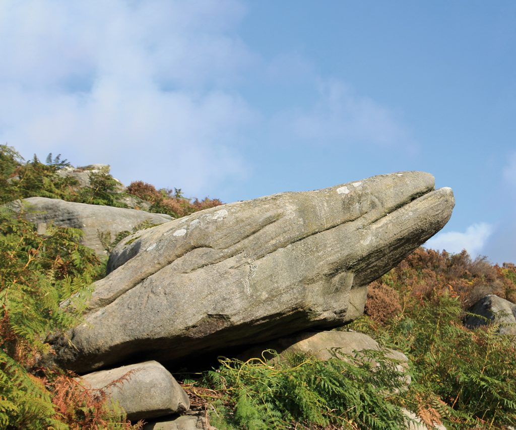
There are many enigmatic remains throughout the Peak District; stone circles, cairns and burial mounds were left by people who did not tell us who they were. Carl Wark the focal point of this walk is one such relic, but we have no way of telling if it was Iron Age or post-Roman, but it tells us that the people who used it had to protect themselves from attack by unfriendly others. When gentlemen took their ease by squinting along the barrel of an expensive shot gun aimed at some innocent moorland grouse, or semi-wild deer, chances are that many of them would have used nearby Longshaw Lodge for their accommodation. During the Great War, the lodge was used as a convalescence hospital for wounded Canadian Soldiers; there is a photograph of a group of them in the snow below the house; it stands beside the path in front of the lodge. With the decline of moorland shooting for so-called pleasure, the moors over which the hunters stalked has been handed over to the National Trust where anyone can wander freely along footpaths crossing the unspoilt moors and wild oak woods covering the valley sides of the lower Burbage River, all the way down to Grindleford. This walk starting from Longshaw joins a roadside path beside the aptly named Toad’s Mouth rock, before wandering out on to Hathersage Moor. At its centre the well-preserved prehistoric fort of Carl Wark sits enigmatically below the wild rocks of Higger Tor. Despite its condition, little is known about the fort’s history, remaining as a potential site for some future teams of archaeologists to work on. A path climbs directly across the moor to reach the massive stone defending walls of Carl Wark fort, by one of its two entrances. At this point the walls make an inward curve, creating overhangs from which defenders using crude bows and arrows could fire down on attackers trapped in the narrow gaps rising to the dual entrances. Today’s visitors can explore the site in total safety, while searching for the enigmatic rocking stone hidden amongst the remains of long abandoned hut circles. The fort is well-sited, at the centre of a nearby series of tracks leading the eye along a path climbing to the summit rocks of Higger Tor, the potential route of an extension to the walk. Our route turns immediately right at the foot of the fort’s rear walls. Here it follows an ancient pack horse track, down to a stone clapper bridge across one of Burbage Brook’s tributaries. On the far side of the bridge, the path climbs steadily uphill to join a path, part of Sheffield Country Walk, one of the long distance routes in this part of the Peak District. A right turn follows this path, later passing an abandoned large stone water trough. Unfortunately it was cracked by an ill-judged final chisel. From the path end beyond the ruined trough, another path starting beside the stream a little way before the Toad’s Mouth bend in the main road, to your right joins the brook which is then followed, past a small weir to a narrow footbridge. Crossing this, the way is gently uphill, past a small lake and then onwards to the lodge where refreshments are on sale. For something stronger there is always the Fox house Inn nearby where Jane Eyre descended from her coach. 00
Walk Derbyshire – Historic Deepdale – A walk back into history

Deepdale you may ask, for the name doesn’t appear on any Ordnance Survey map? Now better known as Dale Abbey, the village was once called Depedale, then Deepdale and eventually the modern name, Dale Abbey in remembrance of the abbey that flourished here from 1162 until Henry VIII’s quarrel with Rome in 1536. A lonely stone arch that once framed a glorious east widow, is all that is left of a Premonstratensian abbey taken over from Augustinian monks who came to this spot from Calke Abbey in 1162. They managed to begin building, but lack of funds led to the work being transferred in 1204 to an off-shoot of the wealthier Premonstratensian French foundation based in Lincolnshire. Small by monastic standards, their work led to the draining of surrounding boggy land and the expansion of farming began alongside iron production using raw materials dug from the local countryside. All went well until the Dissolution when the governing abbot managed to stave off the abbey’s closure by payment of a fine. Unfortunately this was wishful thinking and gradually the abbey fell into disuse. Stones from the abandoned abbey found its way into the walls of surrounding cottages and local churches. It is still possible to trace the use of these stones in some of Dale Abbey village’s older houses. The best example is in a cottage close to the village green. Its foundations and the lower walls support attractive half-timbered main walls. Apart from the lonely arch of the east window, a section of the abbey, in this case part of the kitchen, has been incorporated within a cottage close to the field containing the grassed over remains of the rest of the abbey. Unlike other and more extensive monastic relics, the abbey ruins stand on private land, but permission to get closer to the ruins is usually given by the owner of the nearby cottage. Carved stones discovered by occasional excavations are stored in the shed situated in the bottom corner of the site. A short distance along the road leading from the abbey, there stands what is probably one of, if not the most unique churches in the land. Tiny All Saints the Grade I Listed Parish Church is thought to be part of the abbey infirmary, where the local sick and infirm were cared for. It is a strange combination of house and church all under the same roof. The two-roomed half-timbered medieval house used by the verger, was improved in the nineteenth century, but the church is almost untouched. A mere twenty-six feet by twenty-five feet, inside it is a wonderful jumble of props and posts, all set at strange angles; the oak pulpit leans sideways due to the passage of over 300 years since it was made and the only space for worshippers is in one of the 17th century box-pews. But the oddest seating arrangement is on the massive, uncomfortable-looking chair donated in 1824 by an Earl Stanhope who fell in love with the idiosyncratic church. Despite its discomfort, it became known as the Bishop’ Chair, although it is doubtful if one ever sat there. By strange chance the tiniest church in the land, produced one of the largest chalices. Made in 1701, it measures 9 inches high and 15 inches round. The 15th century font is here with worn carvings of the Madonna and Child and the Crucifixion; fragments of coloured glass rescued from the abbey and the remains of wall paintings reward a careful search. A path winds away from the church around the back of a modern house, then on and into Hermit’s Wood. It covers an escarpment composed of easily worked red sandstone. This was used to full advantage by the man who built his home and hermit’s cell, and became known in myth and legend simply as ‘Thomas the hermit’ of Depedale. Before cutting himself off from society, he lived in Derby where in the early thirteenth century, he carried out his profession as a baker. A kind hearted man, he frequently gave away his bread to many who were unable to pay for his produce. One day he had a vision of setting himself apart from the rest of his fellow tradesmen. A few years before building work began on the nearby abbey, somehow or other he was drawn to the spot where easily worked red sandstone lined the edge of a wooded escarpment. Here he carved out a series of rooms for himself and his animals, welcoming passers-by who knelt with him in prayer. Even now it is easy to seek comfort in his hideaway. As the rock was so easy to work he managed to fit a door and two windows to keep out the draft on cold days. He even made a kind of lean-to conservatory, supported by planks set into post holes that still survive. Thomas the Hermit even had a benefactor, Ralph Fitz Geremund, who came across the hermit while out on a hunting trip. Industry developed over time, first mining ironstone and coal, industry that lead to the founding of the Stanton Ironworks. Narrow gauge railways, some of which are covered on this walk, criss-cross the fields between Dale Abbey and Kirk Hallam. There are also traces of small-scale foundries, such as at Furnace Pond Farm beyond Hermit’s Wood; it is likely the name comes from a nearby pond used to provide power for bellows used to melt iron ore in the production of iron. THE WALK STEP BY STEP From Pioneer Meadows car park, turn left along the curving road around the limits of Kirk Hallam, going past houses for about a quarter of a mile. Look out for a footpath sign on your left pointing to Dale Abbey. Follow field boundaries across four fields, passing well to the right of Ladywood Farm. Cross a deep gulley by means of a footbridge and, bearing very slightly left, cross the field beyond the gulley. In the far corner
Walk Derbyshire – Walking Eyam, Bretton Edge and Foolow
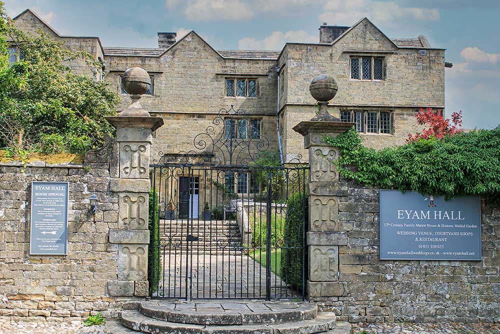
Here is a walk through some of the historical countryside surrounding the plague village of Eyam, a village where the Covid-19 pandemic must have jogged some deep folk memories from a time when the inhabitants of Eyam made a courageous stand against an outbreak far worse than that which beset them in more recent days. The walk starts logically one might say, from the car park directly opposite a small, but fascinating museum devoted to the stand made by those villagers in 1665/6, when led by a far sited young rector, the Reverent William Mompesson and assisted by his friend and predecessor, Puritan minister Thomas Stanley. Simply by what was surely firm and sensible leadership, they managed to persuade the people of Eyam to hold themselves in total isolation, despite more than half their number succumbing to the dreaded virus known as Bubonic Plague. All around Eyam village you can find relics of that terrible experience, from the natural pulpit in Cucklet Dell where Mompesson preached in the open air. Other relics are Mompesson’s Well high above the village on the edge of Eyam Moor where the far sighted vicar aided by the local landowner, the Earl of Devonshire, arranged for kind hearted suppliers to leave essential supplies, paid for by cash left in the purifying waters of the well. Another transfer point is the limestone boulder beside the path leading down to Stoney Middleton. Money dropped into holes filled with vinegar carved in its surface was rendered safe by the purifying action of the vinegar. Along with these exchange points are the number of simple graves dug into places well away from the village church; they were dug by survivors who had the onerous task of burying their nearest and dearest in places ranging from local fields and even gardens. This is a walk that starts by tasking the ability of all those who are prepared to make the steep climb up to the Sir William Hill road, high up on the edge of Eyam Moor. Fortunately this is the one and only climb, and a climb where the effort offers a reward of some of the finest views in the Peakland. Descending from Bretton Edge, the walk passes through Foolow followed by a mile or so of field paths leading all the way back to Eyam. USEFUL INFORMATION 6 miles (9.6km) of moderate walking , beginning with a steep climb from Eyam up a woodland path, followed by open fields leading to moorland road walking, then by a fairly level path across small fields, back into Eyam. Excellent wide-ranging views from Bretton Edge. RECOMMENDED MAP Ordnance Survey 1:25000 scale Explorer Map, Sheet OL24; The Peak District, White Peak Area. PUBLIC TRANSPORT Buses from Bakewell and Sheffield via Grindleford. REFRESHMENTS Eyam village. The Barrel at Bretton and the Bull’s Head in Foolow (open Sat & Sun from 12 noon) CAR PARKING On outskirts of Eyam village, opposite the village museum. Directions : From the car park opposite Eyam Museum, turn left and left again to follow the village’s main street, past the Jacobean hall and then the plague cottages where the dreadful virus first struck. Go through the church gates on your left and follow the path through the graveyard, past the church and then climb out into open fields. (Look out for the amusing memorial stone to a famous county cricketer). Cross the road and climb steeply up the woodland path a few yards uphill from the entrance to Beech Hurst Youth Hostel. Continue steadily uphill across three small fields above the wood, until the path reaches a side lane. (Mompesson’s Well is a little over a quarter of a mile to your right if you wish to make a diversion to this historical place). The walk turns left and crosses the lane for a couple of yards and then turns right to climb over a stone stile in the gritstone boundary wall. Keeping on the left of a boundary wall, climb steadily over Bole Hill which was the site of a small lead smelter for nearby Ladywash Mine. After a quarter of a mile of walking through pasture above Ladywash Mine whose chimney can be seen in trees over to the right, climb over a ladder stile and join the Sir William Hill road. Turn left and walk down the unsurfaced road until it joins a narrow lane at a sharp bend near the start of Bretton Edge. Spend time admiring the wide ranging views, both north and south across the Peak District moors and pastures. Walk along the road for about a hundred yards and then turn right along a descending rough track. The track becomes a narrow surfaced lane servicing the scattered cottages overlooking Bretton Clough. Keep with the lane as it climbs to the left past Bretton hostel in order to reach the ridge-top road once more. It is next to the Barrel Inn. (Food available, both inside the pub and out). Turn right on joining the top road beside the Barrel and begin to walk downhill. After about a quarter of a mile, take the left-hand fork and continue downhill along the road, past a small well and for about three quarters of a mile until it reaches Foolow. (There have never been any people who can be classed as foolish living in and around Foolow. The name actually means Foo’s Hill – Foo would have been the name of an early Saxon settler in these parts). Turn left beside the tiny non-conformist chapel on entering the village and walk past the duck pond overlooked by the village cross on your right and a bull ring almost lost in the grass. With the Bull’s Head pub on your left, follow the Bretton road, bearing left at the fork for about 150 yds. Look out for a stone stile in the wall on your right. Go through the stile and bear left to cross four narrow fields, using stiles in their boundary