A quick look at … Earl Sterndale & The Upper Dove Valley – part two
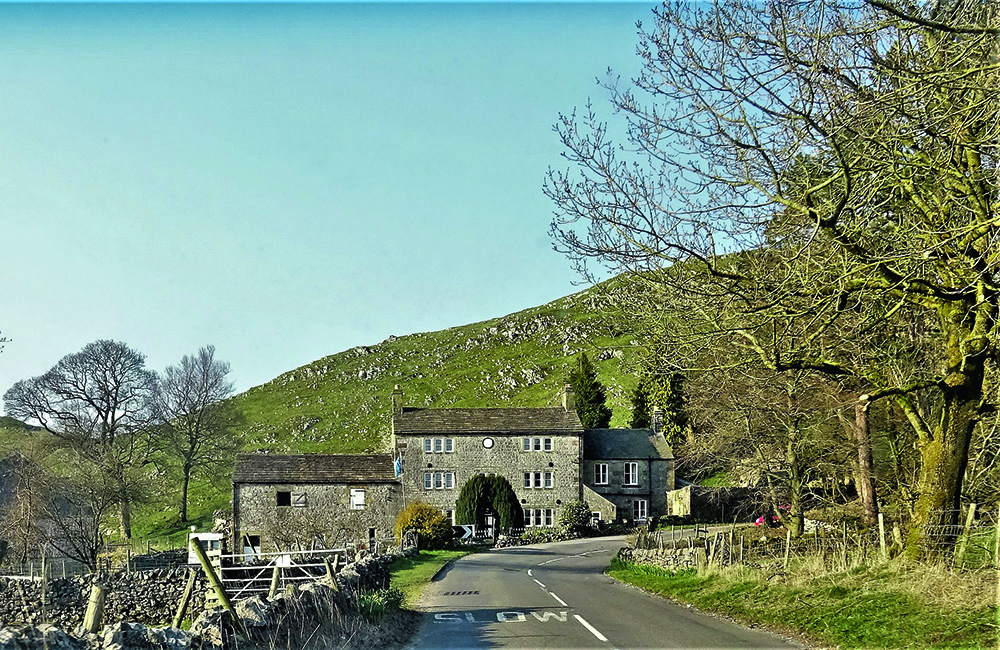
Having adjourned to the Pack Horse Inn at Crowdecote, we felt duly refreshed, and continuing our journey took the turning north, back alongside the Dove, out of the hamlet heading for Earl Sterndale. The road soon leaves the river and climbs gradually, passing the diminutive settlement of Abbot’s Grove; until the 20th century Abbots Grove House was a farm of the Finney family, who also farmed Broadmeadow after the sale by the Batemans. The frequency of dwellings thereafter suddenly increased, and at once a greensward opened out in front of us, wide side furthest away and embowered with trees (and cluttered with parked motorcars): Earl Sterndale, the only really substantial settlement on our tour. The village takes its name from Sterndale, a declivity (Barkdale) which ascends east from the Dove and (its trackway having crossed the old Roman Road, now the A515 on the ridge beyond) descending via Deepdale to the Wye. The name means ‘a valley with rocky ground’ and was first recorded as Stenridile in 1244, becoming Erlisstenerdale by 1330. The ‘Earl’ prefix represents its possession from 1086 until 1265 by the de Ferrers family, Earls of Derby. The eastern settlement, beyond the ridge, King Sterndale, lay in the Royal Forest of the Peak, and took its prefix from the monarch himself. The two most prominent buildings on the green are the stone built 17th century pub on the west side and the much more recent church of St. Michael and All Angels on the east (upward) side. The former, famously named The Quiet Woman, is recorded back into the 18th century, and claimed even greater age, although the building itself appears to have been formed from a row of about three early cottages. The sign depicts a headless woman and, misogynistic by today’s standards or not, was once fairly common, although few so-called survive to day – indeed apart from one on Houfton Road, Bolsover, others have long closed: that at Halstock, Dorset is now holiday accommodation and that on the corner of Brook Walk and Ford Street in Derby went as long ago as 1878. Tragically, the landlord of the inn at Earl Sterndale died in August 2020, causing it to close; it has yet – to the regret of many – to re-open. Whilst the north of the settlement was expanded with 20th century housing (with the Regency and Victorian vicarage above), the rising ground to the east is embellished by the church and school, the church yard forming a visual extension to the green. There was a chapel-of-ease of Hartington here from the fourteenth century – perhaps longer, if the 12th century date for the font is correct – which was falling down in the 18th century and which was finally replaced to the designs of George Ernest Hamilton of Stone in 1828, a simple rectangular building in ‘carpenter’s Gothic’, of carboniferous limestone and gritstone dressings, with a square tower. In 1860 it became a parish church in its own right and, in 1877, R. R. Duke of Buxton added the rather inconsequential-looking chancel. The church had the dubious distinction, on the night of 9th June 1941, of having been gutted by a stick of incendiary bombs, jettisoned by a passing Heinkel 111 en route home from attempting to bomb Manchester, but was well restored by Naylor, Sale and Widdows of Derby in 1952. To its north stands the absolutely delightful school (listed grade II), seemingly straight from the playbook of Sir Joseph Paxton, with its corniced end stacks, gothic traceried fenestration with hood moulds and rusticated quoins. The porch is dated 1895 however, but we were not convinced that this was its true date. After all, the money had been raised by farmer Thomas Lomas of Glutton Grange and the plot donated by the Bachelor Duke in 1853, which would sit much better with its exterior and accord well with a design sent over from Chatsworth by Paxton. We reckoned that the porch was a matching later addition of 1895. Apart from the not wholly successful replacement of the windows in uPVC, it makes a delightful ensemble with the church, all set off the magnificent granite Doric column erected in the church yard in 1919 as a truly heroic war memorial. There was also a flock of chest tombs in the church yard, two to the Finneys of Broadmeadow and Abbot’s Grove, including the unfortunately named Minnie Finney. Coming through the church yard’s iron gates, we turned south to see the miniscule Methodist Chapel of 1860 and the 17th century grade II listed hall beyond, sitting, with Regency-replaced fenestration, behind a fine gritstone pair of ball finialled gate piers and with a superb stable range beyond. Whilst we were unclear which family built it, we noted that in the later 19th century it was home to the splendidly named Prince Beresford, a junior member of a very distinguished Dove Valley family. Unfortunately, of the two rows of 18th century and later cottages opposite some had been disfigured by the insertion of uPVC windows. Coming back to the car, a rather well-spoken villager asked us if we were thinking of buying a house there, to which I replied ‘too bally bleak for us!’ We must have aroused suspicion, snooping round the village; I recall Roy Christian telling me of similar incidents during his village tours in the 1960s! Our last port of call was to leave Earl Sterndale northwards to the junction with the B5053 Brierlow Bar to Longnor road. This winds down towards the Dove again, by High Wheeldon (National Trust, but yet to be fingered with ‘problematic’ associations!) through a charming rocky defile, down to Glutton and then Glutton Bridge. The name, from Middle English gluton (which originated as a surname and means exactly what you’d expect it to mean) reminded us that we had passed other gastronomic sounding names, if less straightforward, like Custard Field (Middle English costard = apple) and, of course, Parsleyhay. We also passed
Earl Sterndale & The Upper Dove Valley pt.1
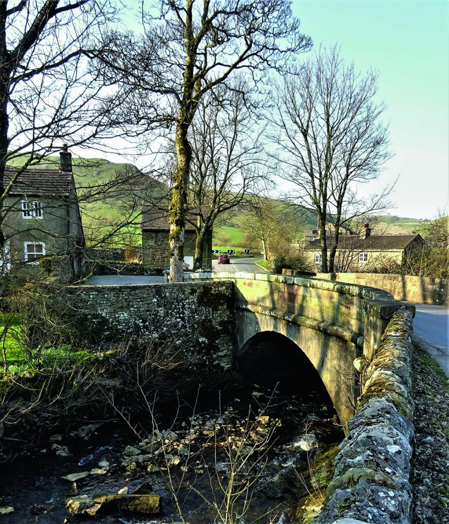
Nucleated settlements are fairly scarce in the White Peak and the upper Derwent Valley, partly because the relief is challenging, not to mention the constant outcropping of limestone. Partly also it is because Saxon settlement came late to this part of Derbyshire, probably not starting in earnest until after around 640, and post-Roman British settlement – as is evident in much of upland Wales to this day – was always discrete, that is to say scattered, with only churches as focal points. This is why the parish of Hartington used to stretch almost to Buxton, being divided into three parts going north from the parish church: Town Quarter, Middle Quarter and Upper quarter, each scattered by diminutive townships, some of which have virtually disappeared over time. The original parish probably represents a pre-Norman and indeed, pre-Anglo-Saxon land unit, utilising the Dove as its western boundary. We had decided to take our tour – necessarily motorised; you would require at least a day and a decent level of fitness to cover our route on foot – of Middle Quarter, centered upon Earl Sterndale, but starting at Hartington so we could enjoy a spectacular view of the Dove’s lush valley as we moved north. Thus, we left Hartington Market Place along Dig Street which leads out of the built-up part of the village to Wallpit Lane, which meanders, very much a single track and gated road, alongside the Dove all the way to Pilsbury. The views are indescribably memorable: the valley is gently enclosed by the riding limestone ridges either side and each minor turn brings further prospects to the north and west. As we progressed, we saw 17th century grade II* listed Broadmeadow Hall, opposite on the Staffordshire side: a striking sight. The last time we saw it, about 1980, it was a picturesque roofless shell, but has since been put back into use, which is gratifying. Once the property of the Poles of Pool Hall, Hartington, it passed to the Sleighs of Pilsbury Grange in 1573. They sold in 1709 to the Haynes of Ashbourne from whom it came to the Batemans of Hartington Hall before becoming a separate freehold on the death of Sir Hugh Bateman 1st Bt., in 1824. We would recommend taking this route by car out of season, as passing would be a problem in places, and in season it might well prove a nightmare. The two and a quarter miles we took at a fast walking place: no-one came up behind and no vehicle approached: perfect. “Most of the area has been part of the Duke of Devonshire’s estate since the 17th century, and much, I suspect, still is. Farms are beautifully kept and the larger farmhouses, like mid-18th century Pilsbury Grange, are very much estate foreman-built pattern book farms: three storeys, three bays wide and still using mullioned windows.” At Pilsbury – Pilsberie in 1086, (‘the fortified place of Pil’, cf. Pilsley) – there are a pair of substantial farms and the road suddenly climbs steeply to the moor above in a series of sharp ascending turns. At the start of the first turn a track continues the route along the Dove’s bank, which those on foot can enjoy, for although Pilsbury Castle, about 600 yards along, is an impressive motte, probably set within a pre-Roman earthwork and well worth a visit, there is nowhere safely to leave a car. The Castle was built by Henry de Ferrers as the focus of his Dove valley holdings not long after the conquest., but was of timber, and never replaced in stone. We drove up onto the moor, therefore, enjoying awesome views southwards and passed Pilsbury Lodge, which has a caravan facility; the presence of farms with ‘lodge’ in the title suggests relics of an ancient hunting preserve, and those with ‘grange’ represent former monastic owned farms. Indeed, continuing east along our way, we eventually met the more easily motorable (but much less scenic) Hartington-Earl Sterndale Road and, turning left, quickly reached a crossroad marking the centre of one such place, Needham Grange at High Needham, embowered by windswept trees, the settlement itself having long since shrunk to three farms. First recorded in 1244, like nearby Heathcote it gave its name to a distinguished Derbyshire family, today represented by the 6th Earl of Kilmorey, an Irish peerage thus an honour which did not prevent him from representing Chippenham in Parliament and serving as a minister under John Major. Here we turned west again, the road winding sinuously and spectacularly back down toward the Dove, crossed by a stone bridge at Crowdecote – ‘the dwelling place of Cruda’ – which is another very small township within Hartington Middle Quarter, with a cluster of stuccoed cottages where the road divides above the bridge itself. We noted a rarity, looking rather forlorn beside a K6 telephone box: an early 19th century iron water spout, much like those provided in more profusion, by the Harpurs at Ticknall. The sight of this made us thirsty, so we adjourned to the Pack Horse inn opposite, and enjoyed excellent blond ale and a snack. It is delightfully unspoilt, aided by being a listed building in a conservation area, having been formed from a pair of cottages of 1727 with later alterations, but still with cosy rooms and friendly staff. Having felt duly refreshed, we took the turning north, back alongside the Dove, out of the hamlet heading for Earl Sterndale. 00