Lost Houses of Derbyshire – Rough Heanor Manor

By Maxwell Craven If you drive from the Royal Derby Hospital to the A38, you might notice that, between the two is an island of overgrown vegetation with a busy slip road on either side of it: a rather desolate place surrounded by roads. Although it is not visible, inside stands an 18th century brick farmhouse and some mainly modern outbuildings: Rough Heanor Farm. It all looks frightfully unprepossessing. Yet in truth the site has a very long history and one not without significance, in the main all well recorded in Medieval charters and post-Medieval estate records. Originally, its name was simply Heanor (Henovere), part of a suite of three names in Mickleover ending with the modern English suffix ‘-over’: Mickleover, Littleover and Rough Heanor. Heanor is a combination of Saxon heah (= high) and ofer (= ridge), thus ‘High Ridge’. A thousand years ago Rough Heanor was part of the large and important manorial estate of Mickleover, first recorded in Domesday Book, and then also consisting of Mickleover itself, Littleover, Findern and Potlock. For reasons now lost to us, the entire manorial estate was, at some time after 25th December 1066 and 1st January 1085 granted by the King to the Abbot and canons of the Abbey of Burton. (Rough) Heanor itself is first named in the early 12th century, in a land grant of Geoffrey, Abbot of Burton, confirmed in a charter issued between 1150/1159 by his successor, Robert who ‘…concedes the grant made by my predecessor of blessed memory Geoffrey…to Robert son of Walchelin…that land in [Mickle]over called Heanor’. This Robert son of Walchelin, or ‘FitzWalchelin’, held the land in perpetuity in return for an annual payment of 5/- (25p) – a nominal sum, representing that although the grant was hereditary, the Abbot remained technically feudal overlord of the estate. Abbot Robert’s successor, Bernard, in 1160/74 increased the annual payment of half a mark (thus 6/8d = 34p). Robert’s father Walchelin held the neighbouring manorial estate of Radbourne. He had married a daughter of Henry de Ferrers, one of the great feudal barons of the Conquest who was by 1086 in possession of 115 manorial estates in Derbyshire alone, including Radbourne. Walchelin’s name suggests that he was already a kinsman of some kind of Henry de Ferrers, too. Robert had three sons, of whom the eldest, Robert III FitzWalchelin became the ancestor of the Chandos and Pole families, the second was settled upon an estate in the NE of Derbyshire, and the youngest, Peter, was settled at Rough Heanor, which was then clearly considered a viable enough estate to support him and his family. This Peter is referred to both as Peter FitzWalchelin and as Peter de Heanor, the latter style clearly implying that he lived on his holding and thus strongly suggests that some kind of a dwelling of élite character must have come into being from this time, the manor house. Peter’s grandson, Nicholas, seems to have achieved considerable status, for we find him holding the manor of Shipley in 1242 and in 1258 sub-divided portions of the manors of (Rough) Heanor and (Kirk) Langley. The family seem to fade from record after the first third of the 14th century, being most probably wiped out in the Black Death ravaging the country 1348-1350. Subsequently the manor and site of the settlement devolved on the de Heanor’s closest kin, the heirs of Robert III FitzWalchelin of Radbourne and became part of the wider holdings of the Chandos family, by that date the FitzWalchelins’ successors. There is also plenty of charter evidence for a settlement as part of the manorial estate, too, although it probably ceased to be viable after the Black Death and the ‘climate anomaly’ that immediately preceded it, which plunged the county into cool wet summers and much colder winters after some 600 years of warmth. There was living in (Rough) Heanor in 1327 a Richard ad Crucem – ‘Richard near the Cross’, suggesting a preaching cross was then still extant. It was probably positioned on the border between this part of Mickleover and Littleover, thus on or by the Uttoxeter Road, as a focus of Christian preaching established before the churches came into being. There is also compelling evidence for the manor house having had a domestic chapel at (Rough) Heanor, too. The fact that this has not been noted previously is that the history of the church of St Mary at the modern town of Heanor has become entangled with references to this chapel at (Rough) Heanor and a lost parish church of St. Mary in Derby. Nevertheless, although not in existence before 1160, the chapel seems to have been founded soon afterwards, probably when Robert FitzWalchelin was granted the estate, as a domestic chapel to the house which Peter FitzWalchelin chose to build there. This chapel may have been dedicated to St. Nicholas, perhaps explaining the congruence with the name of the two successive Nicholas de Heanors, who seem to have been lords of the manor in the 13th century. One 19th century source indeed, avers that Mickleover church to which the chapel belonged, was once so dedicated itself, probably as a confusion with the chapel-of-ease nearby. After the late 1340s, then Rough Heanor became a deserted medieval village (DMV) and the house was probably abandoned, or reduced to act as a farm for a Radbourne estate tenant. Yet documents dating to 1398, 1408-1409 and 1492 mention only a leased messuage (house and land), at one stage successively the residence of younger sons, Thomas and John de la Pole, second and third sons of Sir Peter de la Pole, the man who had acquired Radbourne by marriage with the heiress of Sir John Chandos KG, hero of the Hundred Years’ War. In 1713 William Woolley recorded that ‘In 41 Elizabeth [1597] Germain Pole had an estate here…which he left to his son Thomas. I suppose they may have it still and it is now called Rough Heanor.’ This is the
Lost Houses of Derbyshire – Old Radburne Hall
By Maxwell Craven One of the most delightful, sequestered and ancient parish churches in the county is that of St. Andrew, Radbourne, set beside the Radbourne Brook (effectively a tautology: the clue is in the name, the ‘red bourne’, or stream) in a hamlet which hardly seems to exist, despite being barely four miles from Derby. It is well hidden from the unfrequented road, although well signposted. As you descend the path to the church you can see across a broad pasture to the brook and the ridge beyond, atop which stands the fine Georgian mansion that is today’s Radburne Hall (the spelling differs from that of the settlement, by hallowed tradition), although it is slightly beyond one’s eye-line. The pasture itself is full of strange hollows, and was originally the site of the first known houses on the site. Radbourne is one of those rare landed estates: one that has never been sold since its first recorded owner obtained it. It has, however, passed via an heiress four times since its first record, the first three in the Middle Ages, the fourth currently, but the blood of the first recorded tenant, Wakelin de Radbourne – who is on record for 1100, but was almost certainly the 1086 (Domesday Book) tenant – still flows in the veins of the incumbent family. Who exactly Wakelin was is not clear, although it has been suggested that he was reasonably close kin to his overlord, the tenant in chief, Henry de Ferrers, lord of an hundred Derbyshire manors, other members of whose family certainly used the name. The monumnet to Sir John, now at Mazerolles The grandson of Walkelin left no son but a daughter and heiress, who married John de Chandos who was of a minor gentry family from SW Herefordshire, Chandos being a locality in Much Marcle parish in that county. John’s great-great-grandson was Sir John Chandos, KG, the great hero of the Hundred Years’ War, Constable of Aquitaine and Seneschal of Poitou, created by Edward III Viscount St Saveur-le-Viscomte in the Contentin in 1360. Sir John, born around 1320, was a close friend of the heir to the throne, Edward, the Black Prince and, in 1348 joined his patron in being nominated one of the first ever Knights of the Garter. Described by the medieval historian Froissart as ‘wise and full of devices’, as a military strategist, Chandos is believed to have been the mastermind behind three of the most important English victories of the Hundred Years War. He was chief of staff to the Black Prince at the Battle of Crécy in 1346, was a leading commander a decade later at the Battle of Poitiers and also in the Battle of Auray, in the War of the Breton Succession in 1364, following which his commander, John Duke of Montfort, was able to succeeded as John IV, Duke of Brittany. In addition to his other honours, Chandos was created the lieutenant of France and vice-chamberlain of England. In 1369, the French launched a successful counter-attack, regaining much territory and forcing Edward to recall the retired Chandos, who attempted to deal with the French attempts to regain a foothold in Poitou, of which he was made governor. In a skirmish following an unsuccessful attempt to re-take St. Savin, Chandos met the French on the bridge at Lussac. In the ensuring melée, Chandos’ long coat led to him slipping on the frost. James de Saint-Martin, a French squire, struck Chandos with his lance, piercing his face below the eye although Chandos’ uncle, Edward Twyford of Kirk Langley, standing over his wounded nephew, repulsed the attack. The wounded Chandos was carried on a large shield to Monthemer, the nearest English fortress, but died, unmarried, in the night, either on the 31st December or the early hours of New Year’s Day 1370. Sir John Chandos as Knight of the Garter, 1348 from the Bruges Garter Book Such was Sir John’s reputation that Charles V (‘the Wise’) of France is reported to have said that ‘had Chandos lived, he would have found a way of making a lasting peace’ although French chronicler Jean Froissart was more circumspect, saying ‘I have heard him at the time regretted by renowned knights in France; for they said it was a great pity he was slain, and that, if he could have been taken prisoner, he was so wise and full of devices, he would have found some means of establishing a peace between France and England.’ He added of Chandos that ‘Never since a hundred years did there exist among the English one more courteous, nor more full of every virtue and good quality.’ He certainly comes across much in the heroic mould of those other two hammers of the French, the Dukes of Marlborough and Wellington, although his reputation lost nothing in having been killed in battle. The estate passed to Sir John Lawton, married to one of Chandos’s sisters, although the loss of the original patent creating Sir John a Viscount means that no one is sure whether it was remaindered to his sisters and their issue, failing any heirs of his body, or not. As a French title, albeit granted by the King of England (but as King of France), this may well be true, meaning that Lady Chichester might well be Viscountess de St. Sauveur. Certainly, his heiress brought all his property to her husband to Sir Peter de la Pole from Cheshire. The Poles, too burgeoned mightily once ensconced in the county, for younger branches settled at Kirk Langley, Barlborough and in a moated house north of Hartington, now marked by a farmhouse called Pool Hall; one of this latter branch, John Pole, became the outlaw after whom Castleton’s Poole’s Cavern was (phonetically) named. Nevertheless the Radbourne Poles have been there ever since, although they assumed the additional surname of Chandos in the Regency period as homage to the enduring renown of Sir John. At Radbourne Sir John is reputed to have had a ‘mighty large howse of
The Lost Houses of Derbyshire – Kirk Hallam
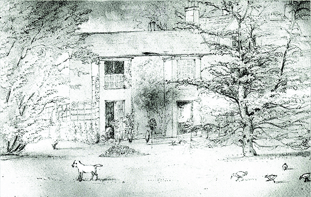
by Maxwell Craven Kirk Hallam was originally a small hamlet atop the ridge that overlooks the Nut Brook and the homonymous canal as one travels east towards Little Hallam and Ilkeston. It takes its name from the Old Norse hallr (= a hill) + kirk (= church) which perfectly describes the settlement, even as it appears on the 1880 OS map, on which there is little to be discerned bar the church, the hall and a scatter of houses to the south of the main road. It is thought that the ‘Kirk’ element was added in the early 12th century as the later settlement that became West Hallam expanded, to differentiate the two. In 1066, the manorial estate was held by one Dunstan, but two decades later, when Domesday Book was compiled, it had come into the hands of Ralph de Burun, one of the great barons and few chief lords holding land in Derbyshire and, under him it was held (so later charters establish) by a family taking their name from the place. In 1155, Hugh de Burun of Horsley Castle, the last of his line, died and the estate passed via his daughter Aelina to Peter de Sandiacre, son of a Viking called Toli, who not only held Sandiacre, but a great amount of property in Derby, too. His son, another Peter, married Beatrice de Hallam, a member of the family that were Peter’s sub-tenants at Kirk Hallam, and we can only presume that they had a capital mansion of some description there. From maps, we know that the later hall lay just slightly SSW of the ancient church of All Saints, and it would be reasonable to assume that the ancient manor house would have been on or very near the same spot. As with one of two of the other lost houses we have looked into, it was never the chief seat of the family that owned the land, so always ranked as a secondary residence. Furthermore, in 1260 John de Sandiacre granted the patronage of the church and much of his estate at Kirk Hallam to the Abbey of Dale, so whoever lived in the manor house was from the later 12th century, a tenant of the Abbot and Canons there. In fact, the generous John de Sandiacre died shortly after his gift to the Abbey, in 1277, leaving two daughters and co-heiresses, of whom one carried Sandiacre and Kirk Hallam to her husband, John de Grey, a younger son of Henry de Grey of Codnor. The estate remained thereafter with the great English baronial house of Grey until it was bestowed upon the daughter and co-heiress of the last de Grey who brought it to John Leake of Hasland in 1409. Yet, once again, the manorial estate had fallen into the hands of a fairly grand, but definitely upwardly mobile, family with a primary residence elsewhere, this time at still extant Hasland Manor House. They also inherited Sutton Scarsdale from the de Greys, too, and the family had also married another heiress, that of the d’Eyncourts of North Wingfield, so they found themselves, by the time of the beginning of the Tudor dynasty, very rich and well endowed with estates, in Derbyshire particularly. The Leakes later built a great house at Sutton Scarsdale and Sir Franics Leake, made one of the very first baronets by James I in 1611, added a hunting lodge nearby called Staveley Hagg, which survives as Hagg Farm. He also aggrandized Sutton Scarsdale, and found much favour with Charles I, who made him 1st Lord Deincourt (the title chosen from his antecedents the d’Eyncourts), a favour he returned by great loyalty to his sovereign during the Civil War, for which he had his estate compounded by Parliament as a ‘delinquent’. The impecunious King rewarded him with an earldom for his pains, and he became 1st Earl of Scarsdale in 1645. We have no information about the manor house at Kirk Hallam through all this time, and it may have decayed through neglect, as we saw at Chellaston. However, the Leakes got their estates back at the Restoration, and the 1670 hearth tax records a house assessed on five hearths at that time, split between a father and son, both called William Blunstone, and it seems likely that the elder was then the tenant. Indeed, the Blunstones were long lived in that area, having come from Sandiacre – probably co-incidentally – at the beginning of the 17th century. However, another William Blunstone was farming in Kirk Hallam in 1827 and his family were still there a generation later, but by then at Ladywood Farm as copyholders, rather than as tenants of the Hall. One wonders if any descendants still live in the area. Meanwhile, their feudal masters had been going from strength to strength until, that is, the time of Francis Leake, 4th Earl of Scarsdale, who managed to blow the family’s considerable fortune, mainly through the expense of building a vast new house (but incorporating parts of its predecessor) at Sutton Scardsdale, designed by Francis Smith of Warwick in 1724 (see Country Images May 2021). Having completed it, he gambled away much of what remained, before dying, broke, in 1736, the last of his line. The estate was, needless to say sold, including the Kirk Hallam elements of it. The purchaser was Francis Newdigate of Nottingham. He, for once, actually decided to live at Kirk Hallam, and elected to build himself a new house. We only have a pencil sketch of this house, although it survived well into the 20th century, so it is difficult to say just what it was like. It appears to have been of brick with gabled cross wings with attic windows, the rest being of two storeys. The roofs were tiled and it was set on a modest park just west of the church. Clearly, Mr. Newdigate was a modest sort of fellow, although by the time of his death in 1764 he
The Lost Houses of Derbyshire – Grangefields, Trusley
Grangefields lies in the northern part of the parish of Trusley and has a long history going back to the compilation of the Domesday Book in 1086, and maybe before, for it lies only a quarter of a mile south of Long Lane, the alignment of the Roman Road from Derventio (Little Chester) to Salinae (Middlewich, Cheshire) via the fort at Chesterton, Staffs. A Roman villa has never been identified in Derbyshire, but if one ever was, a gentle south facing, well-drained slope is the most likely place and the area of Long Lane is a promising one. Whether Grangefields was on or near one has yet to be ascertained, but it would not surprise me if one day such a villa did turn up nearby. Thus, in 1086, both the manorial estates at Trusley had been bestowed on a great lord, Henry de Ferrers, who made a man called Hugh his hereditary tenant of both there. Later charters establish that Hugh’s full name was Hugh le Arbalaster. The name derives from arcuballista a Latin term for a crossbow, which rather suggests that Hugh might have acquired this name from his day-job, so to speak, as a leader of a group of crossbow-men. It would be fun to think that he was wielding one at the battle of Hastings and that Trusley was his reward! Hugh had a son called Serlo, who adopted the surname of Beaufei (spelt in a number of confusing ways), indicating that, whatever Hugh had been up to at Hastings, he probably hailed from the small Norman settlement of Beaufai, Département de l’Orne, not far from the Mesnil, in Normandy. Serlo’s great grandson, Robert de Beaufei, started granting pieces of land to various monastic houses, a habit which his like-named son continued. Between them, the two Roberts made grants to the Abbeys of Croxden, and Burton in Staffordshire, the Priory of St. Mary de Pratis in Derby and the Knights of St. John of Jerusalem at Yeaveley. These were nearly all made from the northern part of Trusley, from just one of the two manorial estates, that away from the village, manor and church, and all between the 1260s and 1290. Indeed, this part of Trusley seems to have originally had its own name, Thurmundesley, as a pair of early charters make clear. This derives from the old Norse personal name ‘Thormund’ + leah = ‘ley’, a meadow or clearing. It would probably have mutated to ‘Thurmandsley’, ‘Thurmsley’ or even ‘Thursley’ today. This may be a clue, indeed as to which of the two men holding Trusley in 1066 had this part of the settlement, for as Ulfketel is also a Norse name, it would be tempting to think of him as Thormund’s descendant or heir, and that Thormund himself must have arrived long before, cleared the land and settled. It was the Cistercian monks of Croxden Abbey, however, who were granted the site of Grangefields, part of a 40-acre gift made by the younger Robert de Beaufei in 1180 and topped up with further land later. Here they established or took over a farm. Sometimes, monks were sent to work such farms, which were called ‘granges’, but more usually lay families were given the tenancies. In time, therefore, the place became known, not as Thurmundesley, but Grangefields, just as a nearby holding granted to the Nuns of Kings Mead Priory in Derby, gradually came to be called ‘the meadow of the nuns of Trusely’, eventually Nunsfield. Certainly, the name Grangefields was recorded (as Graungefeld) in the documents relating the dissolution of Croxden Abbey in 1538. The land and farm at Grangefield was assessed in value by King Henry VIII’s bean-counters at £4 – 6s – 3d (£4.33) – worth £1,817.10 in today’s values, or three cows, or 143 days’ wages in 1538. Thus, Grangefields was acquired speculatively by Dr. Thomas Leigh and William Cavendish (later to become the second husband of Bess of Hardwick) on 17th September 1538 to be assessed, the price fixed and offered for sale. The tenant at the time was William Glossop, of a Wirksworth family and when the estate was sold on in 1545 to Robert Fitch, he appears to have been left in place. Indeed, the sparse surviving records suggest that the Glossops continued as tenants before buying the freehold some time between 1571 and 1598. He did not keep it long though, for he sold it on again first to Edward Kynnersley of Brailsford and then to Francis Curzon a younger son of Francis, of Kedleston. However, at some stage, Francis Curzon seems to have decided to sell it on yet again and it would appear that Robert Glossop, or his father, had become wealthy enough to buy the farm, for Robert was in possession in 1600 when, on 26th October, he mortgaged it to raise money. Unfortunately, whatever Robert needed the money for, the mortgage appears to have been foreclosed with the result that it passed by 1608 to John Gregson ‘yeoman’ of Sutton-on-the-Hill who immediately sold it on to Robert Hope. Unfortunately, not much is known of the family, but Robert was born to Charles Hope at Etwall, not only did Robert Hope buy the estate, but he also appears to have built a fine new house, or more probably, rebuilt the late medieval house which he acquired, adding a crosswing and generally modifying the building, producing an irregular but delightful timber façade. It was described by William Woolley in 1713 as ‘,,, a pretty private seat formerly a grange belonging to Croxden Abbey’, whilst Stephen Bagshaw added, ‘it is a long, half-timbered building having many gables.’ The only comparable house locally are perhaps the earlier West Broughton Old Hall or the slightly later and more symmetrical Wakelyn Old Hall at Hilton. The house fortunately lasted into the age of photography (by a whisker) being the subject of the Calotype photograph which may have been taken by photographic pioneer W. H. Fox-Talbot, who was married
Derbyshire Villages – Rodsley
by Maxwell & Carole Craven Having basked in the remoteness and sequestered lanes of Harehill and Muselane, we were much tempted to stay in that wonderfully pastoral and semi-wooded landscape that lies well west of Derby but close to the south western edge of the county. Hence, last August, we ventured between Shirley and Yeaveley in order to re-acquaint ourselves with the delights of Rodsley which Pevsner appears to have forgotten entirely. I suppose that academic 1950s tourist probably got into mental over-load when it came to relatively unremarkable rural brick buildings, but they never cease to delight us and there are gems to be sought. We approached the hamlet from Yeaveley, where we had been doing some research for a privately commissioned history of the Meynells, and travelled east along Rodsley Lane. You should not be misled, however, for almost every road in Rodsley is called Rodsley Lane, for that upon which we were travelling eventually arrives at a cross-roads in the centre of the settlement, from which you can turn left (up Rodsley Lane) to end up in Wyaston, or right, (down Rodsley Lane) which will lead you to Park Lane and eventually to Long Lane, just east of Alkmonton. If you were to go straight across, however, you will actually be entering Shirely Lane which, needless to say, gets you, fairly rapidly, to Shirley. At this juncture a little background might be in order. In 1066, a Saxon freeholder called Brun (Brown in modern parlance) held what subsequently became the manorial estate at Rodsley, although a small portion of the land had earlier been bestowed on the Abbey of Burton as a parcel of the vast manor of Mickleover. Brun clearly failed to survive the Conquest as, in 1086, when Domesday Book was compiled, a Norman called John was holding it, lording it over no less than six villagers and a couple of smallholders. He also had land in Osleston further east. This John appears to be identifiable with (or possibly father of) the John de Turbeville of Rodsley who endowed both the Abbey of Burton and Tutbury Priory with parcels of his land during Henry I’s reign and held a knight’s fee there – that is, enough land to be able to equip and feed a mounted knight (probably himself) for service with the crown. His probable son, another John de Turbeville, died without any surviving children before 1166, when the estate passed to Robert son of William de Alfreton of Alfreton, from whose family it later passed to the Montgomerys of Cubley and thence to the Vernons of Sudbury, who held on to much of the estate until 5th Lord Vernon sold Rodsley to the Cokes of Longford, in which parish the village actually lay. Hence the lords of the manor always had a principal manor house elsewhere, so there was never such a thing in Rodsley, nor consequently, did these lords ever appear to have founded a church. We do not get much of a picture of Rodsley again until the 1664 hearth tax assessment, when we find that every householder – fourteen – in the village had only one (taxable) hearth except Christopher Pegge, who had three but was taxed on only two of them. Christopher Pegge is referred to as ‘Mister’ in the return, and was thus minor local gentry and indeed, was a member of the Pegge family of Yeldersley. Therefore, going towards the village, the first building we encountered was the charmingly named Three Pots Cottage, end-on to the road on the north side. It had been one of Rodsley’s two pubs in the 19th century (and before) – called the Three Pots – although the origin of name seemed to us impenetrable; it certainly was not heraldic, which was my first thought. It was run by a William Mansfield in 1827, but soon passed to the Ratcliff family, who obviously also had worries about the name for, between 1835 and 1846, they re-named it the New Inn, although it had reverted to the Three Pots by 1857, only to become the New Inn again by 1864 but, by the end of the century, it was calling itself the Old Three Pots. It seems not to have survived the first decade of the 20th century, however and was gone by 1908. As the delightful twin range 18th century brick cottage lies a good way outside the village centre and near nowhere in particular, I cannot say we were surprised! Three quarters of a mile further on and one once again encounters some buildings, part of the appropriately named Corner Farm, the entrance of which is set on the NW angle of the cross roads, which here manifests itself. As we approached the crossroads, we saw a long low brick barn on our left, to which is affixed, near its east end, a cast iron plaque erected by the Sherwin Society in 1976 to mark the canonisation of locally-born Catholic martyr, St. Ralph Sherwin in 1970. Ralph Sherwin was born in 1550, younger son of John Sherwin of Rodsley, farmer, and was educated at Eton as a scholar from 1563, which establishes that John Sherwin was no mere peasant farmer. His wife’s brother was John Woodward, rector of Ingatestone, Essex, who was the appointee of local grandee Sir William Petre and the latter clearly helped Ralph to obtain a fellowship at Exeter College, Oxford, after which he converted, went to Douai, was ordained and then on to Rome, after which he was one of a group of young missionary priests sent to re-evangelise England, but was arrested tried and executed in December 1580. His ministry had lasted hardly six months. We were by no means clear which of the farms clustered round the crossroads had been that worked by John Sherwin, but certainly the family was still in the village in 1666, when the saint’s great-nephew, another John died, leaving the poor of the parish £1 yearly out of
The Wreck of Flying Fortress ‘Over Exposed’
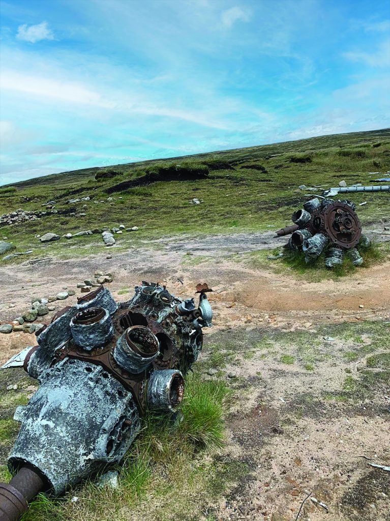
by Brian Spencer Pennine Way walkers almost at the southern end of their epic trek from Edale to Kirk Yetholm look on the crossing of Bleaklow as almost the end of the first day’s section of the ‘Way’. Grateful to enjoy a spell of comparatively easy walking on a path made from flagstones, the walker, if they know the part of Bleaklow where they are, spare a few minutes to make a diversion. About a mile west in the direction of Glossop, Shelf Stones, is a 621 metre high ridge, an unforgiving couple of metres below the moorland crest, the ground is littered with the remains of aircraft wreckage. Closer investigation by those with keen eyesight will spot items stamped with U.S. military reference data. This is all that remains of a U.S. Flying Fortress, once affectionately known as Over Exposed by those who flew in her. Built by Boeing and officially known by its manufacturer’s reference as RB-29A-4-44, she weighed 55,000 lbs fully loaded (36lbbs net), and was powered by four massive rotary engines, two on each wing. First flown in July 1946, she entered military service too late for the actual World War 2 fighting, but was converted to carry photographic personnel and their equipment after joining the 16th reconnaissance Group’s 311st Air Division, photographing the first atomic bomb test, on Bikini Athol, and also took part in the Berlin airlift when the city was effectively held to ransom. Based at Burtonwood American air base near Warrington, Over Exposed ended its working days carrying a team of seven trainee photographers as well as its crew. Weather as we know only too well is, in late autumn, usually damp and misty with poor visibility. The navigator was forced to plan a route by instruments alone, but with all the flight crew fully trained and experienced, the crew and passengers were fully confident of their ability to carry out their planned task. The task they were set was first to fly to Scampton RAF base in Lincolnshire in order to pick up money for the wages of colleagues (and themselves) at their base. This they managed quite easily, leaving Scampton at around 10:15 on 3rd November 1948 in order to give the photographers and navigator’s experience of route finding, probably over hilly country in poor visibility, so a complex cross country flight plan was lodged. This involved changing the route in order to fly west over the highest ground in the District, then flying due west, gradually descending over Glossop and south Manchester to Burtonwood airbase. The navigational task the crew had to answer first involved descending as low as possible in order to get beneath the low clouds. Fortunately the navigator and pilots had the help of scientific instruments to help them find the way, but it is at this point that things went wrong. Was it instrument error? If so it eventually caused the disaster, or maybe sheer carelessness? What ever happened will never be known, the instruments were up-to-date and the navigators experienced. All that is known is that Over Exposed though old in years was flying just a metre or so too low in order to clear the summit of Shelf Stones, almost a matter of inches between life and death. AFTER THE CRASH On the fateful morning of 3rd November 1948 an RAF Search & Rescue team operating from their base at Harpur Hill near Buxton happened to be involved in a training exercise on Kinder Scout. The team arrived at the summit of the Snake Pass at around 4:30 p.m, and despite thick mist, they were able to pin-point the position of Over Exposed crashed on Shelf Stones. Using the summit of the Snake Road as a base they quickly headed for the apparent site of the crash on Shelf Stones. Despite the fairly quick time it took to reach the accident site, as it was readily marked by burning parts of the fuselage; the easiest recognisable item was the tail fin. Only badly distorted remains of crew members were found and the macabre job of carrying them to the Snake Road and eventual identification. The aircraft was found to be carrying about $7400, mainly in paper currency which had surprisingly managed to survive the crash and subsequent fire. All of the money down to the last few dollars was recovered by American Military Police. Immediately after the accident, a large section of the main fuselage was easily recognisable and in fact for several years became a simple bothy providing accommodation for hardy souls intent on spending the night on Bleaklow. Unfortunately less careful visitors no longer look after it so well and, together with vandals, and trophy seekers, very little remains of the original wreckage. However, an attempt has been made to preserve the memory of those who flew on Over Exposed on that fateful day. They are, commemorated on a named military-style grave stone, the centre piece of an annual service at the site. Super Fortress Over Exposed crew and passengers commemorated at the crash site on Shelf Stones Moor. Much of the wreckage of Flying Fortress Over Exposed and items connected to it can still be recognised by those with appropriate training, especially parts of the four turbo-engines, but should be left for future archaeologists to examine. In total there are seven wrecks dating from 1939 to 1956 scattered around Bleaklow and associated moors and are mostly the final resting place of those who flew over the wild moors. Please do not remove any items from the wreck sites without permission. 00
Lost Houses of Derbyshire The Hough, Hulland

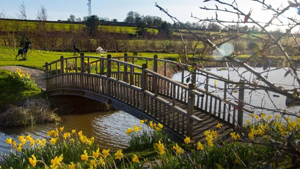
by Maxwell Craven The standing remains of the moated secondary seat of the de Bradbourne family no longer exist for me to share with you, but, like Brizlincote Old Hall, the site is marked by a well-preserved moat, and moated sites are relatively rare in Derbyshire, although many more are recorded in the sources than survive. The site lies east of Brunswood Lane and south of the A517 at Hulland; the well-preserved moat measures 150 by 125 feet (45.7 x 38 m) and includes traces of the abutments of a bridge, although much less well preserved and far less discernable than that at Bearwardcote (see Country Images for August 2014). The name Hough has two old English derivations: either from hoh = ‘spur of a hill’ or from haga = ‘enclosure’. As The Hough is not in the spur of a hill, but in the valley by the immature Brailsford Brook, the latter derivation is probably the correct one, especially as the entire area north of the Ashbourne Road is full of ancient hunting parks. Hulland was owned by the aristocratic Danish settler Toki in 1066, along with much else in the area, but it was granted, as a manor which included Ednaston, before 1086 to Geoffrey Alselin. It descended in his family with Ockbrook, to the Bardolphs (as in Stoke Bardolph in Nottinghamshire) who seem to have had a seat there but who sold The Hough estate before 1250 to Sir Robert de Ashbourn of Ashbourne. He founded a chantry in a domestic chapel previously added to the building (which at that date would undoubtedly have been of timber). His heirs eventually sold the estate to Sir Roger de Bradbourne of Bradbourne, some time before 1296 This family descended from Gerard de Bradbourne, a follower of the de Ferrers Earls of Derby, who had been granted the tenancy of Bradbourne before about 1150 and his descendant, the Sir Roger who acquired the estate, soon afterwards built a house here. His first effort was fashionably moated and may well have been of timber, as was the norm in those days, but at some unknown date – probably around 1451, it was replaced by one of brick and stone, the builder being John Bradbourne, the first of the family to be specifically referred to as ‘of The Hough’. Previously, the junior branch of the family had been settled there, descendants of Sir Roger’s third son, another Roger, whose line ended with an eldest son, Henry. He came to a sticky end, having been executed at Pontefract in March 1322 for joining the rebellion of Thomas, Earl of Lancaster (who was also Earl of Derby), ignominiously defeated at the Battle of Boroughbridge. This was part of the long-running civil war waged between Edward II and various, really quite disparate elements, opposed to the King’s choice infelicitous of advisers. In this case it was the appointment, following the defeat at Bannockburn, of the Despenser family, which enraged the powerful Mortimer clan and, in due course, put out of joint the nose of Earl Thomas, too, for he had been in control of policy since the clear-out of advisers following the defeat by the Scots in 1314. John Borrowe’s late 17th century Hulland Old Hall, north front with the earlier (or re-constructed) portion to the left In the event, the much under-rated Edward II pursued a policy of dividing his opponents; he first disposed (temporarily as it turned out) of the Mortimers in a crushing defeat early in 1322, before turning his attention to Thomas of Lancaster. Unfortunately for the heir of the Bradbournes, Henry ended up on the wrong side! The Bradbourne dynasty, despite this setback, went on from strength to strength. Having rebuilt the house in stone, in 1463, John Bradbourne founded another chantry in the domestic chapel attached to the manor house (in manerio meo de Holendo – ‘in my manor of Hulland’), dedicated to Our Lady, which managed to survive the Reformation, when it became a chapel-of-ease of the parish of Ashbourne but, by the early 18th century it was ‘little used’ and indeed was completely gone by 1750 or thereabouts. The estate, with Lea Hall (see last month’s Country Images) and other nearby property, was inherited by William Bradbourne, on the death of his father Sir Humphrey in 1581. In 1594, however, beset by debts and childless, William sold it all to his brother-in-law, Humphrey Ferrers, who lived on the Bradbournes’ wider estate on a property at Boylestone, inherited from the Waldeschef family, whilst his father was alive and himself occupying the family seat at Tamworth Castle. This is despite William having a brother, Anthony, who was a prosperous London merchant with three sons; what happened to them and whether they had any descendants is not clear. Indeed, despite several other junior branches of the family, the Bradbourne name seems to die out at this juncture altogether. Humphrey Ferrers later inherited Tamworth Castle from his father and was knighted, but his son John (died 1633) lived at Lea Hall and consequently from this time the old house at The Hough appears to have been left empty; indeed it could well be that the Civil War accounted for its eventual destruction. Certainly, the Ferrers family were left in much reduced circumstances after the Restoration – the price of loyalty to the Crown – and in 1690 they sold the estate to the up-and-coming John Borowe of Castlefields, Derby a Nottingham-born former soap boiler. Both William Woolley and Dr. Pegge make clear that by then (the end of the 17th century) the house at The Hough had become a quarry for the convenience of any scavenging old villager wanting to effect an inexpensive home makeover, although Woolley adds that Hulland Old Hall, nearby, was ‘built out of the ruines’ of the Bradbournes’ old house by John Borowe. Examination of the earliest portion of the Old Hall house, which John Borowe had built in the village rather than out at
The Lost Houses of Derbyshire – Lea Hall, Tissington

by Maxwell Craven Lea Hall is a sequestered little paradise, half lost between the villages of Tissington and Bradbourne which, as readers will probably know, lie in the White Peak, almost east-west of each other, although the road between the two villages, south of which Lea Hall lies, is something of an adventure, taking one high over the intervening moor and down through the Bradbourne Brook via a ford, before gaining the main road from Ashbourne. Today all there is to see is an agreeable 17th century farmhouse (in which you can stay, should you feel motivated – see their website) with a late Regency hipped roof, all enlivened by original chamfered mullioned windows of millstone grit, contrasting well with the light grey carboniferous White Peak limestone from which the house was built. Nearby, however – surrounded by much newer such structures – is a large two storey barn of random rubble limestone with a tall gabled roof and with angles sporting almost cyclopean quoins, the walls penetrated here and there by inserted windows, interspersed with traces of others, long since blinded. Both gable ends have kneelers and coping, rising to stone finials, all very reminiscent of Dethick Manor Farm, which is a similar survival of a similar period, but less heavily disguised by centuries of agricultural use. Historic England’s list (on which it is listed grade II) claims that the barn at Lea Hall is 18th century, but even on a cursory examination (which I made about 40 years ago, I must admit) that is clearly quite wrong. However, it would take a detailed examination to be precise about its origin. Both, incidentally, are grade II listed. Lea Hall (which took its name from the hall which, from its name, must have been built prior to the scatter of other houses which make up the hamlet) was once an outlier of the Domesday manorial estate of Bradbourne and was long an extra parochial township, until tidy-minded bureaucrats in 1887 decided to transfer it to the parish of Tissington, on the eastern border of which parish it then lay. We know that from Domesday Book until 1268, Bradbourne was one of the 100 or so Derbyshire manors held by Henry de Ferrers and his heirs, the de Ferrers Earls of Derby, but the book fails to name Ferrers’ under-tenant. However, by about 1180, we become aware of Robert de Bradbourne and his brother Godard, both sons of Gerard de Bradbourne, who must have been in his prime about 1150 and, bearing in mind that Gerard took his surname from the place of which he was the Earl of Derby’s sub-tenant, the likelihood is that he was a direct descendant or heir of the Domesday holder of the manor. Lea Hall, The present farmhouse Godard de Bradbourne’s grandson, Sir Roger, before 1296, managed to purchase Hough Park, in Hulland (which we have yet to look at) and married Philippa, daughter of Thomas Ferrers of Loxley, Staffordshire, a member of the family of the recently disgraced Earls of Derby. He also had a house in Ashbourne and was father to six sons and three daughters, the eldest of whom married Henry de Meynell of Langley. Of the sons, the eldest, Henry, was executed at Pontefract in 1322 for having rather rashly backed Edward II’s cousin, Thomas, Earl of Lancaster’s rebellion, and having thus been on the losing side at the Battle of Boroughbridge. Mind you, it was fairly natural that Henry should have supported Thomas, for Thomas’s father had been granted all the de Ferrers family’s expropriated land by Edward I, his brother. This made Thomas of Lancaster Henry de Bradbourne’s feudal lord at Bradbourne: the latter was thus hardly in a position to refuse to support him in his bid for the throne against the unfortunate and unpopular Edward II. Neither of his two sons lived long enough to be disinherited as a result of their father’s treasonable activities, both having died relatively young. Sir Henry FitzHerbert, 3rd Bt., as painted by Ashbourne born William Corden (1797-1867) [Private Collection] Prior to this, the second brother of the unfortunate Henry was living at Lea Hall and was still there in 1331 when the attainder on Henry de Bradbourne was revoked and Bradbourne itself was returned to the family. Yet only the youngest of his three sons survived his father, and is recorded as having been as of Brassington at his death around 1383. It was the rebel’s third brother’s posterity who ended up with Bradbourne (having previously lived at Parwich), Roger Bradbourne being MP for Derbyshire 1397 to 1405, but Lea Hall only re-surfaces on the record in 1439. It was then home to one of this Henry’s younger sons, passing back in 1519 to his descendant Humphrey Bradbourne. It is not at all clear to what use Lea Hall was put during these years, as the family lived at Bradbourne Hall (which is still there), but one suspects that The Hough and Lea were granted to one or other of the plethora of younger sons produced by each generation of this family. However, in 1594, William Bradbourne sold all his estates to Sir Humphrey Ferrers of Tamworth Castle and, despite having married two wives, seems to have dropped from record. However, one can see the logic, as William’s youngest sister, Anne, was Sir Humphrey’s wife. The Ferrers family, apart from Tamworth Castle, also held the (old) Hall at Walton-on-Trent and cannot have had any use for Lea Hall, and if the ancient hall there had not decayed completely by the date of the sale, it must have done so soon thereafter. It was probably his descendant John Ferrers (or more probably his father) who built the present L-plan farm house, which would originally have been gabled. This John Ferrers also eventually sold Lea Hall and its modest estate (essentially two upland farms) to Samuel Swann of Hurdlow in 1679. The property was with the Swann family for three generations,
Lost Houses of Derbyshire – Morley Old Hall

For somewhere so close to Derby, and somewhere which was once on the very edge of a coal-mining area, Morley is today a remarkably sequestered spot. The village is discrete, as the archaeologists say – not nucleated, but scattered around its parish – but with a magnificent parish church, a very grand Georgian rectory and two country houses – both Victorian: the present Morley Hall from the beginning of the old queen’s reign, and Morley Manor from her last years. One would, therefore, assume that there was very little room for an old hall as well, but in that one would be wrong, for both the Victorian buildings are, essentially, replacements for what had gone before. Indeed, Morley Manor, a fine Arts-and-Crafts mansion in red Warrington sandstone by G. F. Bodley, was built for the Bateman family – the very same family which had destroyed the great late medieval manor house their ancestors had inherited in the 18th century from the Sacheverells. If one seeks any vestige of this house, it is necessary to go to the church and seek out a separate building in the western extremity of the church yard, the Bateman Mausoleum – also by G. F. Bodley – and built in 1897 out of the same red sandstone as the Manor. Standing against this structure’s decorative entrance – with its geometrical wrought iron and Bateman armorial above – is a rather ragged fragment of wall and greyer, being of millstone grit sandstone (from Coxbench quarry in all probability). The relic is called the Loaf Gate, and once saw the distribution of alms (in the form of bread) to the needy of the parish and is part of the original hall at Morley and as such it was probably a subsidiary entrance to the manor house itself. Nor is this the only fragment of a once great house for, slightly east of north from the Grade II* listed Mausoleum, stands the former tithe barn, also listed II*. It appears largely of 17th century date, but its basic structure may be earlier – it is the stone mouldings on the three light mullioned windows that suggest the date. That such domestic looking windows were added rather suggests that the structure was always part of the original main house, but had been adapted as additional accommodation in the early 17th century, possibly as a service wing. The earliest family at Morley took their name from the place – the de Morleys – and they seem to have lived in a house within a moat, the latter feature still to some extent surviving south west of Morley House Farm. Their line eventually became extinct and the heiress married a Cheshire Massey and the heiress of that marriage married a Statham of Lymm, also in Cheshire. Henry Statham, like his Massey predecessors, had a considerable estate in Cheshire and neither family seem to have lived at Morley and we may assume that the old moated (and probably timber framed) house eventually mouldered into ruin. However, there is evidence that this Henry or his father did build a new house, probably on the approximate site of its successor, early in the fifteenth century, for the family obtained an episcopal licence to have a domestic chapel in 1405. All this changed however, when Henry died, for his only child, Joan, had married a Derbyshire gentleman called John Sacheverell. He was very much in the ascendant, for while his earliest ancestor, John de Salta Caprio, had around 1130 inherited in the right of his wife a small estate at Hopwell, a descendant had acquired the remainder through marriage with Roger Hopwell of Hopwell and Wilsthorpe, whose coat-of-arms amusingly bore three conies playing on the bagpipes – ‘hopping well to their own music’ – a typical Medieval heraldic pun! John Sacheverell also held the manorial estate of Boulton and part of that of Snitterton – all accomplished through marrying heiresses. However, he clearly felt that none of these seems to have wholly suited his aspirations, for as soon as Henry Statham had died, he had sold up in Cheshire and in 1480 concentrated on building a ‘very large old building, adjoining the church…of considerable magnitude’, which we presume was an enlargement of the Stathams’ house, and was built of good quality ashlared stone, to judge from the Loaf Gate, although the tithe barn is of slightly coarser work. It is not easy to envisage the extent of the building, upon which hearth tax was paid for 16 hearths in 1670 but, if one assumes that the Loaf Gate was at the SE end of the main front (which faced SSW), and that the tithe barn was attached to the NE angle, then what lay between must have been fairly extensive, probably including a substantial courtyard, and that its western extremity lay in the field to the west of the church yard. Indeed, when the weather is dry, the footprint of the building is relatively easy to see – especially on satellite view. Not that life there was dull, not for one moment. John Sacheverell himself was killed in action at Bosworth Field in support of his king (Richard III) only five years after building his new house. His descendants thereafter kept out of politics (thus accumulating neither honours nor titles) but were drawn back into events through having remained Roman Catholic after Henry VIII’s break with Rome in 1536. Consequently, in the next generation, when Queen Elizabeth I was threatened by the Spanish, a certain amount of paranoia manifested itself. With Mary, Queen of Scots in custody of the Earl of Shrewsbury, Catholic recusants found themselves being harried by the crown’s agents, in Derbyshire heralded by Shrewsbury’s fixers. Hence it was that Morley Hall was raided in August 1581 and Henry Sacheverell briefly arrested before buying his freedom (called paying a fine!) At the time, he had as a guest a Mr. Green, ‘…said to have made all the secret places in Derbyshire’ in
Abandoned Villages

by Brian Spencer A quick look at the Ordnance Survey 1:25000 scale map of the White Peak shows that the region has a history going back thousands of years. Gothic lettered map symbols indicating tumuli, stone circles, field systems or cairns tell us that our forefathers lived and farmed on what are now the high moors of the White Peak, but for some unknown reason abandoned their handiwork for pastures new. There are many reasons why habitations became lost features in the landscape. There are still farms here and there whose early owners would have slaved for their Roman overlords, or worked as lay employees on monastic granges. Later farms, the source of this monastic wealth as huge sheep walks, were split into the comparatively smaller units that became modern farms. Ethnic cleansing and medieval pestilence like the Black Death did far more damage than the Covid 19 pandemic is ever likely to do. Clearances have gone on right up to comparatively modern times, be it flooding pretty villages to create reservoirs or open cast coal mining. Major landowners a couple of hundred years ago moved whole villages simply to improve the look of ducal landscapes. And, of course the most up to date subject of climate change has been around for millenniums in one form or another. Armed with that wonderful aid for exploration, the Ordnance Survey 1:25000 map of the White Peak, we can start to look at our countryside with enquiring eyes. The best way to do this is to try and follow change under a number of headings, i.e. Mythical Accounts. Prehistoric settlements Climate change. Roman influence. Ethnic cleansing. Pestilence. Monastic clearances and later changes in farming patterns. Improvements to ducal estates – the NIMBY syndrome. Inundation during reservoir construction. Urban expansion. MYHICAL ACCOUNTS AND FOLKLORE Children attending Ashover Junior School were reminded of their ancestry when the modern version of an Iron Age roundhouse was built on the site of its prehistoric predecessor. Accurate in many details it told the children that this was just one memory of a bygone era. Some villages have celebrations based on past events, but probably the one that provokes the greater response is one where there is no longer any hint of past habitation. This is Leash Fen, an area of damp moorland on the Chesterfield side of the A621 Baslow/Sheffield road. Apart from a much later preaching cross in Shillito Wood to the north-east, there is nothing left of Leach Fen, but local children do remember it when they sing: “When Chesterfield was heath and broom, Leash Fen was amarket town. Now Leash Fen is all heath and broom, And Chesterfield a market town.” Dunsley near Bonsall no longer exists, but it is mentioned in the Domesday Book and Bonsall folk still accept there is a lost village above Marl Cottage in the via Gellia. Dunsley Spring water has been bottled and sold in the past. CLIMATE CHANGE IN PREHISTORIC TIMES When Neolithic people lost interest in hunting and gathering, preferring instead to lead a more settled life, they opted to farm on high ground, such as Big Moor and around the Upper Padley Gorge, no doubt in places where marauding carnivores could be avoided. The map of Big Moor has many indications of simple farming techniques – words like ‘enclosure’ or ‘field systems’, tell us that farms once dotted the moor. Remembering that the earliest settlers must have arrived not all that long after the comparatively rapid dispersal of ice that once covered the land, it is possible that this form of climate change continued, eventually making the land less suitable for agriculture. THE ROMAN INFLUENCE The abundance of lead and copper first attracted Imperial Rome to invade England in AD43. Between then and when they left around AD476, they left their indelible mark across the land, mostly by their road network and well laid out cities and forts. Place names with ‘Chester’ in their title, such as Chesterfield, are still with us, but only a few of their settlements can be traced to this day, if only by name. Modern Derby has shifted a mile or so to the south of DERVENTIO, Little Chester, a fortress which stood at the junction of Rykneild Street (Leicester to York) and their road from Derventio (Derby) to Mamucium (Manchester), known in later times as ‘The Street’. This road also reached AQVAE ARNEAMETIA, a place now known as Buxton and where naturally warm water still draws devotees. An administrative and lead smelting district known as LUTUDARUM is thought to have existed, and now lies beneath the waters of Carsington Reservoir. Pigs (ingots) of lead stamped LVT ex ARG found as far away as Italy, tell us that the silver had been removed when the ingot was cast at Lutudaron. In order to consolidate their search for lead, often aided by captured slaves, and control movement through the district, forts were built at strategic sites such as Bradwell where only traces of the fort remain, the village or ‘Vicus’ that once sheltered in its protection is long gone. When a Roman soldier completed his service, he was allowed to remain in England where they often married local girls. One of them took on Roystone Farm below Minninglow and the High Peak Trail. The present farm buildings are well away from the foundations of the Romano/Celtic farm’s footings, but they are still there lost in the mists of time. THE NORMAN CONQUEST & ETHNIC CLEANSING When King William, the ‘Conqueror’s’ scribes toured his new kingdom in 1086, collecting data for what became the Domesday Book they found that tax income was a fraction of what it had been under King Edward III, the Confessor. Time after time the comment ‘Wasta Est’ appears after a once wealthy place. Wasta Est indicated the ‘all is waste’, in other words, the place was deserted, all the crops ruined, the stock slaughtered and the inhabitants either murdered or fled. This had come about by the systematic