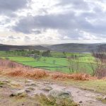
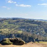
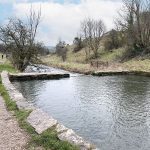
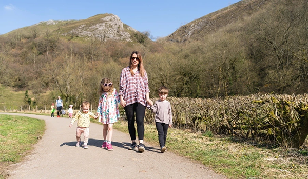
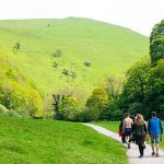
Edit Template

Walks In Derbyshire

There really is no better way to see the beautiful area that we live in than to walk in Derbyshire. Over the years we have walked what feels like pretty much the entire of Derbyshire and Nottinghamshire and feel it only right to share those walks with you. In every edition of Country Images Magazine we feature a walk for you to follow and now we’ve put them online for you to read too. If you have a mobile or tablet, why not follow the walks on it, with a map and an explanation of where to go it’s ideal for you to follow so as not to get lost. We hope  you enjoy the selection below and check back regularly for new walks.

 
  • All Posts
  • Walks
Walk Derbyshire

October 30, 2024

Belper is a lovely little town with many shops, restaurants and a gorgeous cinema. It is situated on the Derwent River and has a vast history. Belper is the birthplace of the factory system. Derwent Valley Mills were inscribed on the UNESCO World Heritage List in 2001. With Cromford Mill hosting a visitors centre to introduce people to the story of Richard Arkwright, Jedediah Strutt, a partner of Richard Arkwright built a water-powered cotton mill in Belper in the late 18th century.  The mill is still standing today, however it is no longer used in this industry.   Belper is also known for its lovely River Gardens which are worth a visit as they regularly hold brass bands playing at the weekends. In the summer months you can hire a rowing boat and spot the kingfishers. There is a cafe and a play park on site.  The walk takes us past Wyver Lane Nature Reserve which also has the Wyver Lane Firing Range wall which you can see within the Derwent Valley Mills World Heritage Site. The Strutt family, who built water-powered cotton mills in Belper from 1776 onwards, used their own militia to protect the mills, in case of visits from mill-wreckers and even invasion, in the time of Napoleon Bonaparte. In 1800, a firing range was provided for Belper volunteers on the Chevin Hill – a large wall which can be seen today by walking along the North Lane footpath, accessed from Sunny Hill at Milford or Farnah Green Road. We see some beautiful vista’s, farmland and in the spring months lambs and calves. There is a pub halfway around the walk too so a great place for a swift pint.  THE ROUTE You can park for free on Belper Road or  until 6pm at night you can...

Walk Derbyshire – A Hike Through Dovedale & Beyond

October 2, 2024

Dovedale is one of those iconic places in Derbyshire which everyone knows about, but finding a circular route can be a little tricky. You have a few choices on this walk to either walk down to the stepping stones, have a paddle, head up to Thorpe Cloud for the views or just picnic by the river.  However, on an extremely wet September day we decided to venture a little further and enjoy a circular walk we had done once before. It is challenging though so best to be enjoyed on a dry day as the rocks are very slippery in parts. Also, the ascent is tough but there are a few tree stumps on the way up, should you need to rest your little legs.  Along the way, we pass the stunning River Dove which is always teeming in wildlife. We pass by Thorpe Cloud (summit 287m) on your right, which you can always head up to before you start the walk if you want a really long hike. Thorpe Cloud and Dovedale were used as filming locations for Robin Hood (2010) with Russell Crowe.  Dovedale is well known for its many limestone rock formations. On this walk you will pass Lover’s Leap where a young woman who believed her lover had been killed in the Napoleonic War, threw herself from the hill. Her skirt got caught in the branches of a tree as she fell which saved her life. When she returned home, she heard that her lover was alive.  When you reach Ilam Rock, you can then turn around to see  a formation called the Twelve Apostles.   Details Parking: National Trust car park at Dovedale (£4 for 4 hours or £7 all day unless you are a NT member then it is free). Pubs:  The Old Dog...

Walk Derbyshire – A Wander With An Ogston View

September 9, 2024

This has got to be one of our favourite walks which we discovered just coming out of lockdown. It takes in the beautiful views over Ogston Reservoir. You also get a bit of height on this walk so the view down the hills at one or two points is pretty stunning. Ogston Reservoir is owned by Severn Trent Water and is a Site of Special Scientific Interest. There is a public hide overlooking the reservoir in the West Bank Car Park. Ogston Reservoir is known for its sailing club and many twitchers come here to view the vast array of migrating birds. You can’t actually walk all the way around the reservoir directly, but there are some beautiful places to walk and where you can take in the views, it really is idyllic and so is a firm favourite.  Ogston Sailing Club is worth checking out as they have paddle-boarding sessions and social sailing sessions, so take a look at their website for more details.  The walk starts from the West Bank Car Park at the reservoir. It is a moderate walk but after we have had a downpour, you will find you definitely need wellies to go through the farmers field as it can be very muddy – also they sometimes have the cows in one specific field so please be aware and extremely cautious when walking with dogs. THE ROUTE There is free parking in the West Bank car park, then walk back towards the entrance and follow the road straight up ahead. Don’t go around to the right but straight up and you will see a house. Follow the track to the right and walk to the top of the track where you will already start to take in the views.  Follow this up until you get...

Walk Derbyshire – An Amble through Ashover

June 25, 2024

Set alongside the River Amber is the picturesque village of Ashover. Quaint cottages, stone houses and old pubs fill this favourite Derbyshire village of mine. It may take you a while to drive through the village as it is so pretty, with many cute cottages for you to stop and admire.  Ashover has a truly rich history with quarries, lime kilns and lead mines. It holds All Saints Church dating from between 1350 and 1419 which was built by Thomas Babington. (One of his family members was executed for plotting against Elizabeth I).  Ashover is also the home to the long standing Ashover Agricultural & Horticultural Show – this year’s show takes place on Wednesday August 14th. It is a great day out for all the family.   In the village there are three pubs, a cafe, a cute coffee shop and gorgeous little village shop which sells gifts, cakes and ice cream (cash only!). There is a lovely cricket pitch with football goals, a nice children’s park and play area, and tennis courts, so plenty to occupy you.   Adjacent to the cricket pitch is Ashover Parish Rooms now the Village Hall, which can be hired for weddings and events.  There’s a plethora of walks in and around Ashover featuring stunning views, high vantage points, buttercup filled meadows and babbling brooks. You can see why this is a favourite for myself and many other walkers.  USEFUL INFORMATION This walk is pretty easy to do. Takes just over an hour or longer if you are taking time to take in the beautiful scenery. We came through a field of cows with calves so please be careful if you have dogs. It’s a very peaceful walk which goes through fields, meadows, along the river and is easily shortened or extended. Near...

Walk Derbyshire – A Walk Through Upper Lathkill Dale

May 1, 2024

It was while I put the final bits and pieces to April – Monyash edition and, mentioning in the text that it starts and finishes in Monyash, it struck me that there is another of my favourites also starting from Monyash old market square.  It is only a little under four miles, but it leads to one of the Peak District’s prettiest dales, Lathkill Dale.  Over the years, this dale has become one of my favourites and can be tacked on to any number of walks radiating from Monyash, such as the one I am about to describe.  It is strictly in two halves, an upper and lower along Lathkill Dale, with the upper having the furthest views.  This walk like the Monyash/Flagg walk, can form a figure-of-eight, radiating from the market square and back.  In total, when combined with April’s walk to Flagg, the combined distance is just under nine miles.  Although further than most of my walks published in Country Images, it should be well within the capabilities of the average fit walker on a day when the sun shines and all the wild flowers are in bloom.  There are three main features worth adding to the description of features seen along the way.  The first is noted soon after leaving Monyash, where Peakland lead mining history can be traced from the records of Monyash Barmote Court.  (The late C.H. Millington from Monyash, was the last of Peakland independent miners). The mass of narrow, stone-walled fields indicate that the land hereabouts was being tilled by Saxon settlers long before the Romans came this way, in their insatiable quest for lead. The turning point of the walk is One Ash Grange farm.  It was once a monastic outpost, so far from the parent monastery that it was frequently used...

Walk Derbyshire – A Walk Between Monyash & Flagg

April 2, 2024

If you were living in the Peak District countryside around a hundred years ago, the chances are that you would be following a dual working schedule.  Part of your working day would be tending the needs of a dairy herd and maybe carrying out a little ploughing and growing feed crops for those valuable cattle.  The other and entirely unrelated occupation could be spent underground, frequently working alone with nothing to help see what was in nearby rocks, other than by candle power. Tools would be a simple pick and shovel.  The last independent Peak District lead miner was the late C.H. Millington who lived in Monyash. The name Monyash frequently leads to much argument with pros and cons on two sides.  There are those who say the name means ‘Many ash trees’, but the more widely read side disagree, saying the name should be based on Maneas, a title that seems to have been popular as far back as early records indicate.  Apparently Maneas means ‘wet lands’ in Saxon, a fitting title for a village built on an ancient clay bed 5million years old. This clay deposit has allowed five ponds to provide drinking water for cattle, (plus one now in-filled as a car park).  All those currently in use, are to the south of the village green, with Jack Mere to the north used for parking cars. Monyash is built around a small clusters  of cottages and a network of popular footpaths leading into Lathkill Dale form a linked network of field paths where lead miners would plod their weary way home after working underground after a day, still having to tend their cattle, or mow hay for their winter feed.  Monyash was an important centre covering a section of the underground riches.  The village even had its...

Load More

End of Content.

We hope you enjoy the walks, but check back regularly for more walks in Derbyshire and walks in The Peak District as we are constantly adding new ones.

Country Images Magazine

Featured Posts

Euromedia Associates Ltd

Country Images Magazine is Derbyshire’s leading independent lifestyle magazine, proudly rooted in the heart of the county and dedicated to celebrating its rich heritage, natural beauty, and vibrant communities. Each issue features a carefully curated selection of articles exploring Derbyshire’s history and landscapes, alongside the latest home and interior design trends, local theatre productions, cultural events, dining destinations, and lifestyle inspiration.

In addition, Country Images provides a trusted platform for showcasing independent local businesses, highlighting those that offer outstanding products, personalised service, and a genuine commitment to quality. Through thoughtful editorial and strong community connections, the magazine continues to inform, inspire, and connect readers across Derbyshire.

Euromedia Associates Ltd Logo