Looking Around Duffield
Leafy side roads lined with pleasant houses, home for many Derby commuters, fill a sheltered hollow where the Ecclesbourne meets the River Derwent. Regular flooding by the latter meant that development was kept well above the water meadows lining both sides of the meandering river. After the Norman Conquest, the village became a kind of administration centre controlling Duffield Frith, a royal hunting forest, but the only reference to its earlier Saxon occupation was in the Domesday Book when Duvelle was part of the Wapentake of Morleyside. It was in this time that foundations of the parish church were laid close to the river crossing at the opposite end of the to, and closer to the river. Dedicated to the eighth century martyred Northumbian prince St Alkmund, the church is one of only six in the country. Its position, well away from the town and close to the flood plain is explained by its original purpose, as a place of refuge for travellers crossing the hazardous River Derwent.  The scant remains of a castle that once had one of the tallest keeps in Britain, stand above the north end of the village. In medieval times Duffield’s purpose in life was serving the needs of royal huntsmen who came to enjoy the chase across the Chevin and beyond. Until the 13th century wolves abounded in the area and one of the jobs of the steward in charge was to prevent them killing off the fallow deer. Duffield Frith extended from Wirksworth and the then tiny hamlet of Belper in the north, through Heage, Mackeney and Hazelwood and across to Windley. Hardly anything remains of the castle built by Henry de Ferrers. Standing on a high earthen mound above what is now the A6 before it crosses the railway line near Chevin Golf Club, there are only a few stones left plus the top of a deep well to indicate the position of the motte and its outer bailey. Originally the settlement’s main occupation was farming. Flaxholme, the area a little to the south of the main village was where flax was grown, providing textile fibres before the advent of cotton. Many of the farm houses still standing in and around the village date from at least the seventeenth century. Ashtree Farm on Duffield’s main street occasionally has cattle that seem to hark back to older times. These are English Longhorn Cattle, a beef breed whose long curling horns seem to hint of a certain wildness; wild they may look but they are remarkably docile, even if not exactly disposed to being photographed. Nearby textile magnates like Richard Arkwright and Jedediah Strutt provided cotton thread for the framework knitters who comprised the non-agricultural workers and Duffield’s gradual expansion took place in three stages. The first was when the Derby to Chesterfield turnpike replaced the old coach road on the far side of the valley in the 18th century. Several of the older buildings in and around the centre of the village date from this time and at least one of them, Archway House looks very much as though it was originally a coaching inn. The second phase was when the railway came to Duffield, offering communications into and out of Derby. This eventually led to the third and currently the greatest spread of residential properties. Starting at the north end of the village where the A6 crosses the main line, the first feature is the Chevin Golf Club and its carefully manicured greens. Next come the castle remains, the stronghold of Henry de Ferrers, steward of the royal hunting grounds. It is reached by a short flight of steps through dense undergrowth currently being cut back by the National Trust. A nearby descriptive poster shows that the scant remains look as though the castle was composed of an outer wall surrounding a palisaded tower on top of a man-made earth mound; a stone beehive structure now protects the top of the castle’s well. The main road leads through the village centre where an attractive line of shops and pleasant cafes provide for both residents and visitors alike. Just before the road swings left to cross a railway bridge, there is a side road off to the left. This goes down to Duffield’s two railway stations, but main line trains do not stop here. The Derby to Matlock trains do however, and are well used by commuters and shoppers travelling to and from Derby. The second station is adjacent, but no longer connected to the mainline. This is the southern terminus of the Ecclesbourne Valley Line from Wirksworth. Unlike many post-Beeching closures, the line was abandoned piecemeal, first to passenger services in 1947 and then to freight in 1964, but even then the line was kept open for occasional goods traffic until 1989. In 1992 a group of enthusiastic volunteers got together to found Wyvern Rail; keeping the history of the line alive by using the original logo of what became the London, Midland and Scottish Railway. Gradually and with thousands of voluntary man-hours’ labour, by 2011 the ten-miles of track was finally reopened from Wirksworth to Duffield. Running to an advertised timetable of five return trains each way, it is now possible to enjoy the unspoilt scenery of the little known Ecclesbourne Valley. For train times and running days together with details of special events throughout the year, check the web site – www.e-v-r.com Known only to narrow gauge railway enthusiasts, from 1874 until 1916 there was a fifteen-inch mile long narrow gauge track on the far side of the valley directly opposite Duffield’s twin stations. This was the brain child of Sir Arthur Heywood who lived at Duffieldbank. Something of an experimenter he not only used the line to link nearby quarries as well as running passenger services, he also saw the military advantages of the quickly laid track and lightweight rolling stock. Despite the ‘blimpish’ attitude of the military, narrow gauge railways systems were used extensively to
Product Test – Miller Harris

For more information and to buy online visit www.millerharris.com Scherzo Body Wash £24 Lose yourself in your own story with the unique character and intensity of our Scherzo Body Wash. Every lather unleashes a new chapter of lavish richness with the heady combination of Davana, Patchouli and Oud. With coconut extracts and vitamin E to nourish, and floral energy to excite, every shower becomes a plot twist that leaves your skin silky and your mind intoxicated. Scherzo HandCream £22 Delve into the dramatic sensation of our intensely scented Scherzo Hand Cream. The complex characters of rose, oud and patchouli meet the richness of shea butter, argan oil, glycerin, and aloe vera in a story of sensorial pleasure for the hands. Tell a tale with every application; the plot twists are sure to be many. Scherzo Body Cream £40 Adorn yourself with a vibrant and heady cloud of scent rich with bold contrasts. Sweet, sugar flowers and opulent roses dance beneath a haze of smoky oud and golden olibanum, creating an intoxicating and addictive signature. Scherzo Body Cream is richly scented and nourishes the skin with shea butter, coconut oil and organic argan oil, skin softening vitamin E and vitamin B5, and white tea extract, leaving it smoothed and moisturised. PRODUCT TEST :: PRODUCT TEST :: PRODUCT TEST Body Cream “Superbly scented body cream which leaves the skin nourished and feeling soft.†– VP Hand Cream “This lightly scented cream that reminded me of sitting in a floral garden in the middle of summer. I found it a good moisturiser and yet it didn’t leave my hands feeling sticky but nice and smooth†– JP Body Wash “Gorgeous body wash. It smells so amazing and it lingers on your skin long after you use it, a small amount makes a rich lather. Highly recommended†– CB 00
Lunch at Meynell Langley

There aren’t many of them left; I’m talking about nurseries. Not the ones where you abandon your offspring but the places where you can buy plants that have probably been grown from seeds or cuttings by the person who served you. The family-run Meynell Langley Gardens is one such place. It’s a retail nursery and tea rooms offering a wide range of garden plants, trees and shrubs. Susan and myself visited the nursery on a week-day lunch time. In our own garden I’d moved a Victorian, crown topped chimney pot from obscurity at the side of the shed to a more prominent position close to the house. We wanted to use it as a planter… but needed a plant. Meynell Langley Gardens is an ideal place to combine lunch, plant shopping and a chat with knowledgeable staff. Pot plants, herbaceous perennials and bedding plants are all grown and sold from the nursery. The evidence that it’s a working nursery is all around you and to my eyes, a welcome sight. The nursery’s tea room, close to the entrance, is a purpose built summerhouse of generous proportions complete with air conditioning. The first thing you notice as you enter the huge café come summerhouse, is the extensive display of cakes and scones and the lunch menu displayed on the wall. One of the friendly staff explained that we could sit at any vacant table, make our lunch selection, order at the till and the lunch would be served at our table. And what a selection! There are paninis with a choice of five different filling: bacon and brie, tuna and cheese, Stilton and apple, mozzarella and tomato or good old fashioned cheese and onion. All served with a salad garnish. 3 types of quiche: Cheese and onion, Stilton and broccoli or the classic Lorraine; served with salad, coleslaw and chutney. Two very popular dishes on the menu are the homemade lasagne and a fish platter of salmon, mackerel and prawns dressed with Marie Rose sauce. I chose one of the salads that are on the menu: the ploughman’s. A very filling and tasty lunch. There were two large wedges of cheese: a mild and tasty red Leicester and a full flavoured crumbly mature cheddar along with a small tub of dark pickle. A small pork pie accompanied by pickled onion and beetroot. To offset the sharpness there was mound of sliced dessert apple. A creamy homemade coleslaw, a fresh salad, potato crisps and a couple of slices of wholemeal bread completed the plate. The other salads are ham, prawn or tuna. Plus a Greek salad with feta, black olives and a balsamic dressing. Susan selected the jacket potato with prawns in a Marie Rose sauce. The potato skin was crisp and the inside fluffy. A generous portion of prawns, in the classic delicate pink sauce, was served in a separate dish enabling you to top up the jacket as you progressed through lunch. As with the other fillings of cheese, beans and tuna the plate was garnished with coleslaw and salad. If you’re looking for something a little lighter for lunch there is a selection of sandwiches including ham, tuna and cheese. Plus, for the more chilly days, a fresh soup. And after the hearty lunch if you need a dessert there are three all time favourites to choose from: hot apple pie, chocolate sponge or sticky toffee pudding. Fully fed and watered (we’d ordered a large cafetière to drink with lunch) we decided to take a stroll through the Meynell Langley Trial Garden. It’s attached to the nursery and used as a showcase for their finest, home-grown produce, from bedding plants to fruit trees. With it’s imaginative planting ideas and a large pond fed by an elevated rill, it’s a garden layout that encourages you to sit and admire the carefully constructed views. Seeing garden ideas like the grass path edged with clipped box and espalier apple trees makes you want to try them in your own garden. The Trials Garden is well worth a visit. There are also regular open days for the National Gardens Scheme charity. Later in the year there are demonstrations of fruit pruning and interestingly, apple tasting days. Plus autumn bedding ideas followed by their home-made wreaths, poinsettias and cyclamen, so completing the gardening year before they start sowing again for the next year. The nursery is on the outskirts of Derby between Kedleston Hall and Kirk Langley and the tea rooms are open daily from 10 a.m. till mid-afternoon serving delicious homemade cakes and cream teas along with the hot and cold lunches. Meynell Langley Gardens, Lodge Lane, Kirk Langley, nr Derby DE6 4NT tel. 01332 824358 00
Walk Derbyshire – Bretton Clough

Starting from a popular pub, the Barrel Inn, which is the focal point of the hamlet of Bretton, a small hamlet high on Eyam Edge, the walk enjoys delightful views over the surrounding countryside. Wooded valleys, one of which, Bretton Clough, is the focal point of this walk. By tradition Bretton Clough is where the last Britons lived. Unfortunately there is no evidence to support this story, but it is good to imagine these ancient Britons holding out against the invading Roman legions, invaders who came this way in search of lead, for which they planned to use local tribesmen as slave labour. The only proof backing this legend are the remains of a Roman fort called NAVIO near Bradwell, an ancient lead mining settlement. Two historic small towns or villages lie close to Bretton Clough. Eyam to its south east has gone down in history as the village which managed to stave off the worst rigours of an outbreak of the dreaded plague by isolating itself for over two years. Bretton Clough points the way to a much larger village, Hathersage. It became Morton in Charlotte Brontë’s Jane Eyre. She also used places such as North Lees Hall as settings for much of the ever popular story-line. Earlier still, Hathersage is said to have been the home of Little John, Robin Hood’s friend and right-hand man. Who this man as is uncertain, but a grave close to Hathersage church door, when it was excavated, proved to contain the skeleton of a very tall man, as confirmed by his 32 inch thigh-bone. Both these villages can be seen from views over the northern portion of the White Peak, together with the gritstone outcrop of Stanage Edge escarpment filling the eastern distance beyond the walk. Gliders soaring gently on thermals above Bretton Clough and Hucklow Edge are from the local gliding club. Many by skilful use of updrafts manage to circle Mam Tor at the head of the Hope Valley before returning to their hilltop landing field. Bretton Clough itself is too steep to farm and, as a result the land is given over to natural scrubland favoured by a wide range of birdlife. To reach this attractive area, the way from the main roads is via the almost hidden side road through Eyam and then up on to Eyam Edge by way of Mompesson’s Well, one of the places where money was left in return for essential goods by the brave young parson who kept his flock together throughout the horrors of what could have ended in total disaster. A left turn near the well joins a narrow road just waiting to be followed all the way to the Barrel. The walk turns back along the edge-top road, before swinging left to descend into Bretton Clough. It follows farm tracks and moorland paths, downhill into the bottom of the Clough. From here a wide path climbs alongside Abney Clough as far as its namesake hamlet. A left turn here for about 220 yards joins a field path going back downhill into Bretton Clough. By crossing the valley bottom stream, where the start of the last climb begins, it rises by a meandering path as far as a remote cottage whose driveway joins a narrow lane. A right turn along this lane passes the now privately run Bretton Youth Hostel on your right. This is a pleasant spot, ideal for families and small groups enjoying a break in these delightful surroundings. The Barrel Inn stands beside the junction of the lane and the road along Eyam Edge, the perfect place to finish this perfect walk. USEFUL INFORMATION: A moderate walk over 5 miles (8km) of moorland paths with two fairly steep climbs. RECOMMENDED MAP: Ordnance Survey Outdoor Leisure 1: Sheet OL24; The Peak District, White Peak Area. CAR PARKING: Barrel Inn, or nearby roadside if not planning to visit the pub. PUBLIC TRANSPORT: Busses from Sheffield and Chesterfield. REFRESHMENTS: Barrel Inn at the start and end of the walk. THE WALK – STEP BY STEP Follow the edge-top road uphill and away from the Barrel Inn for a little under half a mile in order to reach a side track on your left. Turn left on to the track and follow the walled, grassy way, keeping ahead at a track crossing. Go past a small wood and out into open fields. Keep well to the left of an old farmhouse. Follow a grassy path on the right of the first of a trio of pine plantations and go through the second, and then right again at the third. After half of a mile, bear left at a path junction and go over a stile, then turn to the right along a grass-topped, rocky terrace in order to walk down into the valley bottom at Stoke Ford, which is where Abney and Bretton Cloughs join. Cross Bretton Clough and follow a field path beside Abney Clough, going steeply uphill until the stream makes a sharp left turn. Take the streamside path uphill, bearing right in its final stages in order to reach Abney hamlet. Turn left and walk along the village street for a little over 200 yards. Beyond the last houses, turn left over a stile signposted to Nether Bretton. Walk steeply downhill, keeping left past Cockley Farm and out into the valley bottom, following waymarks over a series of meadows. Cross two plank bridges and follow the path steeply uphill through unspoilt scrub. At the top of the hill go to the left of the cottage, keeping between it and an old barn. Reaching the surfaced lane, turn left to walk uphill, past the hostel and turn left at the road junction, directly next to the Barrel Inn. +10
Celebrity Interview – Joe Absolom

By Steve Orme Reading an obituary of the award-winning thespian Sir Antony Sher was the start of an epiphany for Joe Absolom. The 43-year-old actor who came to prominence as Matthew Rose in the BBC soap EastEnders noted Sher’s success and thought that if anyone read Joe’s obituary, it would be really boring. “He did The Bill, he did a peanut butter advert and then he did Doc Martin,†says Joe self-deprecatingly about his own career even though he won the best actor accolade in the British Soap Awards in 2000 and was nominated in the best supporting actor category in the BAFTA TV Awards in 2020. That was for his role in the ITV drama A Confession. “I thought as a proper actor maybe I should try a bit more theatre,†remarks Joe before telling the story which convinced him that theatre should be his next step. He was invited to a rehearsal of a one-person show, an abridged version of one of Charles Dickens’ best-known tales, at a church hall in Cornwall. “There was a 6ft 2in blonde woman in a miniskirt with her back to me. And I thought ’wow’. It was Eddie Izzard! Eddie walked out and did two hours of Great Expectations. I thought it was fantastic and inspiring. And I thought anything’s possible. I got in touch with my agent and said I really want to do some theatre.†The result is that Joe is playing Andy Dufresne, a bank manager who is wrongly accused of murdering his wife and her lover, in the Bill Kenwright production The Shawshank Redemption. It has just started a tour and Derby Theatre will be the second venue it visits. You may know The Shawshank Redemption from the 1994 film starring Tim Robbins and Morgan Freeman or the Stephen King story on which the movie is based. It’s difficult to believe that this will be Joe’s first theatre tour. When he speaks he is effervescent, passionate and jovial – nothing like the sulky teenager he played in EastEnders or the likeable but unsuccessful guesthouse owner and pub landlord Al Large in Doc Martin. “When we do Doc Martin it’s nice and we have a fantastic time but you don’t get nervous or get sweaty palms. You turn up and have a really good time for five months. You know your lines, you run through them and that’s it. You probably get three minutes’ television a day, if that. Doing a play, everyone does a lot of rehearsals and lots of talking about the intentions of the characters.†Andy Dufresne is different from many of the roles Joe has taken in his career. “A lot of the parts I’ve played have been horrible murderers or useless red herrings. This is cool. It’s an older role and as I get older as an actor the roles are changing a little bit. “When I was a child actor I did adverts, a kid drinking Sunny Delight. As you get older you end up like Andy Dufresne the bank manager stuck in prison.†Joe Absolom was born on 16 December 1978 in south east London. When he was nine, interest rates were at 16% and someone told his parents they could supplement their income by getting work for Joe. So his father sent Joe’s picture to an agent. Joe did several commercials, including one for peanut butter, but didn’t totally enjoy it. “When you turn up for auditions for adverts, it’s full of really annoying kids who are all good at dancing and singing. I was just a little kid from Lewisham.†That prompted Joe to try for speaking parts because fewer children were going for them. It led to a part in a play on BBC2 and from then on the work continued. “It was never something I really wanted to do. I wanted to be a Stormtrooper or a pilot. I wanted to be something useful because an actor’s not very useful . . .†After an appearance on the BBC crime drama Silent Witness, EastEnders came up. “I actually knew the casting director and the director because I’d worked with them before. I felt it was an easy shoe-in,†says Joe matter-of-factly without a hint of big-headedness. “But it was a big decision to do EastEnders because I was at college and had to pull out of education. I was doing A-levels – media studies, French and politics. I was hoping to go to university. “I remember speaking to my mum and dad and they said ‘do whatever you want’.†Joe spent 18 years on Doc Martin doing ten series and a Christmas special. Martin Clunes who plays the central character says there won’t be any more episodes after the current series has aired. Joe is sad to see Doc Martin finish but he feels the time is right for it to end. “We’re going out with all guns blazing. There’s no point turning up every 18 months flogging it. Yes, it’s popular, yes we can sell it around the world, but let’s keep the quality high.†He’s grateful to the series for introducing him to Cornwall where he now lives with his wife Liz and children Lyla who is 16, Casper who is 11 and nine-year-old Daisy. All of them have appeared in the show and Casper who wants to follow in his father’s footsteps had a small speaking part. This year has been a busy one for Joe. He started work on the final series of Doc Martin in February, had a week off and then began rehearsals for The Shawshank Redemption. It will tour to nine venues over 11 weeks. “All I’m focussed on now is getting the play as good as we can. I’m a bit of a perfectionist – I want everything to be fantastic. “I’ve got a lot to do before I start worrying about the next job. I’m going to try to enjoy the tour and working with other actors in
A quick look at … Earl Sterndale & The Upper Dove Valley – part two
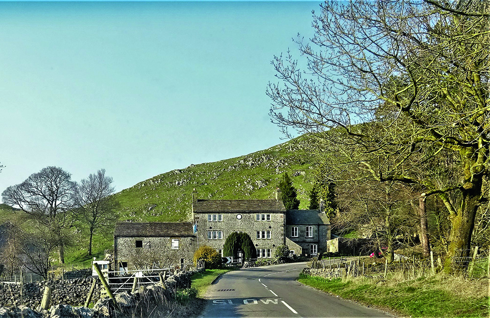
Having adjourned to the Pack Horse Inn at Crowdecote, we felt duly refreshed, and continuing our journey took the turning north, back alongside the Dove, out of the hamlet heading for Earl Sterndale. The road soon leaves the river and climbs gradually, passing the diminutive settlement of Abbot’s Grove; until the 20th century Abbots Grove House was a farm of the Finney family, who also farmed Broadmeadow after the sale by the Batemans. The frequency of dwellings thereafter suddenly increased, and at once a greensward opened out in front of us, wide side furthest away and embowered with trees (and cluttered with parked motorcars): Earl Sterndale, the only really substantial settlement on our tour. The village takes its name from Sterndale, a declivity (Barkdale) which ascends east from the Dove and (its trackway having crossed the old Roman Road, now the A515 on the ridge beyond) descending via Deepdale to the Wye. The name means ‘a valley with rocky ground’ and was first recorded as Stenridile in 1244, becoming Erlisstenerdale by 1330. The ‘Earl’ prefix represents its possession from 1086 until 1265 by the de Ferrers family, Earls of Derby. The eastern settlement, beyond the ridge, King Sterndale, lay in the Royal Forest of the Peak, and took its prefix from the monarch himself. The two most prominent buildings on the green are the stone built 17th century pub on the west side and the much more recent church of St. Michael and All Angels on the east (upward) side. The former, famously named The Quiet Woman, is recorded back into the 18th century, and claimed even greater age, although the building itself appears to have been formed from a row of about three early cottages. The sign depicts a headless woman and, misogynistic by today’s standards or not, was once fairly common, although few so-called survive to day – indeed apart from one on Houfton Road, Bolsover, others have long closed: that at Halstock, Dorset is now holiday accommodation and that on the corner of Brook Walk and Ford Street in Derby went as long ago as 1878. Tragically, the landlord of the inn at Earl Sterndale died in August 2020, causing it to close; it has yet – to the regret of many – to re-open. Whilst the north of the settlement was expanded with 20th century housing (with the Regency and Victorian vicarage above), the rising ground to the east is embellished by the church and school, the church yard forming a visual extension to the green. There was a chapel-of-ease of Hartington here from the fourteenth century – perhaps longer, if the 12th century date for the font is correct – which was falling down in the 18th century and which was finally replaced to the designs of George Ernest Hamilton of Stone in 1828, a simple rectangular building in ‘carpenter’s Gothic’, of carboniferous limestone and gritstone dressings, with a square tower. In 1860 it became a parish church in its own right and, in 1877, R. R. Duke of Buxton added the rather inconsequential-looking chancel. The church had the dubious distinction, on the night of 9th June 1941, of having been gutted by a stick of incendiary bombs, jettisoned by a passing Heinkel 111 en route home from attempting to bomb Manchester, but was well restored by Naylor, Sale and Widdows of Derby in 1952. To its north stands the absolutely delightful school (listed grade II), seemingly straight from the playbook of Sir Joseph Paxton, with its corniced end stacks, gothic traceried fenestration with hood moulds and rusticated quoins. The porch is dated 1895 however, but we were not convinced that this was its true date. After all, the money had been raised by farmer Thomas Lomas of Glutton Grange and the plot donated by the Bachelor Duke in 1853, which would sit much better with its exterior and accord well with a design sent over from Chatsworth by Paxton. We reckoned that the porch was a matching later addition of 1895. Apart from the not wholly successful replacement of the windows in uPVC, it makes a delightful ensemble with the church, all set off the magnificent granite Doric column erected in the church yard in 1919 as a truly heroic war memorial. There was also a flock of chest tombs in the church yard, two to the Finneys of Broadmeadow and Abbot’s Grove, including the unfortunately named Minnie Finney. Coming through the church yard’s iron gates, we turned south to see the miniscule Methodist Chapel of 1860 and the 17th century grade II listed hall beyond, sitting, with Regency-replaced fenestration, behind a fine gritstone pair of ball finialled gate piers and with a superb stable range beyond. Whilst we were unclear which family built it, we noted that in the later 19th century it was home to the splendidly named Prince Beresford, a junior member of a very distinguished Dove Valley family. Unfortunately, of the two rows of 18th century and later cottages opposite some had been disfigured by the insertion of uPVC windows. Coming back to the car, a rather well-spoken villager asked us if we were thinking of buying a house there, to which I replied ‘too bally bleak for us!’ We must have aroused suspicion, snooping round the village; I recall Roy Christian telling me of similar incidents during his village tours in the 1960s! Our last port of call was to leave Earl Sterndale northwards to the junction with the B5053 Brierlow Bar to Longnor road. This winds down towards the Dove again, by High Wheeldon (National Trust, but yet to be fingered with ‘problematic’ associations!) through a charming rocky defile, down to Glutton and then Glutton Bridge. The name, from Middle English gluton (which originated as a surname and means exactly what you’d expect it to mean) reminded us that we had passed other gastronomic sounding names, if less straightforward, like Custard Field (Middle English costard = apple) and, of course, Parsleyhay. We also passed
The Lost Houses of Derbyshire – Culland Hall

by Maxwell Craven It is perhaps quite a stretch to envisage the sheer antiquity of the site of Culland Hall, were you to visit the place today, the splendid gardens which are occasionally open to visitors and which are well worth visiting. Indeed, the present house is an agreeable neo-Georgian brick mansion, much in the later style of Sir Edwin Lutyens, and was built for the late Col. Sir Edward Thompson (1907-1994) – of Marston, Thompson & Evershed, brewers of the incomparable Pedigree ale – in 1939-41 to the designs of George Morley Eaton PRIBA of Derby who indeed died in office whilst building was going on. These works, however, necessitated the demolition of the previous house, by then apparently exceedingly dilapidated, having been in use for some generations as a farmhouse. The place gets its first mention in a charter of 1220, when it was granted to Nicholas de Caveland, second son of Henry de Osmaston and grandson of Eutropius of Brailsford . Thus, both Eutropius’ son and grandson had taken their surnames (then something of an innovation) from the place settled upon them by inheritance. Eutropius, in turn, descended from the Domesday tenant, Elfin (correctly Aelfwine), one of the few Anglo-Saxon grandees to retain their estates through the upheavals of the Conquest. And, of course it tells us how the place name Culland was rendered in the 13th century: Caveland, meaning ‘the land of Cufa’, an attested personal name, and presumably a long-forgotten pre-1066 owner, seemingly of Norse descent. This family continued there for a couple of generations and, one must assume, built a capital mansion, for which no direct evidence survives, although a moat was traceable in the 1930s, a short way from the present house. This modest estate had passed by 1380 to the Montgomerys of Cubley, then a very powerful and influential family, and was settled on a younger son, Thomas, who was recorded there also in 1401. Some time prior to 1470, the estate and presumably the ancient house, was sold or passed by inheritance to the Shaw family, whose origin is not clearly understood, and remained with them until 1497 when Thomas Shaw died. His successor was his brother, Robert, who was disbarred by being a lunatic: people with mental disability were in those days deemed incapable of administering property and were thus prevented from inheriting by statute. Thus in 1519 after a number of lawsuits, the heiress, Joan, brought the estate to Sir Ralph Shirley of Brailsford, Shirley and Staunton Harold, upon whose younger son Francis it was settled, only for him to dispose of it, before 1600, to one James Draper. The heralds’ Visitation of Derbyshire tells us that he was previously of Dockenfield, Hants., although in reality, this village is in Surrey, nearer to Farnham. The 1634 heralds’ visitation of the county informs us that arms were borne without authority and that his wife was Mary, daughter of a former London pewterer living at Bradley called John Morrey; the 1662 Visitation, contrarywise, calls her the daughter of the somewhat grander John Merry of Barton Blount. Whoever she was, they had a son called Thomas who died in 1646 leaving, by Dorothy, daughter of Robert Port of Ilam, two sons and four daughters. The eldest son was Robert (1625-1689), and he is reputed to have built a new house, of which the stable block survives, albeit extended and slightly altered in the nineteenth century. It is of red brick with Keuper sandstone dressings, gables decorated with small ball finials, flush quoins, oeil-de-boeuf windows and a plat band, now listed grade II. We may safely assume that the new house was similarly constructed and was probably a gabled, E-plan house with end gables flanking a central two storey gabled porch. It was assessed on 6 hearths in 1664, so it was only of modest size. Robert Draper married Elizabeth, daughter of Richard Harpur of Littleover Old Hall (see Country Images of June 2014) but there were no surviving children and on his death his brother Thomas, a Coventry businessman, was passed over (or had died without issue) and the youngest daughter Prudence, succeeded, having married George Newall of Windle Hill in Thurvaston. It was in his rime that William Woolley described the house in 1713 as ‘a pleasant seat – a small manor on a hill about one mile south west of Brailsford….and pretty good enclosed land.’ This period also saw the drawing of an estate map by the ubiquitous Thomas Hand (dated 1709) showing the house with two storeys and attics and three gables, all facing south west across a small park with a miniscule lake, still discernable on the 1922 6 inch OS map. The estate then ran to a modest 4191/2 acres. A generation later and George Newall had sold the estate to his cousin John Port of Ilam Hall and in 1794, the whole lot was sold to Derby lead trader William Cox of Brailsford Hall (builder in 1809 of the Derby shot tower), whose family owned it from then until the end of the Victorian era. Cox, a great improver, decided that the house should henceforth be run as a tenanted farm as part of his Brailsford hall estate (see Country Images April 2019), and decided to reduce and extensively rebuild the hall again, early in the nineteenth century. He re-orientated the main part of the house, providing two brick parallel ranges running east-west with gabled ends, stuccoed, and leaving only one range of the older house which, oddly, was retained and, being orientated SE to NW, gave the post-rebuilding plan a rather odd look. The new south front was given superimposed Regency tripartite windows flanking a central pedimented entrance with a single sash above. There were lower extensions to the east and west, that to the west being very much lower, probably older, and was presumably a service wing. The stables lay behind, with other ‘model’ farm buildings provided to the north, now amply
Exploring The Castle, Colleges & Cathedrals of Durham City

By Brian Spencer Having only seen Durham city from the train stopped at Durham Station, perched on a ledge high above the River Wear, Brian Spencer vowed that one day he would spend more time exploring the city, but it took a short break with Slack’s Coaches, basically to visit the unique museums nearby (see Country Images, July and August editions 2021), before he managed to get a closer look at this ancient city. Even though recent excavations indicate there was a Roman settlement at Durham, we have the marauding Danes to thank for the origins of the present city. When they stormed across the North Sea in their longboats around AD 875, monks living on Lindisfarne fled inland, carrying with them the coffin of St Cuthbert, after wandering about the North of England for over a century. In AD995 the monks eventually settled on a site high above a tight loop of the River Wear, founding what became the City of Durham. The site chosen for their abbey was perfect and used the natural defences offered by the steep rocky peninsula, almost surrounded by the sharp meander of the River Wear. William the Conqueror established a palatine, or semi-autonomous region based on Durham to protect northern England against the Scots. Prince Bishops ruled this country until 1836, formulating their own laws, levying taxes and minting their own currency. They even had powers to raise their own army. The original wattle church, the simple building erected by the monks of Lindisfarne, was pulled down and in 1093 the Norman Prince Bishop William began building Durham Cathedral. This magnificent soaring construction, the greatest piece of Norman architecture in northern Britain, took only 40 years to build – lasting–testimony to the devotion of its creators. The Norman castle was built nearby, soon after the Conquest, and became the key defensive point against attacks from over the Border. Durham grew as a city around the cathedral and castle, the narrow streets or ‘vennels’ reached down to the Wear. Easily protected by gates, the vennels closed off the city at night, or whenever danger threatened. A college developed by the monks has grown into one of the major universities of England. Today the city is still centred upon its ancient bastion and original street pattern. More recent development has been on the relatively flat ground away from the river. Durham grew first to the east around Elvet Bridge and, later, to the west around the London-Edinburgh railway line. The railway skirts the older part of Durham on high viaducts on either side of the station. This was where I gained my first tantalising glimpse of cathedral, castle and rooftops, peeping as it did on that occasion, through swirling early morning mist. Durham University grew around the cathedral, its antecedents in the teaching activities of monks and clergy’s teaching activities. It was established as England’s third university by an 1832 Act of Parliament. Outgrowing their ecclesiastical foundations, the modern colleges and campuses now spread themselves across the wooded slopes of Elvet Hill to the south of the river. A striking modern bridge by Ove Arup links Palace Green with Dunelm House over the river. We found the most natural way of exploring Durham was on foot, starting at the oldest and finest building, the cathedral. A monster’s head in bronze pierced it is said by a Scottish arrow serves as the sanctuary knocker on the main door. This is only a replica (the original is preserved in the cathedral’s Treasury Museum), but this is a faithful copy. The first impression a visitor has on entering the cathedral is of the massive strength embodied in the Romanesque pillars supporting the nave roof. At the west end beyond the font, a line of Frosterley marble is the demarcation beyond which women were once forbidden to pass. At that time they had to worship in the Galilee Chapel, built in 1175 and now the resting place of the Venerable Bede (born AD672, died at Jarrow monastery AD735). It was he who wrote the Ecclesiastical History of the English people – a source vital to the history of the conversion to Christianity of the Anglo-Saxon tribes. In the south transept an astronomical clock from around 1500 only displays 48 minutes. Behind the high altar is the beautiful Neville Screen, carved in 1375 from Caen stone. It acts as a backing for the simple tomb of St Cuthbert who has rested here since 1104. Traditionally St Cuthbert’s body did not decompose while it was being carried around the North, but when the tomb was opened in 1827, only the remains of a skeleton and a second skull, thought to be that of St Oswald the great Northumbrian king, were found. Relics of the saint, are on display together with other precious items in the Treasury Museum. The chapel of the Nine Altars, built in the Early English style, fills the eastern transept and dates from 1242. Since the Dissolution, monks no longer live in close proximity to the cathedral. Their dormitory, dating from 1400, now serves as the Library. Behind the cathedral are several elegant private houses, together with the 18th-century water tower and the well-kept memorial gardens to the 7th Durham Light Infantry. Palace Green fronts Durham Cathedral, leading by cobbled ways to the castle. Begun as a motte and bailey mound, the fortress withstood attacks by the Scots as late as the 17th-century, when it was held for the crown during the English Civil War. Later maintenance and additions to the castle were the prerogative of incumbent bishops until it became University College and later Bishops of Durham made Auckland Castle, in Bishop Auckland their official residence. The castle is open throughout the summer. Georgian buildings line North Bailey, which leads to the Market Place where the 14th-century Elvet Bridge is surrounded by some fine medieval buildings. Further along is Hallgarth Street where the medieval Tithe Barn stands. Attractive small restaurants and pubs lining the
Earl Sterndale & The Upper Dove Valley pt.1
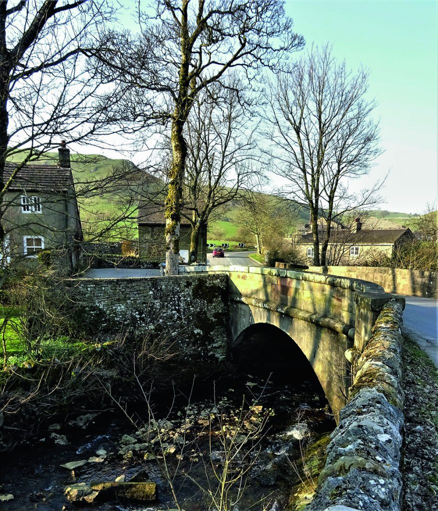
Nucleated settlements are fairly scarce in the White Peak and the upper Derwent Valley, partly because the relief is challenging, not to mention the constant outcropping of limestone. Partly also it is because Saxon settlement came late to this part of Derbyshire, probably not starting in earnest until after around 640, and post-Roman British settlement – as is evident in much of upland Wales to this day – was always discrete, that is to say scattered, with only churches as focal points. This is why the parish of Hartington used to stretch almost to Buxton, being divided into three parts going north from the parish church: Town Quarter, Middle Quarter and Upper quarter, each scattered by diminutive townships, some of which have virtually disappeared over time. The original parish probably represents a pre-Norman and indeed, pre-Anglo-Saxon land unit, utilising the Dove as its western boundary. We had decided to take our tour – necessarily motorised; you would require at least a day and a decent level of fitness to cover our route on foot – of Middle Quarter, centered upon Earl Sterndale, but starting at Hartington so we could enjoy a spectacular view of the Dove’s lush valley as we moved north. Thus, we left Hartington Market Place along Dig Street which leads out of the built-up part of the village to Wallpit Lane, which meanders, very much a single track and gated road, alongside the Dove all the way to Pilsbury. The views are indescribably memorable: the valley is gently enclosed by the riding limestone ridges either side and each minor turn brings further prospects to the north and west. As we progressed, we saw 17th century grade II* listed Broadmeadow Hall, opposite on the Staffordshire side: a striking sight. The last time we saw it, about 1980, it was a picturesque roofless shell, but has since been put back into use, which is gratifying. Once the property of the Poles of Pool Hall, Hartington, it passed to the Sleighs of Pilsbury Grange in 1573. They sold in 1709 to the Haynes of Ashbourne from whom it came to the Batemans of Hartington Hall before becoming a separate freehold on the death of Sir Hugh Bateman 1st Bt., in 1824. We would recommend taking this route by car out of season, as passing would be a problem in places, and in season it might well prove a nightmare. The two and a quarter miles we took at a fast walking place: no-one came up behind and no vehicle approached: perfect. “Most of the area has been part of the Duke of Devonshire’s estate since the 17th century, and much, I suspect, still is. Farms are beautifully kept and the larger farmhouses, like mid-18th century Pilsbury Grange, are very much estate foreman-built pattern book farms: three storeys, three bays wide and still using mullioned windows.†At Pilsbury – Pilsberie in 1086, (‘the fortified place of Pil’, cf. Pilsley) – there are a pair of substantial farms and the road suddenly climbs steeply to the moor above in a series of sharp ascending turns. At the start of the first turn a track continues the route along the Dove’s bank, which those on foot can enjoy, for although Pilsbury Castle, about 600 yards along, is an impressive motte, probably set within a pre-Roman earthwork and well worth a visit, there is nowhere safely to leave a car. The Castle was built by Henry de Ferrers as the focus of his Dove valley holdings not long after the conquest., but was of timber, and never replaced in stone. We drove up onto the moor, therefore, enjoying awesome views southwards and passed Pilsbury Lodge, which has a caravan facility; the presence of farms with ‘lodge’ in the title suggests relics of an ancient hunting preserve, and those with ‘grange’ represent former monastic owned farms. Indeed, continuing east along our way, we eventually met the more easily motorable (but much less scenic) Hartington-Earl Sterndale Road and, turning left, quickly reached a crossroad marking the centre of one such place, Needham Grange at High Needham, embowered by windswept trees, the settlement itself having long since shrunk to three farms. First recorded in 1244, like nearby Heathcote it gave its name to a distinguished Derbyshire family, today represented by the 6th Earl of Kilmorey, an Irish peerage thus an honour which did not prevent him from representing Chippenham in Parliament and serving as a minister under John Major. Here we turned west again, the road winding sinuously and spectacularly back down toward the Dove, crossed by a stone bridge at Crowdecote – ‘the dwelling place of Cruda’ – which is another very small township within Hartington Middle Quarter, with a cluster of stuccoed cottages where the road divides above the bridge itself. We noted a rarity, looking rather forlorn beside a K6 telephone box: an early 19th century iron water spout, much like those provided in more profusion, by the Harpurs at Ticknall. The sight of this made us thirsty, so we adjourned to the Pack Horse inn opposite, and enjoyed excellent blond ale and a snack. It is delightfully unspoilt, aided by being a listed building in a conservation area, having been formed from a pair of cottages of 1727 with later alterations, but still with cosy rooms and friendly staff. Having felt duly refreshed, we took the turning north, back alongside the Dove, out of the hamlet heading for Earl Sterndale. 00
Walk Derbyshire – Historic Deepdale – A walk back into history

Deepdale you may ask, for the name doesn’t appear on any Ordnance Survey map? Now better known as Dale Abbey, the village was once called Depedale, then Deepdale and eventually the modern name, Dale Abbey in remembrance of the abbey that flourished here from 1162 until Henry VIII’s quarrel with Rome in 1536. A lonely stone arch that once framed a glorious east widow, is all that is left of a Premonstratensian abbey taken over from Augustinian monks who came to this spot from Calke Abbey in 1162. They managed to begin building, but lack of funds led to the work being transferred in 1204 to an off-shoot of the wealthier Premonstratensian French foundation based in Lincolnshire. Small by monastic standards, their work led to the draining of surrounding boggy land and the expansion of farming began alongside iron production using raw materials dug from the local countryside. All went well until the Dissolution when the governing abbot managed to stave off the abbey’s closure by payment of a fine. Unfortunately this was wishful thinking and gradually the abbey fell into disuse. Stones from the abandoned abbey found its way into the walls of surrounding cottages and local churches. It is still possible to trace the use of these stones in some of Dale Abbey village’s older houses. The best example is in a cottage close to the village green. Its foundations and the lower walls support attractive half-timbered main walls. Apart from the lonely arch of the east window, a section of the abbey, in this case part of the kitchen, has been incorporated within a cottage close to the field containing the grassed over remains of the rest of the abbey. Unlike other and more extensive monastic relics, the abbey ruins stand on private land, but permission to get closer to the ruins is usually given by the owner of the nearby cottage. Carved stones discovered by occasional excavations are stored in the shed situated in the bottom corner of the site. A short distance along the road leading from the abbey, there stands what is probably one of, if not the most unique churches in the land. Tiny All Saints the Grade I Listed Parish Church is thought to be part of the abbey infirmary, where the local sick and infirm were cared for. It is a strange combination of house and church all under the same roof. The two-roomed half-timbered medieval house used by the verger, was improved in the nineteenth century, but the church is almost untouched. A mere twenty-six feet by twenty-five feet, inside it is a wonderful jumble of props and posts, all set at strange angles; the oak pulpit leans sideways due to the passage of over 300 years since it was made and the only space for worshippers is in one of the 17th century box-pews. But the oddest seating arrangement is on the massive, uncomfortable-looking chair donated in 1824 by an Earl Stanhope who fell in love with the idiosyncratic church. Despite its discomfort, it became known as the Bishop’ Chair, although it is doubtful if one ever sat there. By strange chance the tiniest church in the land, produced one of the largest chalices. Made in 1701, it measures 9 inches high and 15 inches round. The 15th century font is here with worn carvings of the Madonna and Child and the Crucifixion; fragments of coloured glass rescued from the abbey and the remains of wall paintings reward a careful search. A path winds away from the church around the back of a modern house, then on and into Hermit’s Wood. It covers an escarpment composed of easily worked red sandstone. This was used to full advantage by the man who built his home and hermit’s cell, and became known in myth and legend simply as ‘Thomas the hermit’ of Depedale. Before cutting himself off from society, he lived in Derby where in the early thirteenth century, he carried out his profession as a baker. A kind hearted man, he frequently gave away his bread to many who were unable to pay for his produce. One day he had a vision of setting himself apart from the rest of his fellow tradesmen. A few years before building work began on the nearby abbey, somehow or other he was drawn to the spot where easily worked red sandstone lined the edge of a wooded escarpment. Here he carved out a series of rooms for himself and his animals, welcoming passers-by who knelt with him in prayer. Even now it is easy to seek comfort in his hideaway. As the rock was so easy to work he managed to fit a door and two windows to keep out the draft on cold days. He even made a kind of lean-to conservatory, supported by planks set into post holes that still survive. Thomas the Hermit even had a benefactor, Ralph Fitz Geremund, who came across the hermit while out on a hunting trip. Industry developed over time, first mining ironstone and coal, industry that lead to the founding of the Stanton Ironworks. Narrow gauge railways, some of which are covered on this walk, criss-cross the fields between Dale Abbey and Kirk Hallam. There are also traces of small-scale foundries, such as at Furnace Pond Farm beyond Hermit’s Wood; it is likely the name comes from a nearby pond used to provide power for bellows used to melt iron ore in the production of iron. THE WALK STEP BY STEP From Pioneer Meadows car park, turn left along the curving road around the limits of Kirk Hallam, going past houses for about a quarter of a mile. Look out for a footpath sign on your left pointing to Dale Abbey. Follow field boundaries across four fields, passing well to the right of Ladywood Farm. Cross a deep gulley by means of a footbridge and, bearing very slightly left, cross the field beyond the gulley. In the far corner